
TRAILBREAKER Resources LTD
ATSUTLA GOLD PROJECT

Introduction
The Atsutla Gold project represents a brand-new, high-grade gold discovery in British Columbia where greenfield exploration has returned rock samples assaying up to 18.38 oz/ton (630 g/t) gold and 55.25 oz/ton (1,894 g/t) silver in an area with no previously known gold mineralization. The project consists of 39 mineral tenures covering over 40,000 hectares of underexplored, highly prospective ground in northwestern British Columbia. All but one claim (132 ha) are 100%-owned by Trailbreaker Resources with no underlying royalties or payments.
Project Location

The project covers a portion of the Atsutla mountain range within the Kawdy Plateau of northwestern BC; 70 km south of the BC-Yukon border and 120 km northwest of Dease Lake, BC. Although placer gold was recorded in multiple drainages in the area during the early 1900s, very little mineral exploration has occurred since then. The area was briefly explored for copper, tungsten, and molybdenum during the 1970s with gold mineralization completely overlooked.
The Atsutla Gold project is centred over the crustal-scale Teslin – Thibert fault system that marks the division between the Quesnel and Cache Creek tectonic terranes. Gold mineralization on the property is closely related to the Mesozoic intrusive batholiths that comprise the Atsutla mountain range. The geological setting suggests strong potential for multiple styles of gold mineralization including Cu-Au porphyry, epithermal, orogenic vein and intrusion-related.
To date, Trailbreaker has defined 5 significant gold zones over 26 kilometers: Highlands, Christmas Creek, Snook, Willie Jack and Swan. For ease, the property has been divided into two main areas: Atsutla West and Atsutla East.
Atsutla Property Zone Map
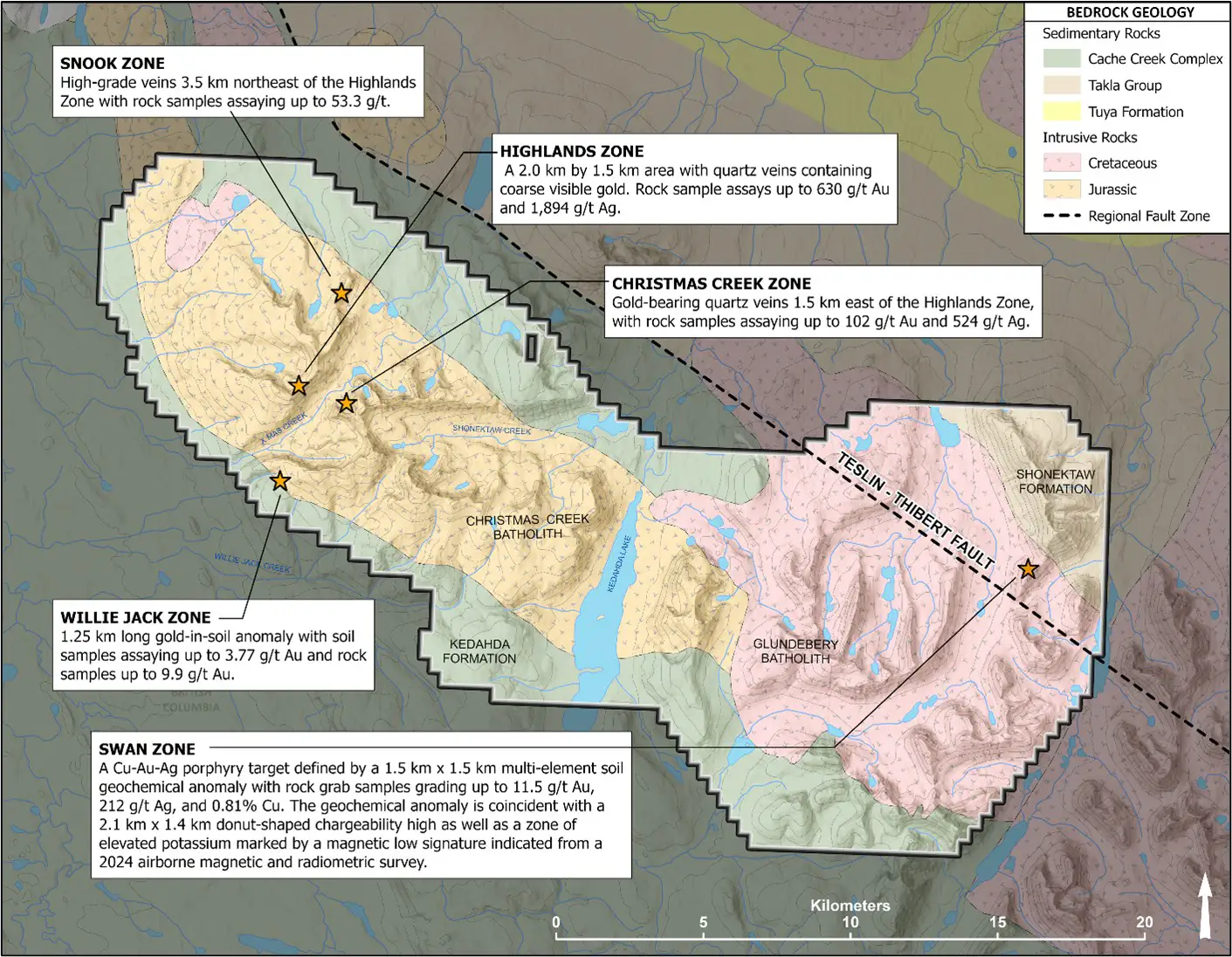
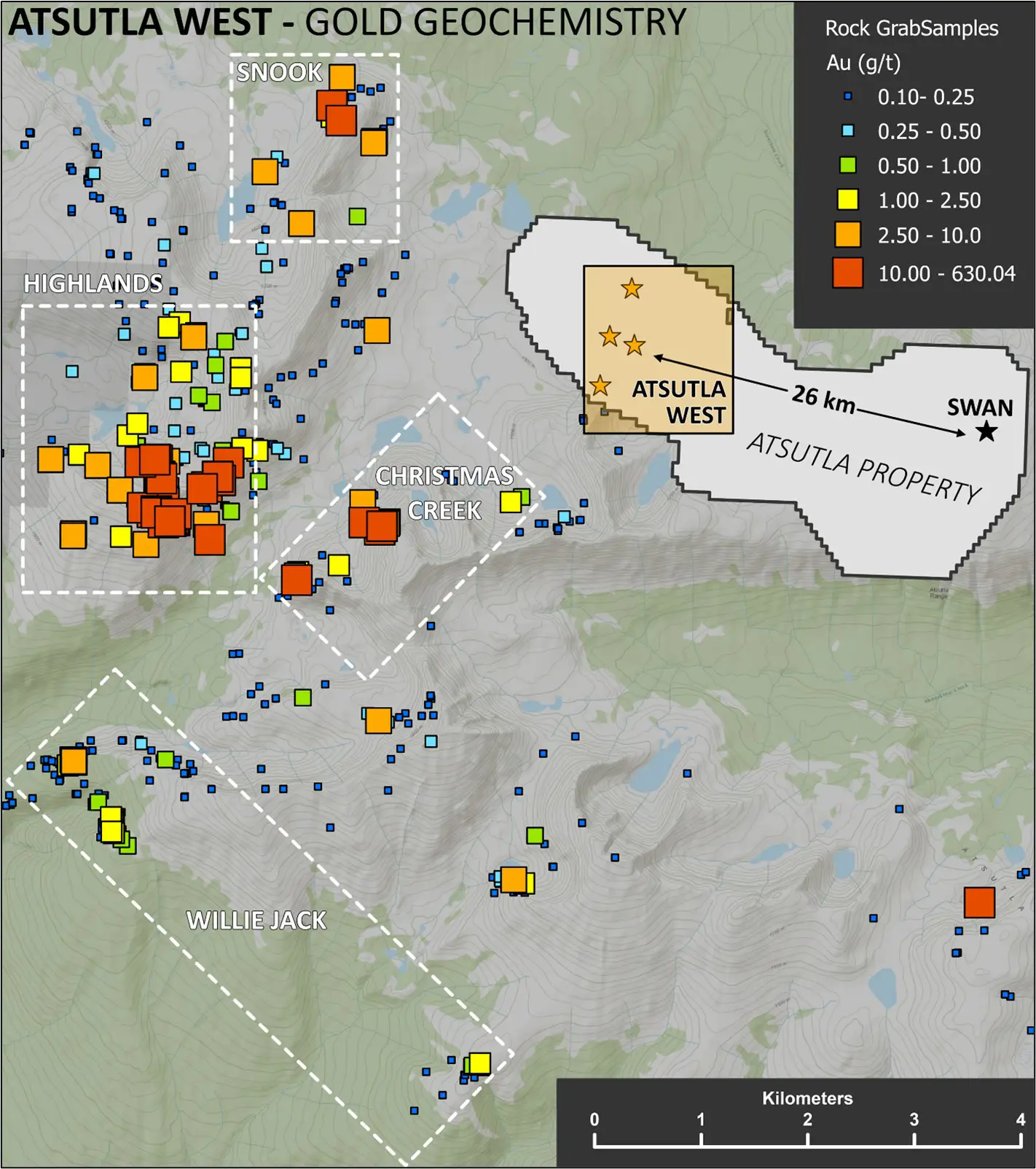
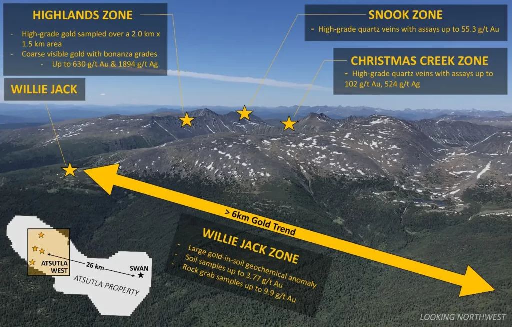
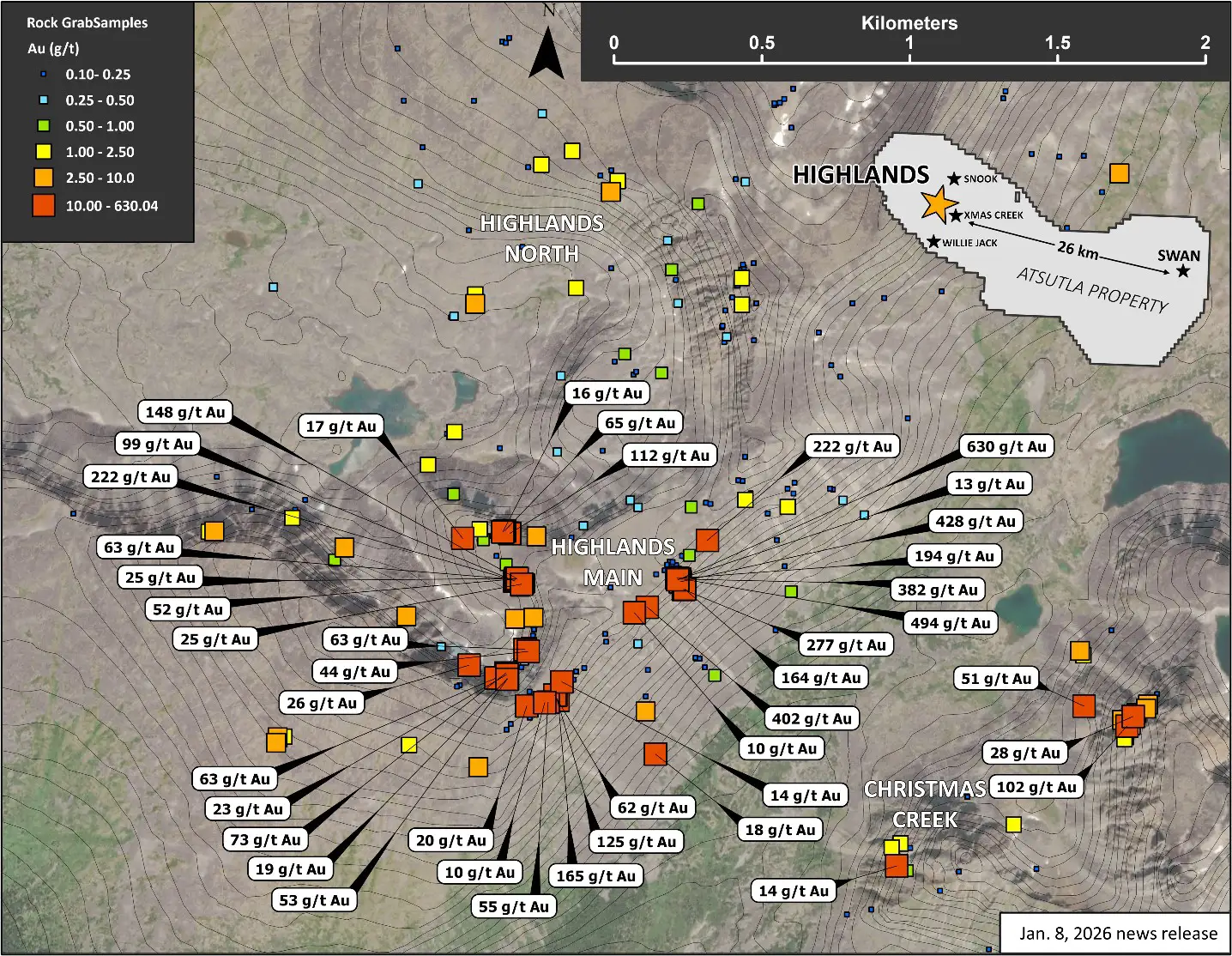
Atsutla West covers the western portion of the property and hosts high-grade quartz veins within and on the margin of the Jurassic age Christmas Creek batholith. Atsutla West includes the Highlands, Christmas Creek, Snook, and Willie Jack zones.
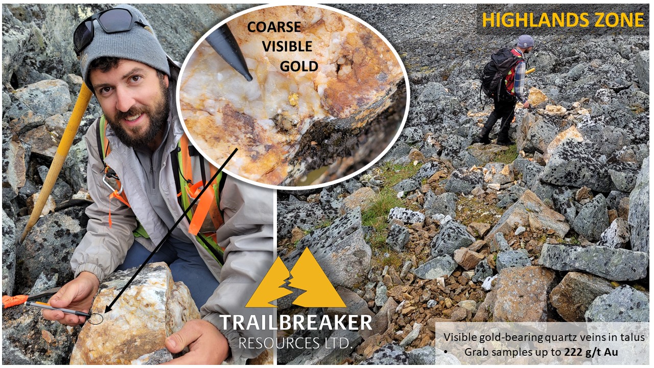
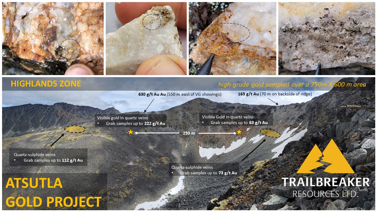
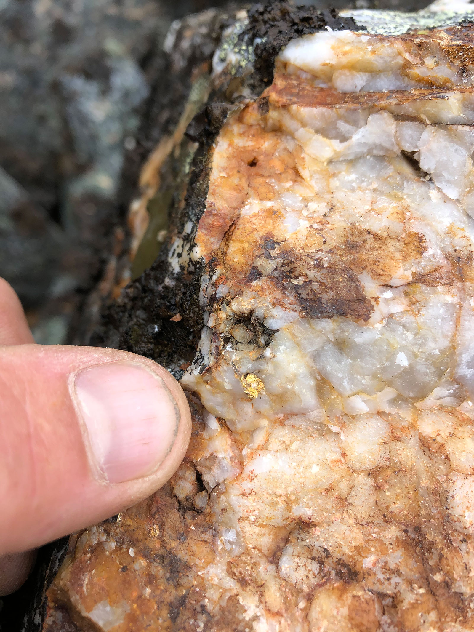
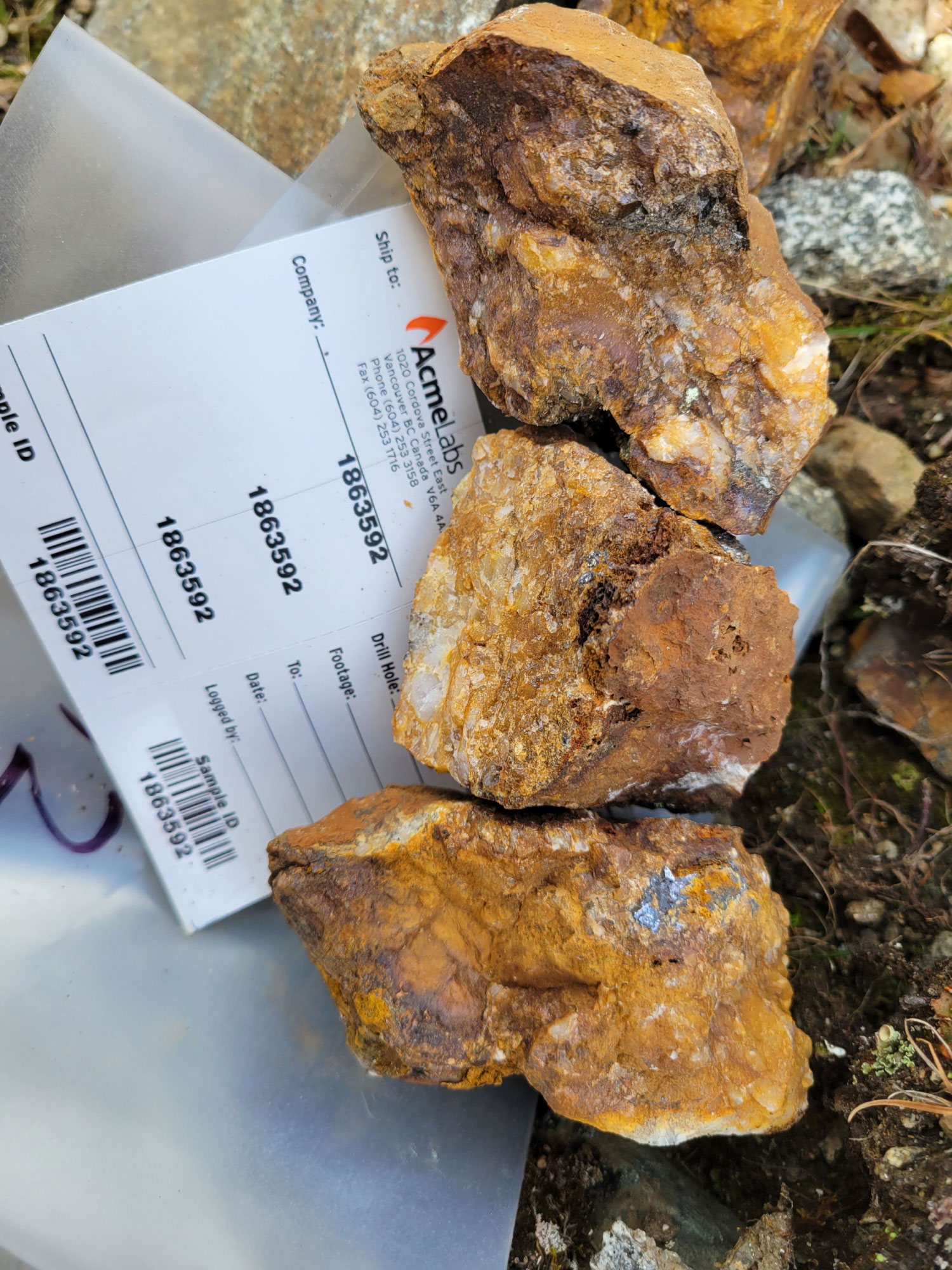
- The Highlands zone is a 2.0 km by 1.5 km area in the western Atsutla Gold project region, with veins containing coarse visible gold assaying up to 630 g/t (18.38 oz/ton) Au and 1,894 g/t (55.25 oz/ton) Ag.
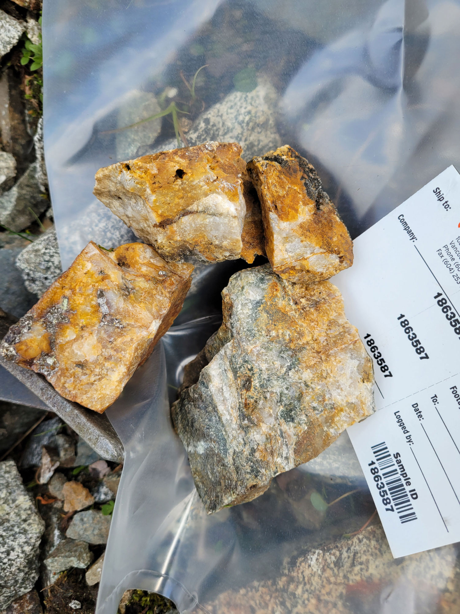
- The Christmas Creek zone is located 1.5 km east of the Highlands Zone, with rock samples assaying up to 102 g/t Au and 524 g/t Ag.
- The Snook zone is located 3.5 km northeast of the Highlands zone and displays multiple generations and styles of mineralized veins. Rock samples have returned assays up to 53.3 g/t Au.
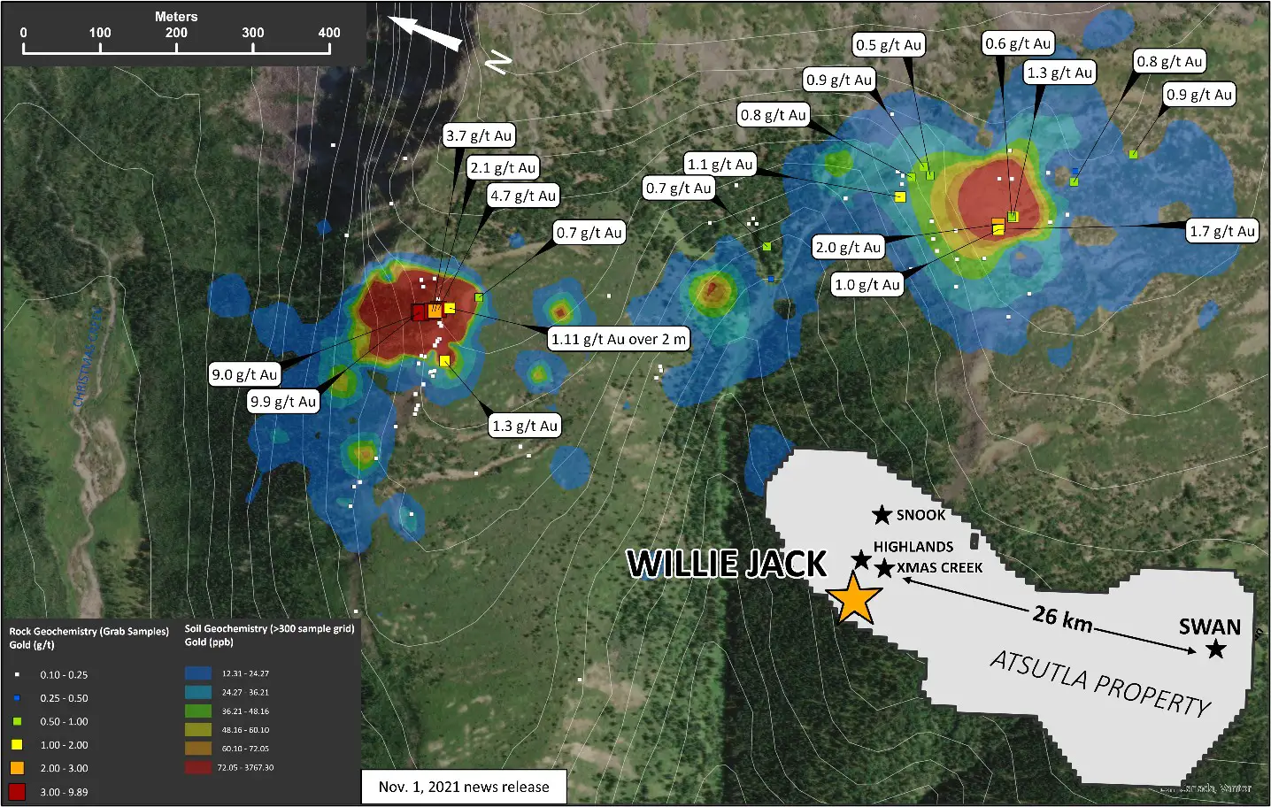
- The Willie Jack zone consists of a 1.25-kilometer-long gold-in-soil anomaly, with soil sample assay values up to 3.77 g/t Au and rock grab samples up to 9.9 g/t Au.
Atsutla West Overview Map
Atsutla West
Snook, Highlands and Christmas Creek Zones
Highlands Zone Geochemistry Map (Au)
Willie Jack Zone Geochemistry Map (Au)
Atsutla East represents the eastern portion of the Atsutla property and covers the large, Cretaceous age Glundebery batholith. The primary feature is the Swan zone, a Cu-Au porphyry target.
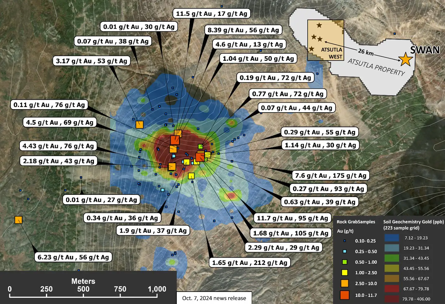
- The Swan zone is centered on a ~1.5 x 1.5 km multi-element soil anomaly (Au-As-Ag-Cu-Mo-Sb-Bi), with soil sample assay values up to 406 ppb Au and grab samples up to 11.7 g/t Au, 212 g/t Ag, and 0.81% Cu. Recent geophysical surveys have identified a co-incident chargeable feature 2.1 x 1.4 km in size, suggesting the presence of a mineralized porphyry system. The Swan zone anomaly is directly adjacent to a historic molybdenum-copper porphyry prospect that was not explored or analyzed for gold.
Swan Zone Geochemistry Map (Au, Ag)
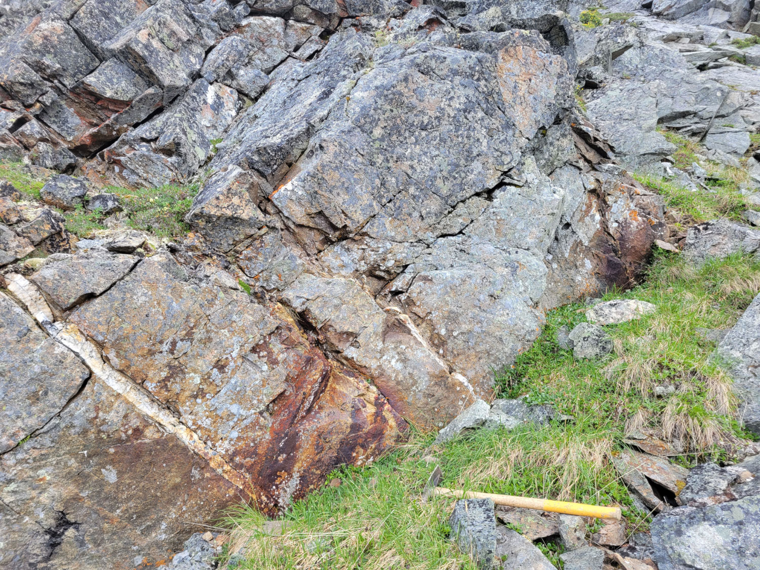
Swan Zone Gossan
Swan Zone Porphyry Geophysical Target

Location / Infrastructure
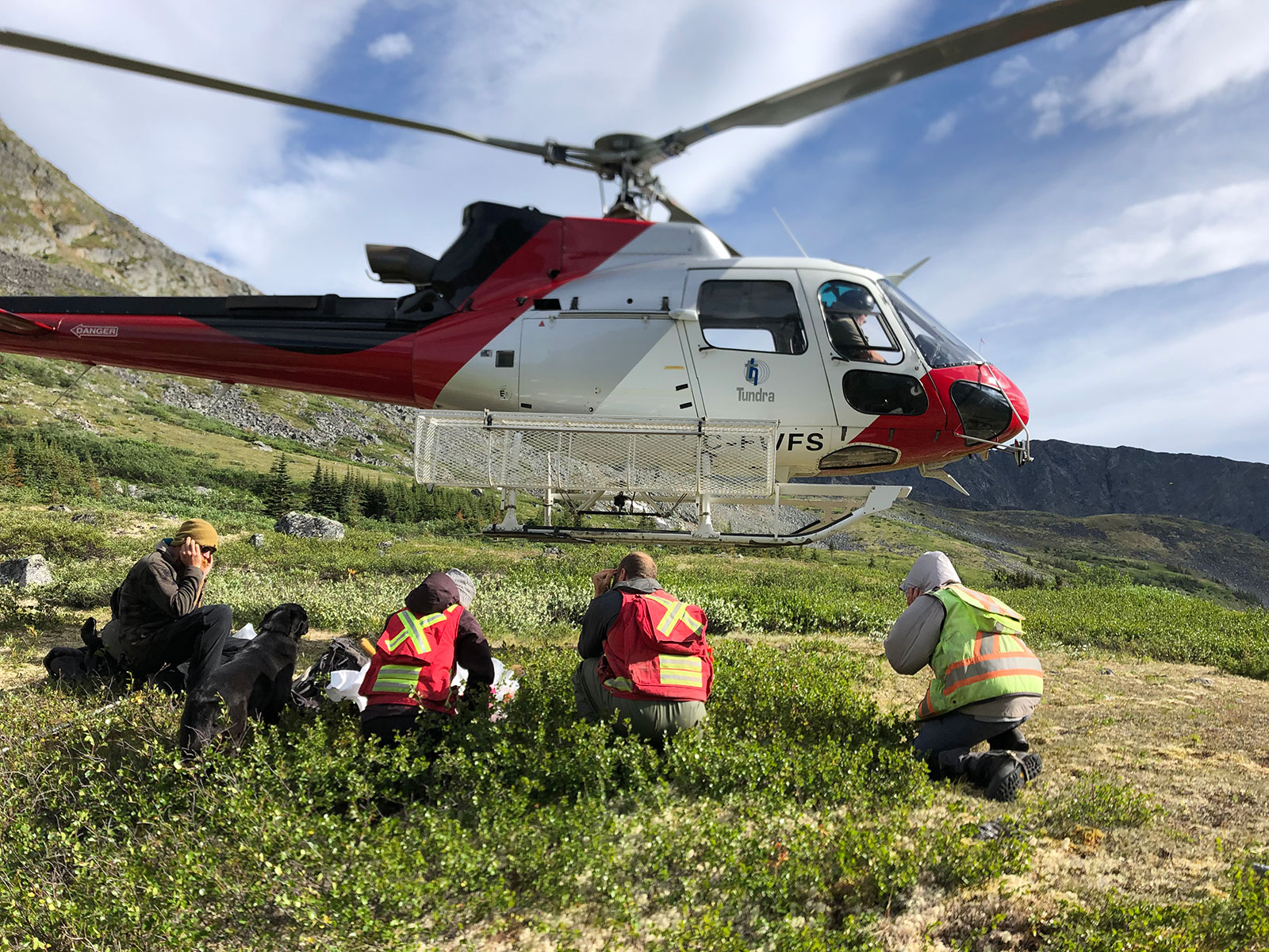
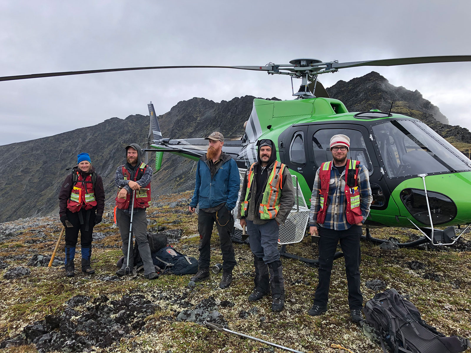
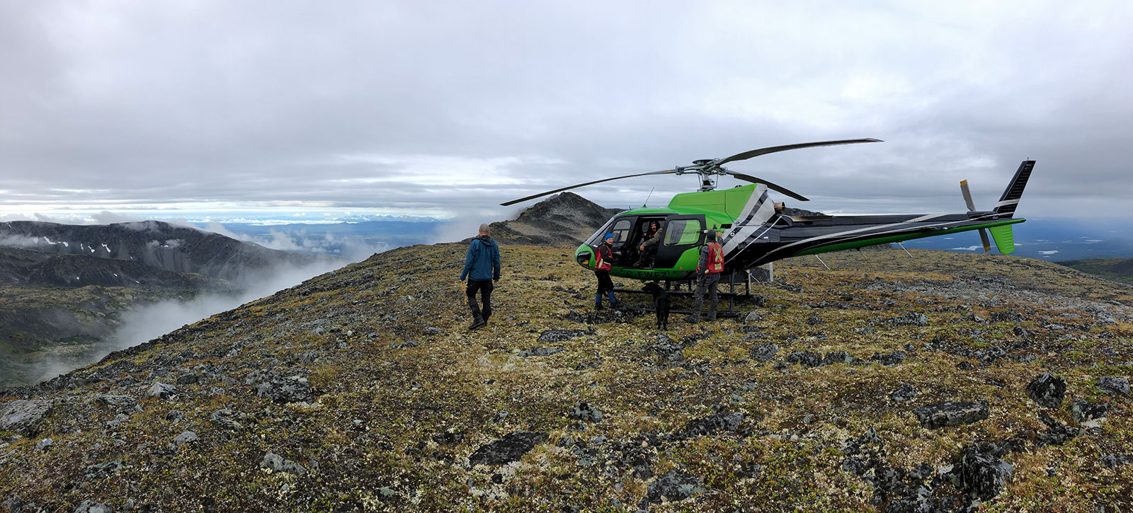
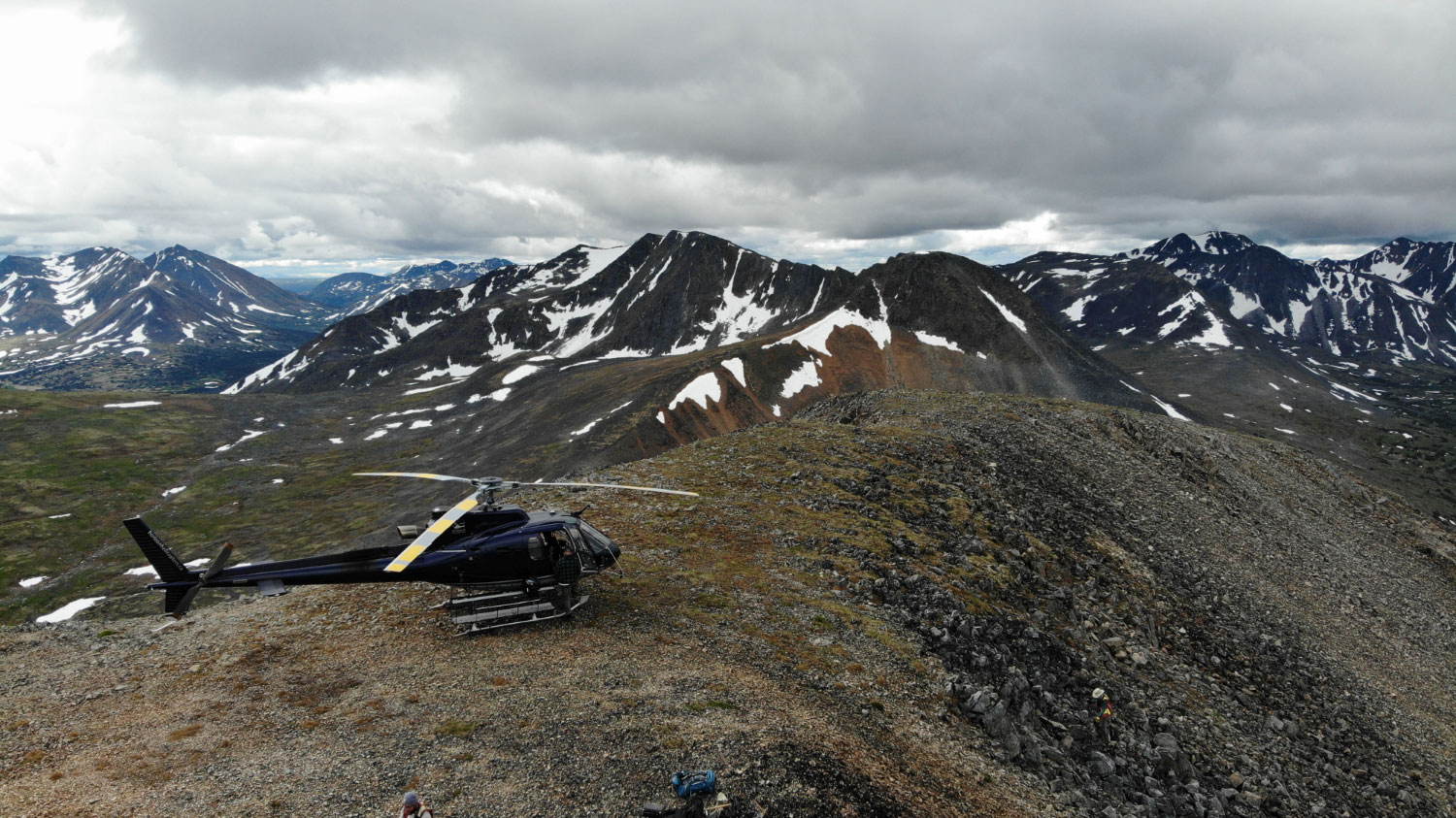
Located 130 km NW of Dease Lake, BC and 75 km south of the Yukon-BC border. The nearest road is the Alaska Highway, 55 km to the north. Currently the property is only accessible by helicopter chartered from Atlin or Dease Lake, BC. Kedahda Lake provides the most suitable float plane access and is conveniently centered on the property.
History
1912
Placer gold discovered on Willie Jack Creek.
1943
Government geologists conducted a reconnaissance geological mapping and prospecting program in the Atsutla mountain range and discovered abundant mineralized quartz veining with malachite staining with a single sample assaying 2.06 g/t Au and 72 g/t Ag.
1969 – 1976
The Atsuta Property was briefly evaluated for its Cu-Mo porphyry potential by various companies between the late 1960s and early 1970s.
In 1969 Quebec Cartier Mining Company conducted a large, regional-scale (1800 sq km) stream sediment sampling program that discovered anomalous Cu draining the present-day Atsutla West part of the property. The stream sediment samples were only analyzed for base metals (no gold). In 1971, El Paso Mining conducted geological mapping and prospecting, following up on Quebec Cartier’s work, and identified widespread Cu mineralization hosted both in narrow quartz veins and fractured wall rock (granodiorite and monzonite). No rock grab samples were sent for geochemical analysis.
In the late 1960s, Union Minière Mining Corp. discovered molybdenum mineralization in porphyry float within the present-day Atsutla East (Swan zone) part of the property. In 1978, Amax Potash Limited conducted geological mapping, soil geochemical grids, and IP in the area with a focus on molybdenite. No assays for gold mineralization were done.
1979
Geological Survey of Canada completed a regional stream sediment sample program but with no analyses for gold, arsenic, or antimony. Dupont Canada Exploration followed up on anomalous tungsten and molybdenum stream sediment samples in the area with no gold assays done.
2000
Geological Survey of Canada re-analyzed the 1979 stream sediment samples for multiple elements; including Au, As, and Sb. These 3 elements are strongly anomalous and spatially associated with the historic placer gold-bearing Willie Jack Creek that drains the Atsutla West portion of the property.
2005 – 2008
Hastings Resources Corp. staked the molybdenite showings identified in the 1970s, which now comprises a portion of the Swan zone within the Atsutla East part of property. A phase 1 soil geochemical survey followed by a shallow diamond drill campaign consisting of 13 holes and totalling 992 meters were completed. Drilling intersected broad, low to mid-grade molybdenite mineralization, returning up to 0.06% Mo over 73 meters, as well as several significant silver intercepts including >26 g/t Ag over 3 meters. Again, no geochemical analysis for gold was done.
2020 – 2025
Trailbreaker Resources completed a reconnaissance first pass exploration program in 2020, evaluating the area for its gold potential. A total of 185 soil and 94 rock grab samples were taken. Widespread gold mineralization was discovered with quartz veins assaying up to 164 g/t Au and soil samples up to 806 ppb Au. A large land package was secured and the Atsutla Gold project was born.
An aggressive prospecting, geological mapping, and soil sampling program was executed at the Atsutla Gold project the following year (2021). A total of 2100 soil samples and 532 rock samples were collected over two work phases. Four significant gold zones were defined: Highlands, Christmas Creek, Willie Jack, and Swan. An airborne magnetic and radiometric survey was also flown over Atsutla West.
The 2022 program involved both follow-up prospecting and exploration on newly staked claims. It also included detailed structural and geological mapping at the four high-grade gold zones discovered in 2021, with a focus on drill target generation. A new gold zone was discovered northeast of the Highlands zone (Snook), and a new area of mineralization was discovered at the Swan zone.
No work was done on the property in 2023 due to permitting delays. In 2024, Trailbreaker focused exploration efforts at the Swan zone in Atsutla East, with the primary goal to delineate drill targets. The program involved a widespread soil geochemical survey (1165 soil samples), a detailed IP survey (21 line-km), and a 43 square kilometer airborne magnetic/radiometric survey.
In 2025 Trailbreaker consolidated key ground within the Atsutla Gold project claim boundary, near the Highlands zone and executed a first-pass reconnaissance exploration on the new ground, including geological mapping, prospecting (77 rock grab samples), and soil sampling (147 samples). The program was successful in expanding the Highlands zone structural feature to a 1.0 km x 1.2 km area. Additional sampling confirmed the continuity of the shallowly-dipping shear structure which hosts high-grade gold-bearing quartz veins.
Geology / Mineralization
Regional Scale
The Atsutla Gold project is located in the northwestern portion of the Atsutla mountain range within the Intermontane Belt. The property is situated along the regional-scale, northwest-trending Teslin – Thibert strike-slip fault system that juxtaposes and divides the Cache Creek and Quesnel tectonic terranes. The Quesnel terrane hosts numerous Cu-Au porphyry deposits along the length of British Columbia, including Copper Mountain, Highland Valley, New Afton, Mount Polley, Mount Milligan, and Kemess. The Cache Creek terrane hosts numerous high-grade orogenic gold deposits in BC including the nearby Atlin and Cassiar Gold camps (>3 Moz Au combined). The property is also positioned at the southern fringe of the Tintina Gold Belt that hosts many intrusion-related gold deposits across Alaska and the Yukon. These deposits include Pogo and Fort Knox in Alaska and Brewery Creek and Dublin Gulch in Yukon Territory.
The Atsutla Gold claims cover two large Mesozoic batholiths that intrude Paleozoic sediments of the Kedahda Formation and Triassic volcanics of the Takla rock group. These batholiths contain elevated concentration of gold, silver, copper, molybdenum, arsenic, and antimony. The high-grade gold sampled in quartz veins at the Highlands zone is hosted in the granitic Jurassic age Christmas Creek batholith. The Willie Jack zone is hosted at the fringe of the Christmas Creek batholith with northwest-trending auriferous quartz veins and shear zones hosted in the metasediments of the Kedahda formation. The Swan zone is hosted in a leucogranite-porphyry unit of the Upper Cretaceous Glundebery batholith.
Property Scale
Atsutla West – Visible gold in an extensive vein system
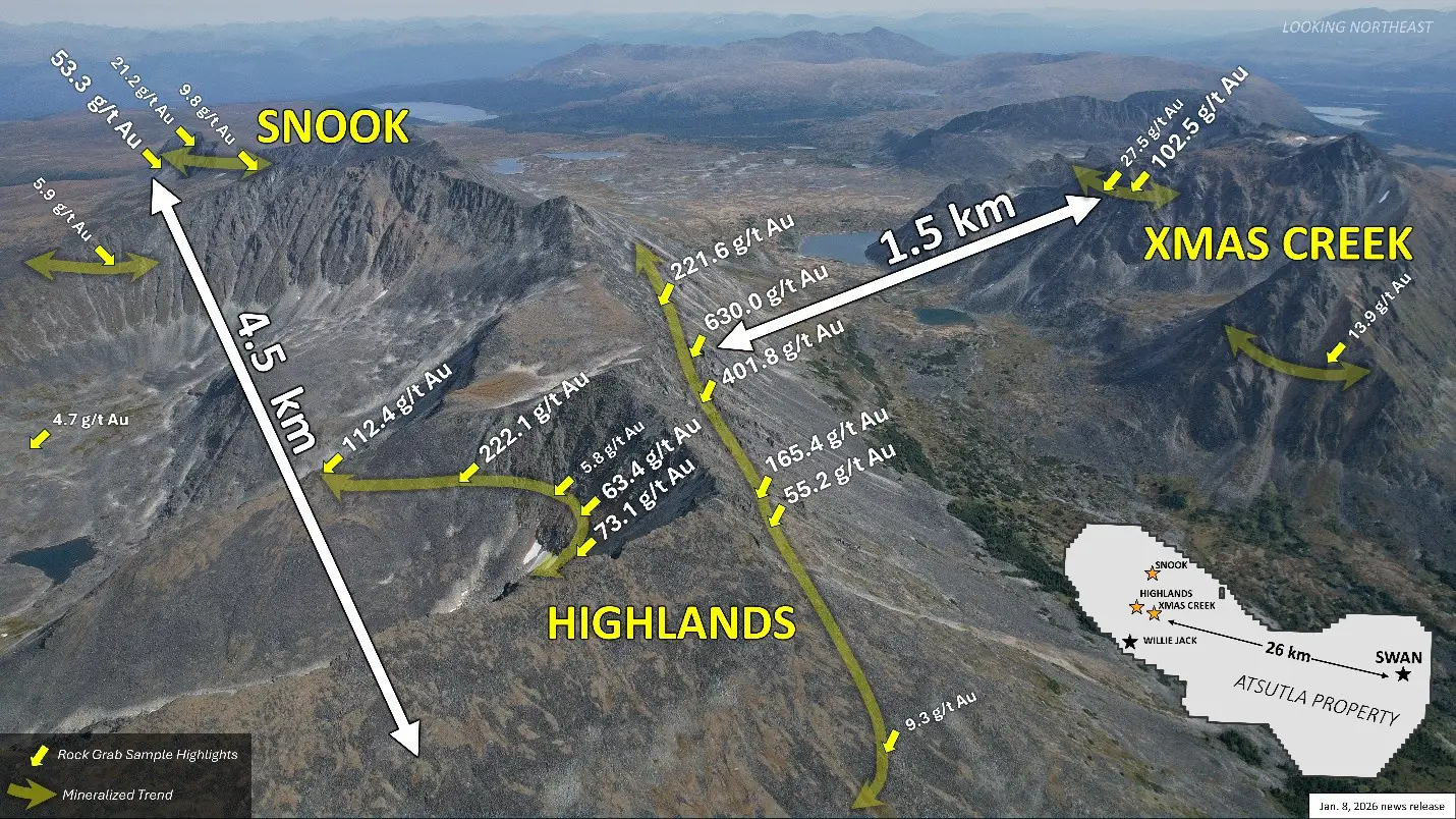
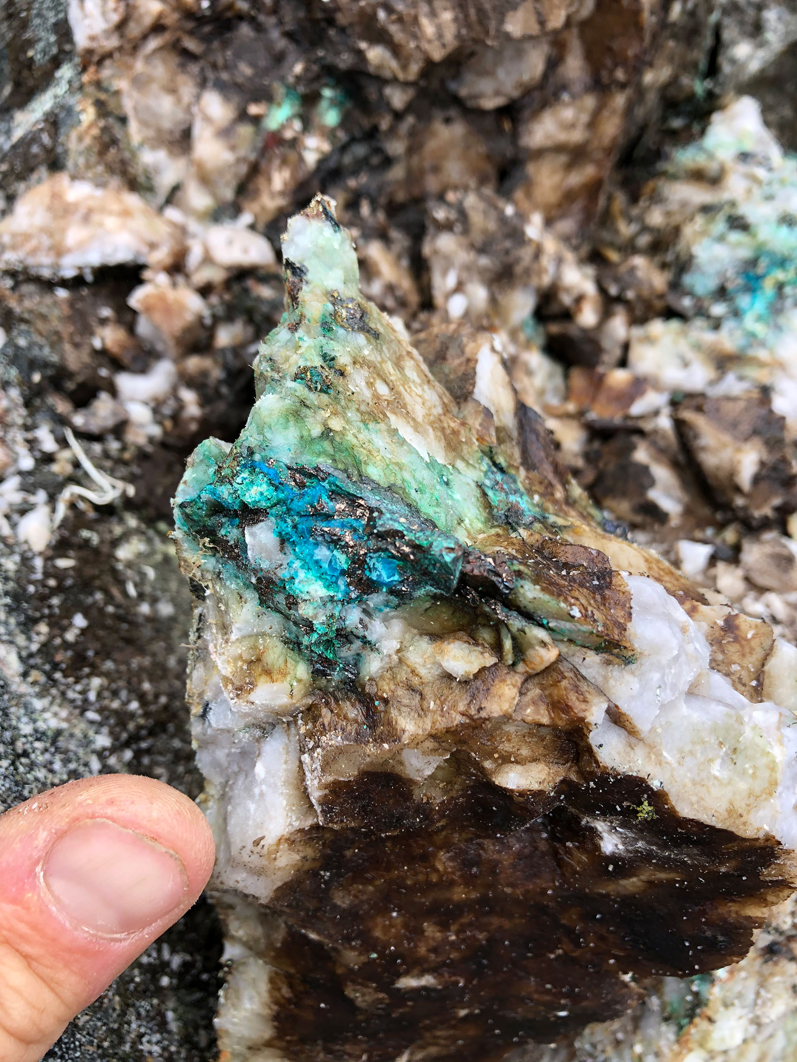
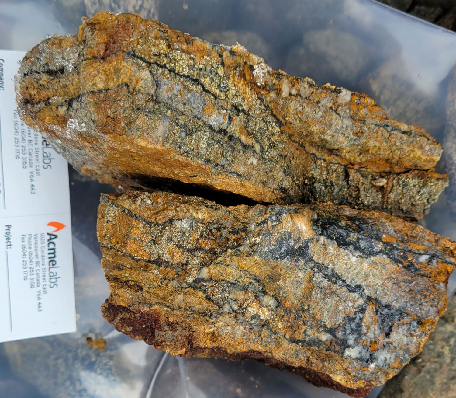
The Highlands zone is entirely hosted within early Jurassic-age granite of the Christmas Creek batholith. The zone is comprised of an extensive, high-grade (>100 g/t Au) quartz vein system occurring within a 1.1 km x 1.2 km area with multiple coarse visible gold showings. The high-grade gold and silver veins are closely associated with a prominent gossan shallowly dipping shear structure with numerous 20-50 cm thick quartz veins displaying arsenopyrite, pyrite, galena, and visible gold mineralization. Bedrock and proximal float samples have returned grades up to 630.04 g/t (18.38 oz/ton) Au and 1,894 g/t (55.25 oz/ton) Ag.
Approximately 1.5 km east of the Highlands zone, across the Christmas Creek valley, prospecting discovered additional high-grade quartz veins bearing many similarities to those found at the Highlands zone. Bedrock samples from galena-rich quartz veining returned assays up to 102 g/t Au and 524 g/t Ag. This area has been coined the Christmas Creek zone and Trailbreaker’s team has interpreted the shear structure delineated at the Highlands zone to be continuous, with similar structures found at the Christmas Creek zone.
The Snook zone is located 3.5 km northeast of Highlands where a prominent east-west trending fault (the Snook Fault) defines the southern boundary of the zone and cuts through Snook Lake. At least two generations of quartz veining were identified at the Snook zone and all hosted entirely in the granodiorite of the Christmas Creek batholith. The earlier set comprises steeply dipping sheeted veins which are crosscut by later shallow-dipping veins. Sulphide mineralization consists of variable amounts of pyrite, bornite, chalcopyrite, galena, and arsenopyrite. Galena and arsenopyrite appear to be constrained to the later set of quartz veining. Highlights include up to 55 g/t Au obtained from outcrop samples of 5 -10 cm sheeted quartz veins.
The Willie Jack zone is situated 2.5 km southeast of the Highlands zone and covers the southwestern margin of the early Jurassic Christmas Creek batholith, where it lies in contact with older, Permian Kedahda formation sediments. Gold mineralization is unique to the other zones as it is hosted within these metasediments. A 1.25-kilometer-long Au-As-Ag-Mo-Te soil anomaly, coined the Willie Jack trend, hosts auriferous quartz veins with rock grab sample assay values up to 9.9 g/t Au. The Willie Jack trend falls within a broader, 6.5-kilometer-long anomalous gold trend with soil sample assays up to 3.77 g/t Au. Sampling of quartz float and quartz in bedrock indicate that the anomalous gold-in-soil trend is caused by a series of metasediment-hosted, northwest-trending auriferous quartz veins. A chip sample across siliceous quartzite yielded 0.35 g/t Au over 6.5m in the eastern part of the Willie Jack zone; suggesting potential for low-grade bulk tonnage style mineralization.
Atsutla East (Swan Zone) – A Cu-Au porphyry target
The Swan zone area was staked to cover a historical molybdenum-copper porphyry prospect that was discovered in the late 1960s and explored periodically since then. Despite more than 500 soil and surface rock samples and almost 1,000 meters of shallow diamond drilling, no geochemical analysis for gold was ever completed in the period before Trailbreaker staked the area in 2020. Historical geological mapping and drill hole logging indicate a complex intrusive system, comprising widespread quartz-feldspar porphyritic monzonite cut by a variety of felsic and mafic dikes. Molybdenite-pyrite mineralization is closely associated with sheeted quartz veins, quartz stockwork and breccia zones. The historical drilling at Swan intersected broad, low to mid-grade molybdenite mineralization, returning up to 0.06% Mo over 73 meters, as well as several significant silver intercepts including > 26 g/t Ag over 3 meters.
Trailbreaker has defined a 1.5 x 1.5 km multi-element soil anomaly (Au-Ag-As-Cu-Mo-Sb-Bi-Te ± Pb-Zn) that corresponds to a large gossanous ridge that is adjacent to the historical drilling. Sample assay values returned up to 406 ppb Au and grab samples up to 11.7 g/t Au, 212 g/t Ag, and 0.81% Cu. The soil anomaly and underlying gossan occur within a leucogranite-porphyry unit of the Upper Cretaceous Glundebery Batholith.
Follow-up prospecting in this area uncovered significant arsenopyrite mineralization in bedrock, proximal float, and talus float. Rock samples taken from the core of soil anomy at a mid-slope outcrop returned grades up to 11.5 g/t Au with 16.8 g/t Ag and 8.39 g/t Au with 55.8 g/t Ag. Additional samples obtained from float within the anomaly have yielded grades of 11.7 g/t Au, 212 g/t Ag, and 0.12% Cu.
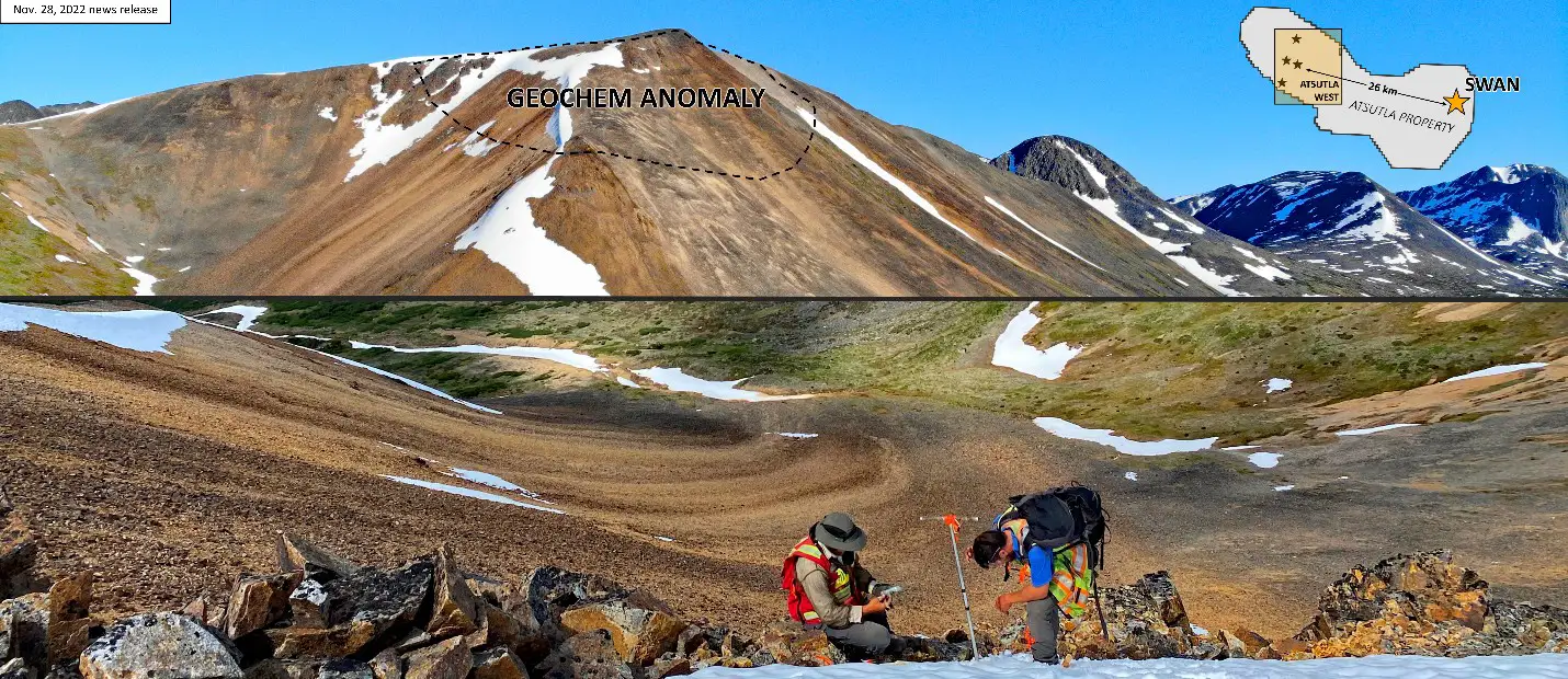
Detailed geological mapping found that all rock units in the Swan area, except for mafic dikes, are variably altered. Rocks display a strong hydrothermal overprint, which was interpreted to be concentrically zoned. Alteration is weakest at the periphery of the mapping area and intensifies towards the main mineralized zone, grading from phyllic to advanced argillic. It was determined that these features may represent the shallow, lithocap levels above a mineralized porphyry system.
The IP survey, in combination with historic IP data, presents a distinct, donut-shaped chargeability high feature with dimensions of approximately 2.1 km x 1.4 km. This feature is co-incident with the multi-element soil anomaly. The thickness of the chargeability high is approximately 200 m to 500 m. The chargeability signature is strongest near-surface and extends to at least 300 m of depth. The southern portion of the chargeability high feature is correlated with a wider (~700 m) zone of low resistivity.
The high chargeability anomaly may represent the distribution of disseminated pyrite, and the low resistivity feature may be caused by alteration minerals, including sericite, pyrophyllite, and clay minerals identified during geological mapping. The combination of these features commonly occurs in the phyllic alteration assemblage surrounding porphyry deposits.
The airborne geophysics defines a magnetic low coinciding with the donut-shaped IP chargeability high, with a subtle magnetic high in the center of the donut. The magnetic low may be caused by magnetite-destructive phyllic alteration, whereas the subtle magnetic high in the center may indicate a magnetite-bearing, potassic altered intrusion at depth. A zone of enriched potassium relative to thorium and uranium in radiometric responses occurs on the eastern side of the center of the chargeability donut. Elevated potassium is commonly associated with K-feldspar and biotite (potassic) alteration, common in the early phases of a porphyry system
The data collected at the Swan zone to date gives strong evidence to the presence of a Cu-Mo ± Au-Ag mineralized porphyry at depth. The zone is now considered by Trailbreaker to be drill-ready and is fully permitted.
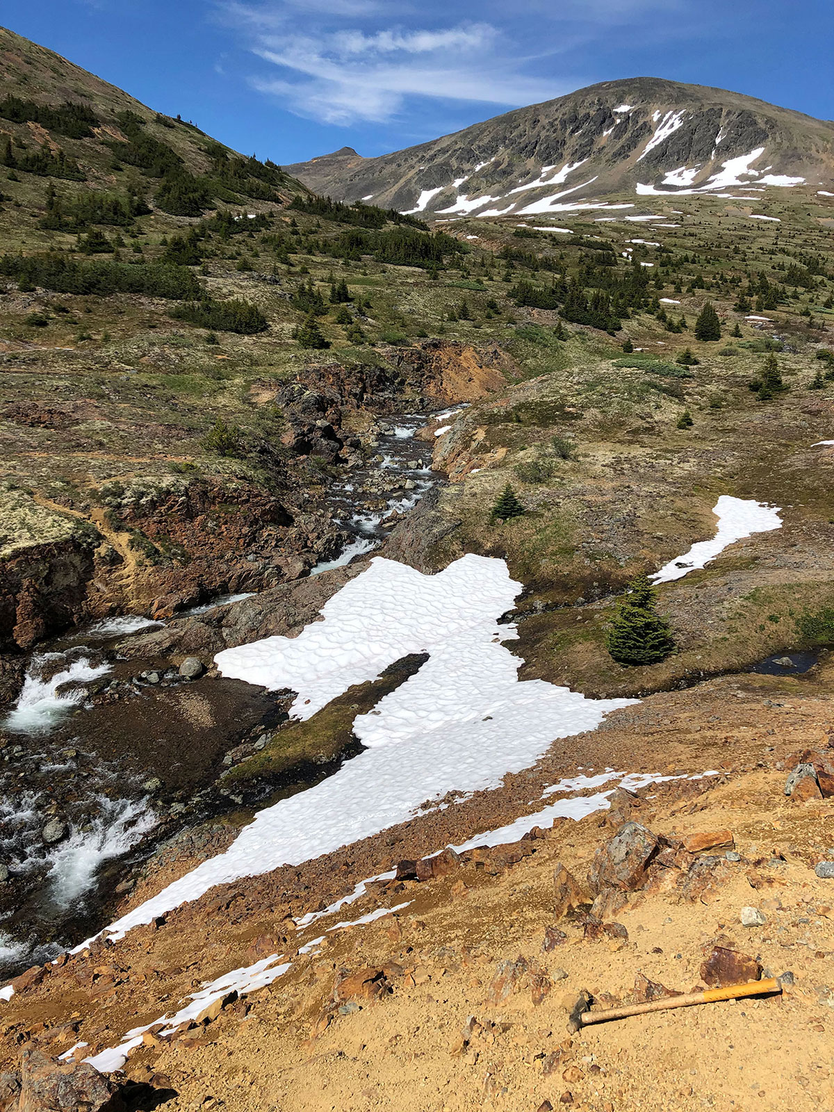
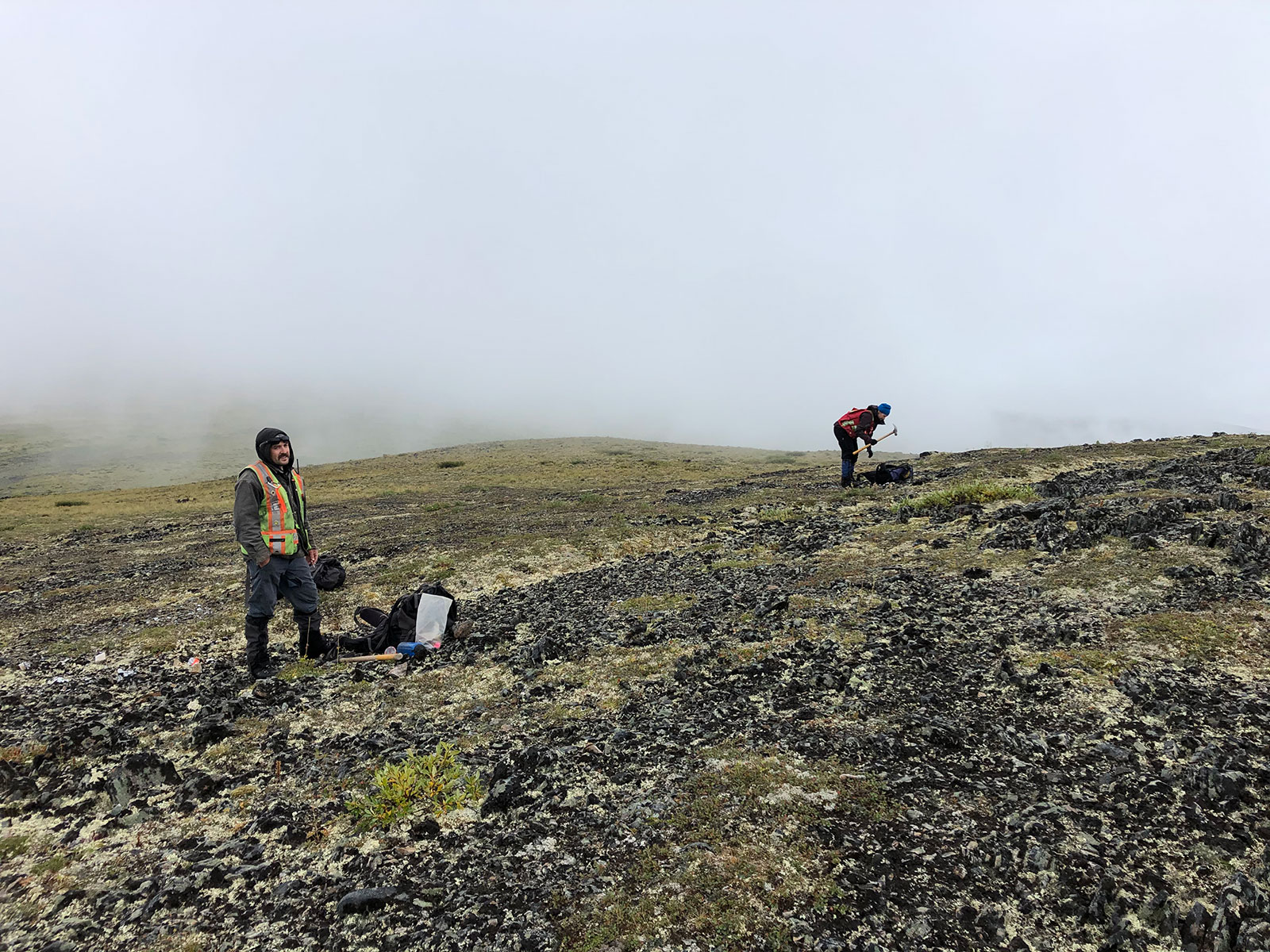
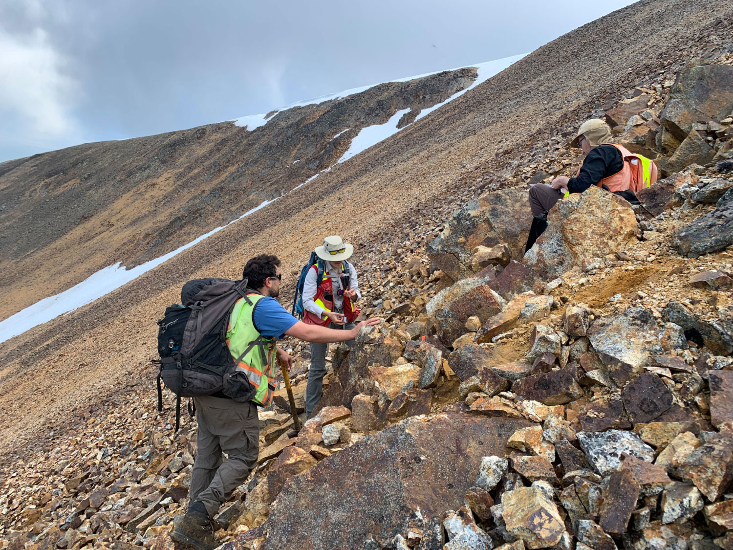
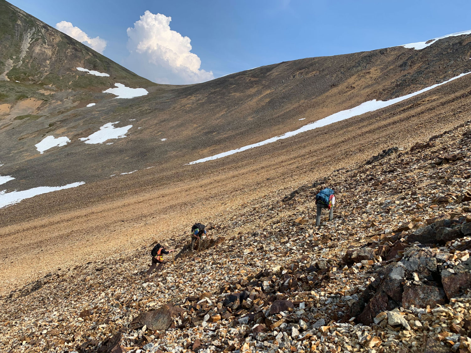
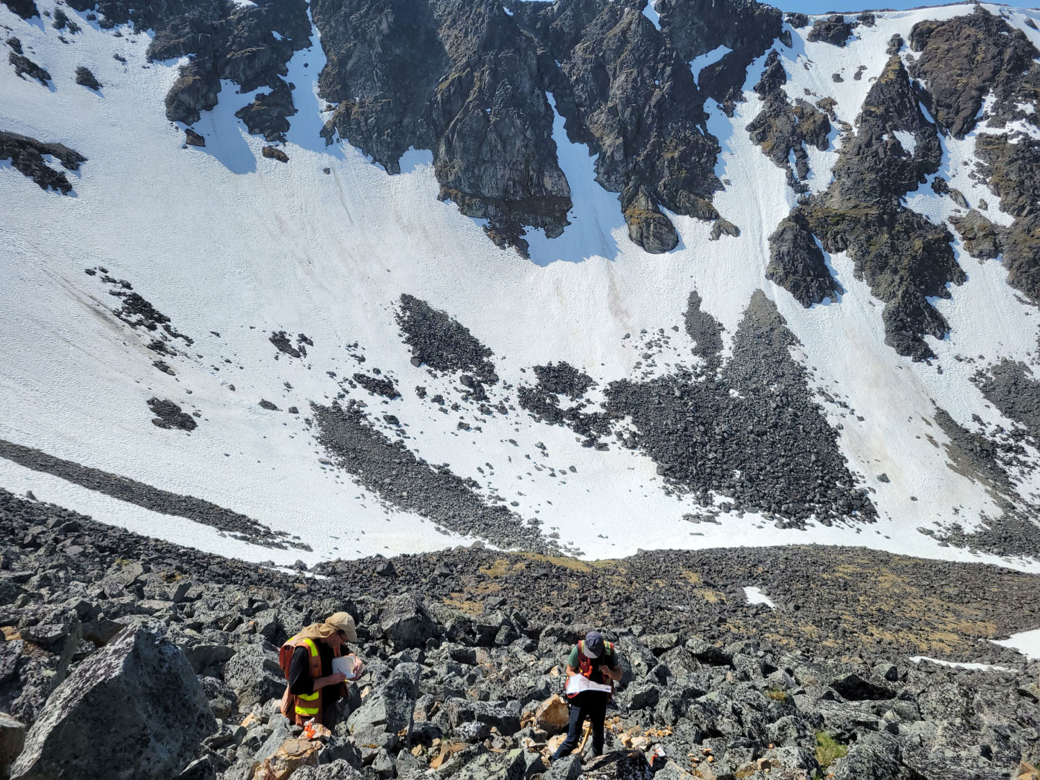
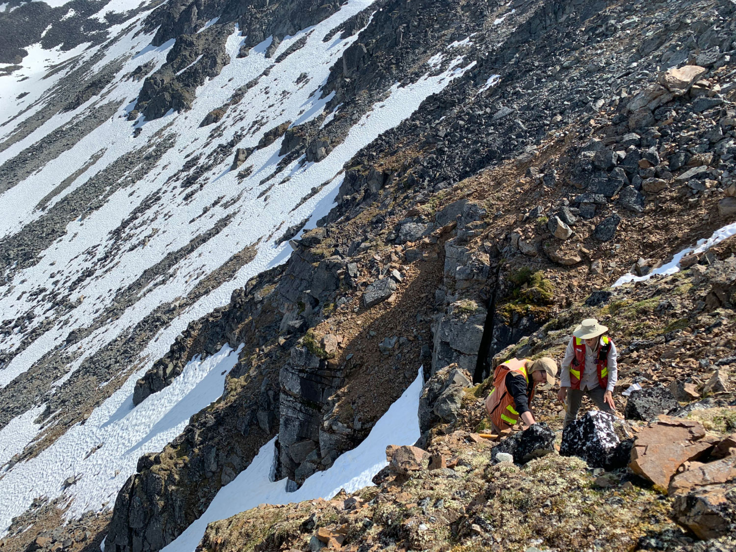
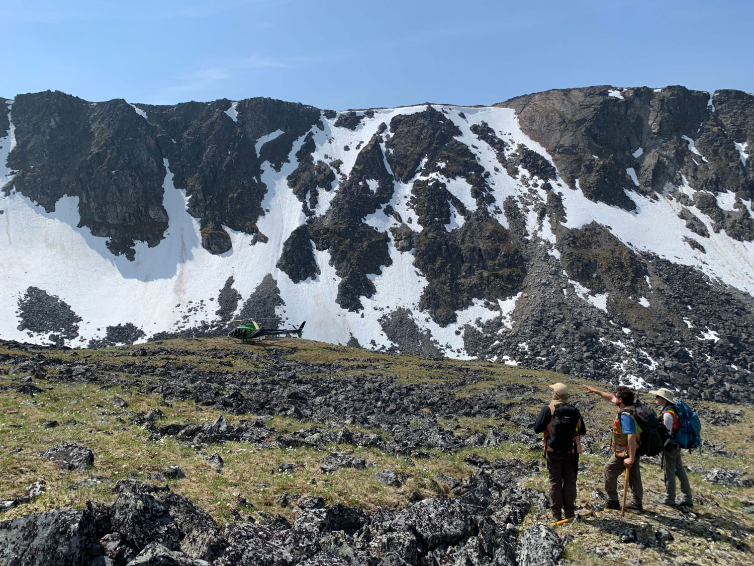
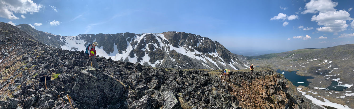
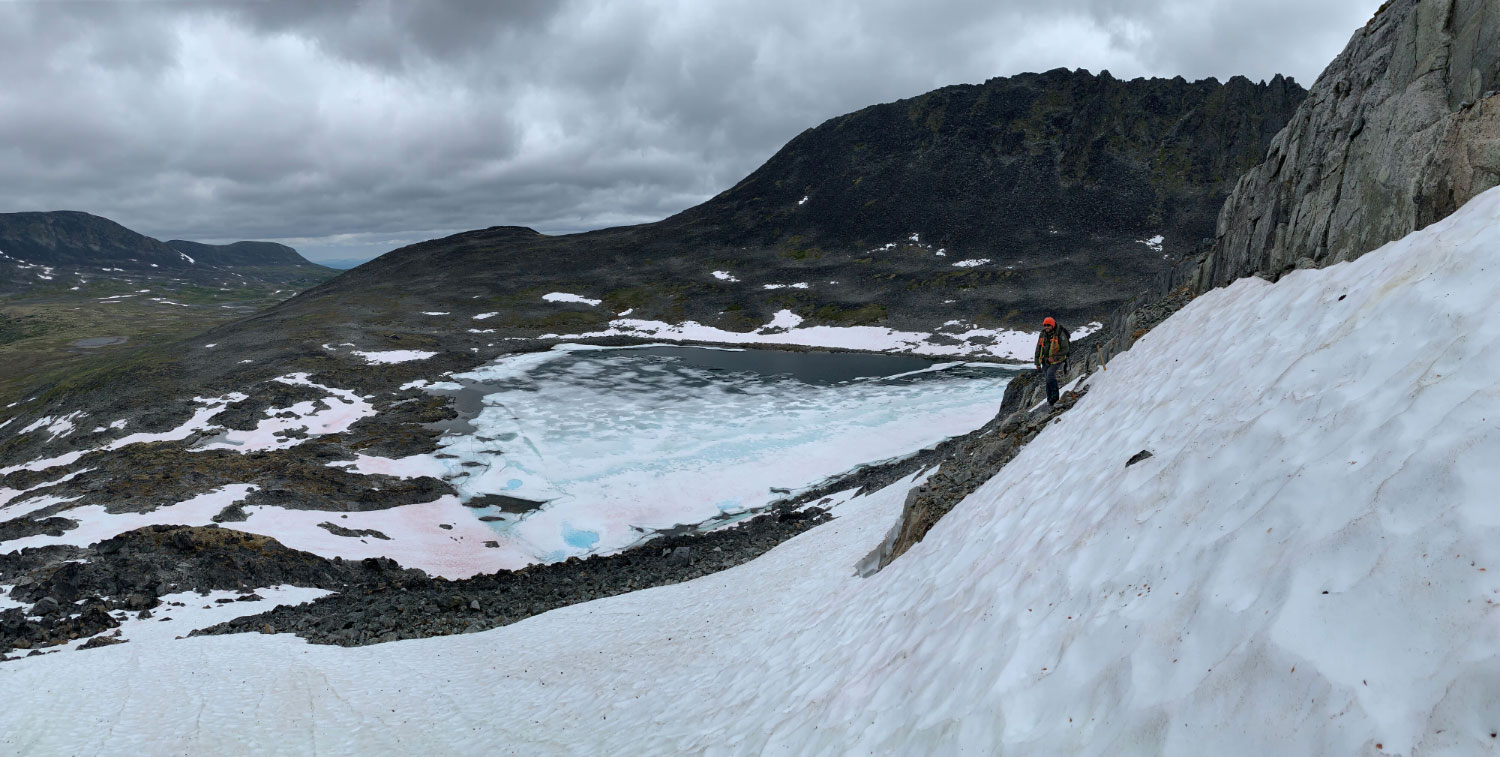
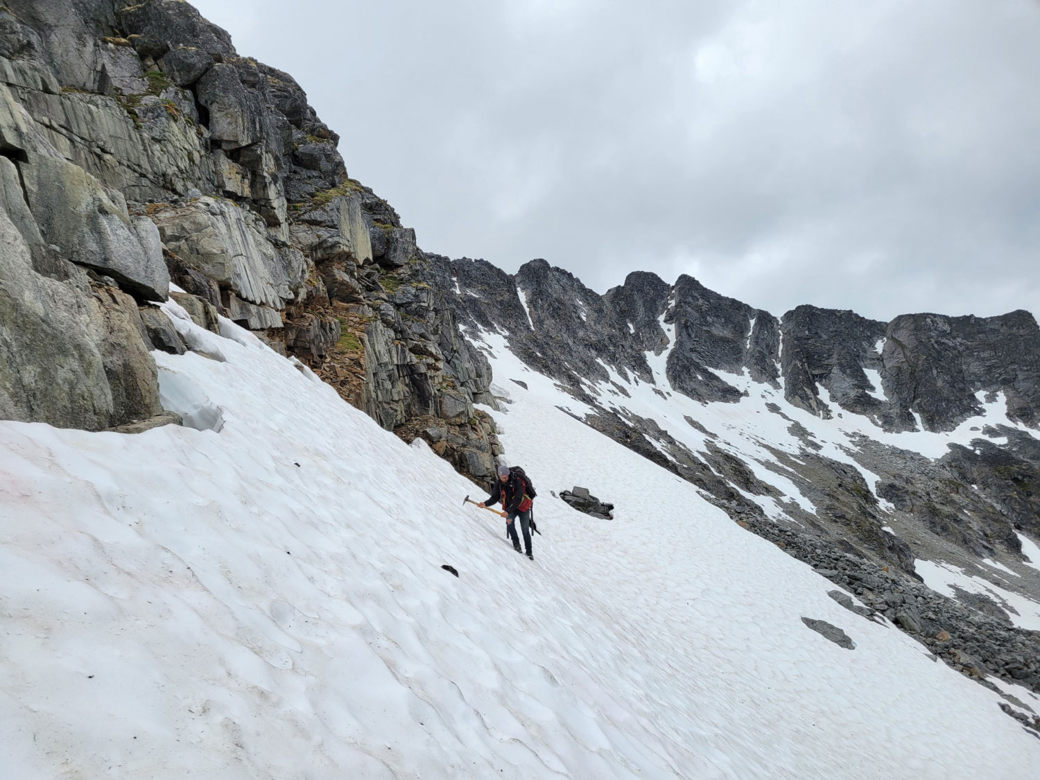
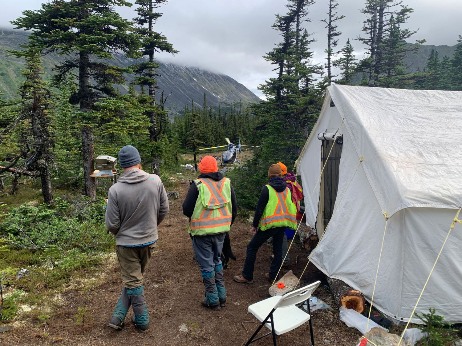
Photos


Presentation
Address
Trailbreaker Resources Ltd.
650 W Georgia St # 2110
Vancouver, British Columbia
Canada, V6B 4N9