

Introduction
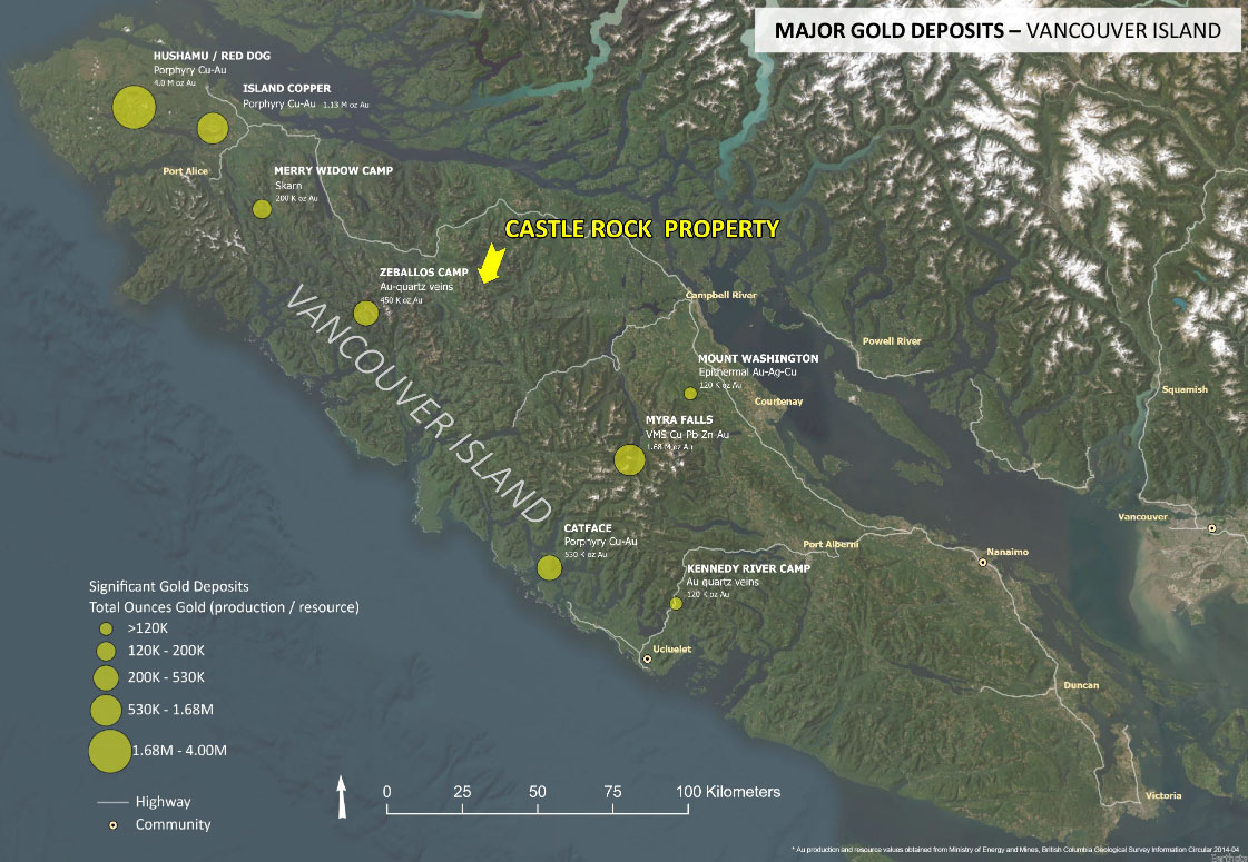
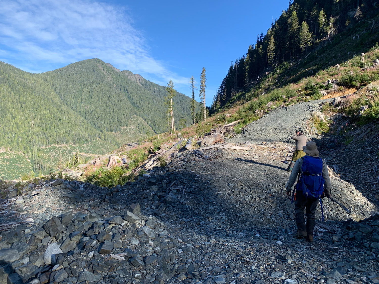
The Castle Rock project is an early-stage copper-gold porphyry prospect situated on northern Vancouver Island, British Columbia. Covering of 3,108 hectares of prospective land, the claims are located approximately 70 km northwest of Campbell River, BC. The property is easily accessible via active Forest Service Roads that branch off of Highway 19.
Northern Vancouver Island is host to several large Cu-Au porphyry deposits including Northisle’s Hushamu deposit that contains an Inferred Resource of over 5.57 Moz AuEq and BHP Billiton’s past producing Island Copper deposit that produced >2.7 B lb Cu and >1.0 Moz Au. The Merry Widow gold camp is situated 75 km to the northwest and the Zebellos gold camp is located 40 km to the west.

Property Location
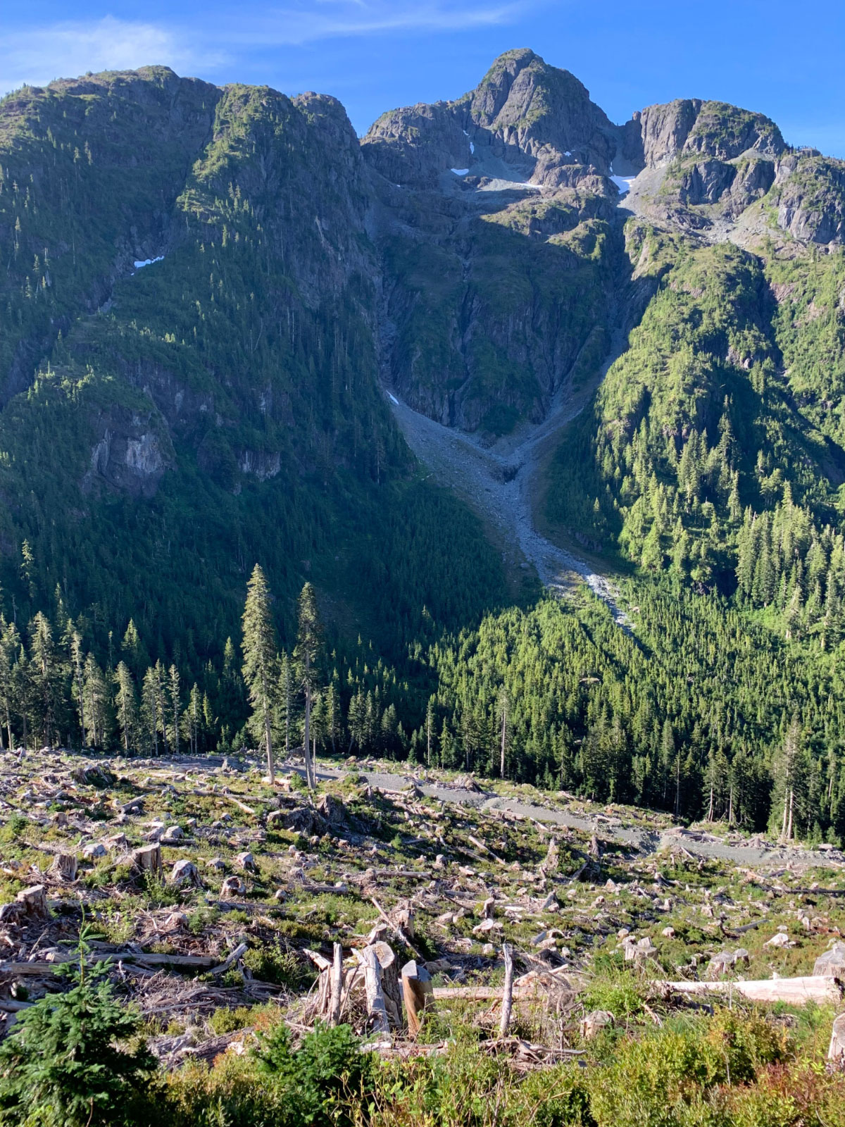
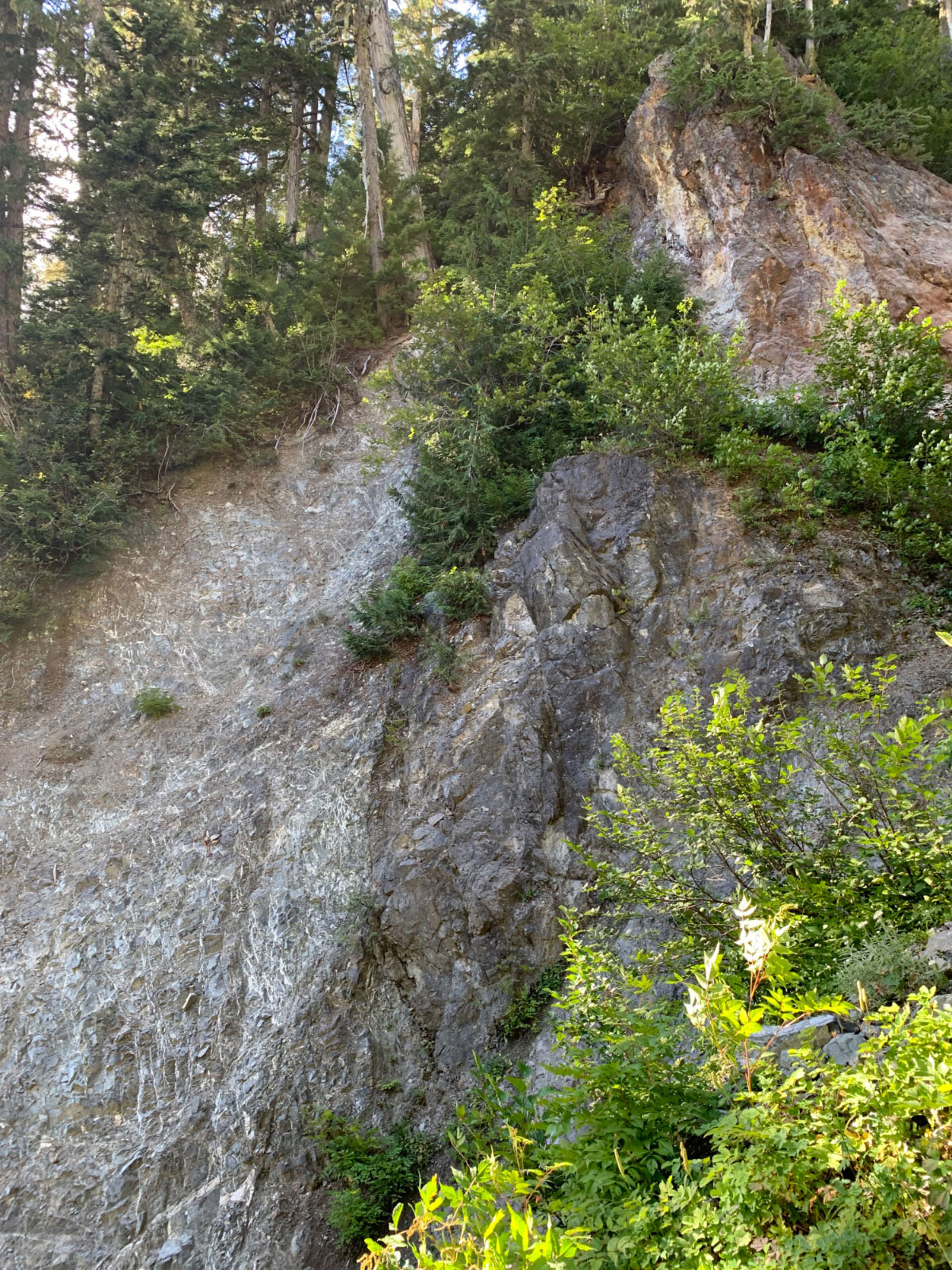
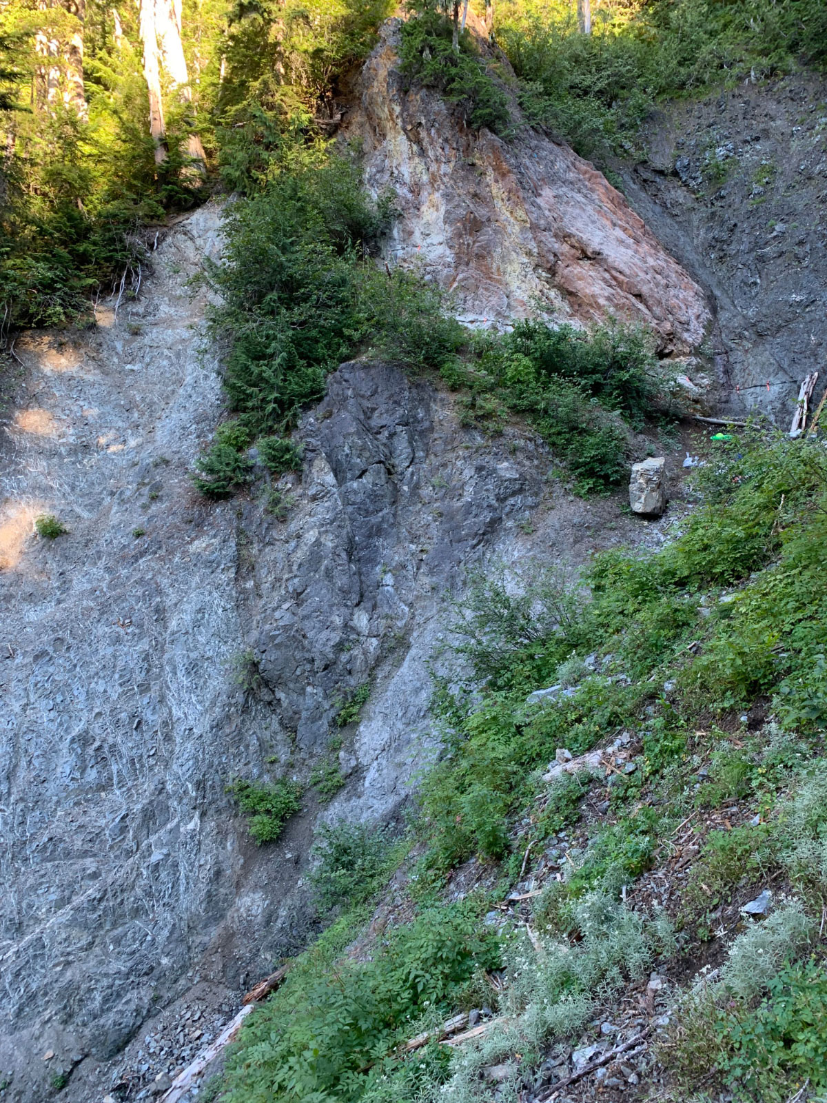
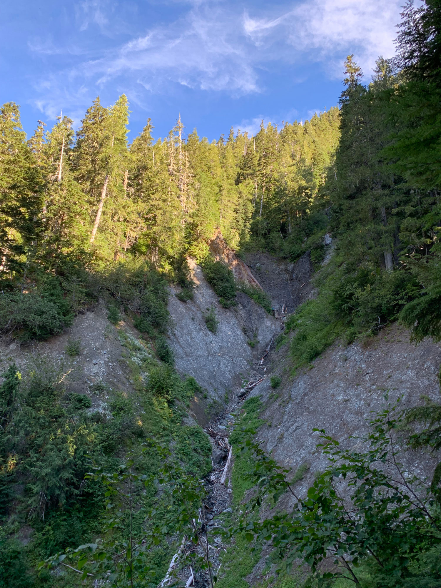
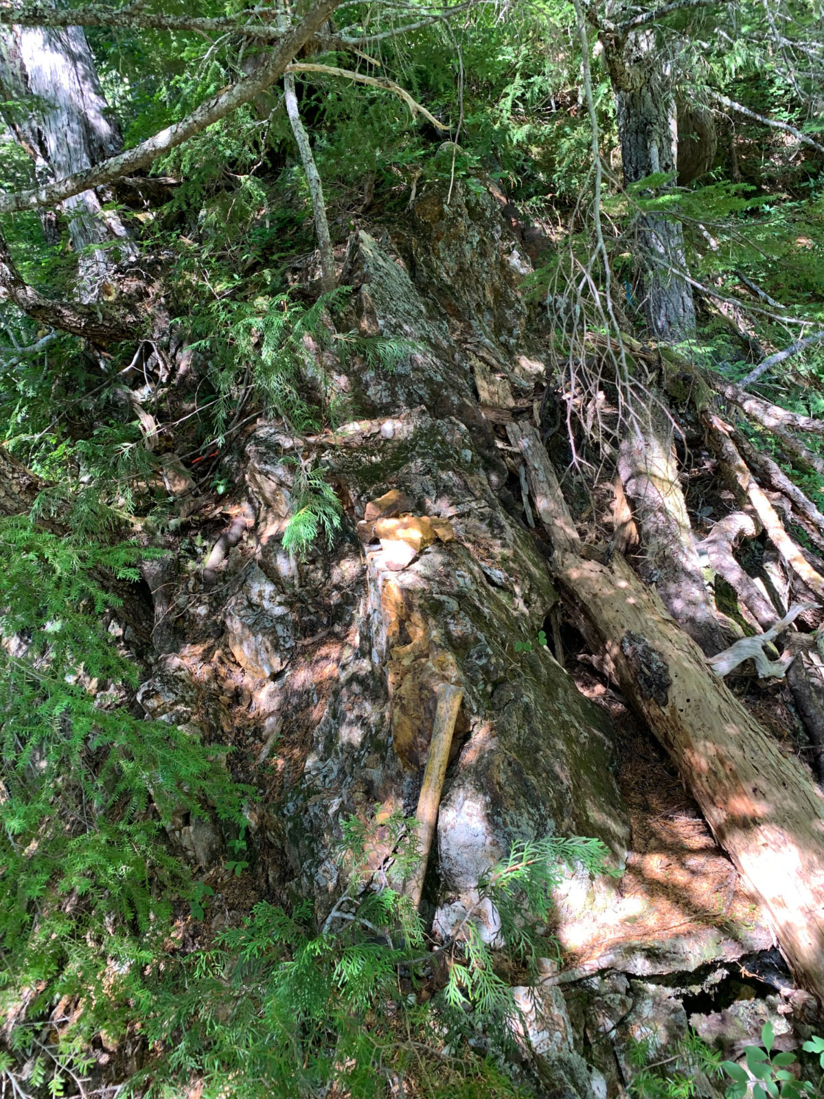
Castle Rock represents a relatively new gold discovery within a part of Vancouver Island that has seen limited exploration to date and was not previously known for its gold potential. The steep, rugged terrain of the Schoen Creek drainage has kept this area underexplored. The area was first opened to logging activity in the early 2000s. The new logging road networks allowed for a property-scale geochemical silt survey in 2012 which led to the discovery of a large gossanous outcrop (coined the Heart zone) with a chip sample returning 2.0 g/t Au over a 30 meter interval. The gold is hosted in Jurassic age granodiorite dykes that have intruded along a regional-scale fault zone separating Lower to Middle Triassic age sediments from the Upper Triassic Karmutsen basalts. The auriferous intrusive displays strong hydrothermal alteration and brecciation with gold mineralization associated with disseminated and veined pyrite.
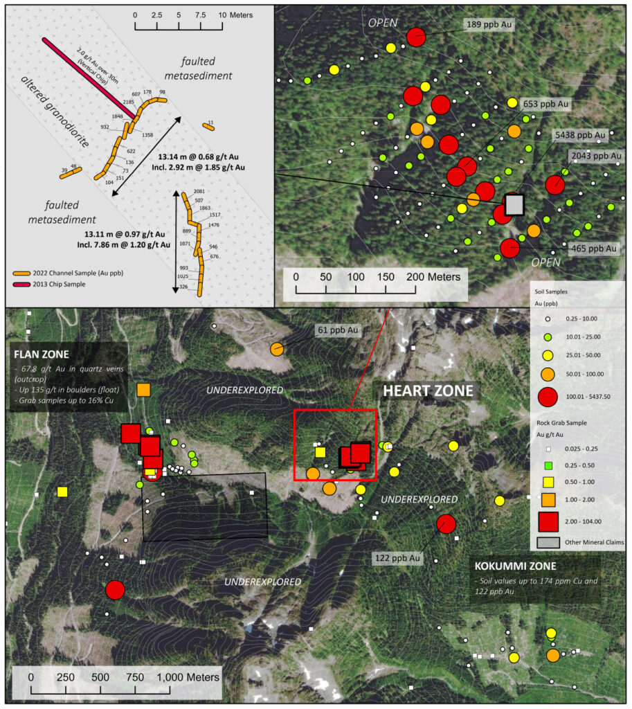
In 2022, Trailbreaker confirmed historic gold grades reported at the Heart showing, with a bedrock channel sample of 0.68 g/t Au over 13.11m, including a subinterval of 1.85 g/t Au over 2.92m. A property-wide soil geochemical survey conducted during the 2023 and 2024 exploration seasons has outlined several gold-in-soil anomalies along a 3 km long northwest-southeast trend. Geological mapping suggests these gold anomalies are associated with an inferred regional-scale structural corridor (fault) separating the Middle Triassic age sedimentary rocks of the Sediment Sill Unit (basal unit of the Vancouver Group rocks) from the Late Triassic basalt of the lower Karmutsen Formation. The anomalies include (north to south): Flan, Heart, Watchtower, and Kokummi.

Summary of Each Zone:
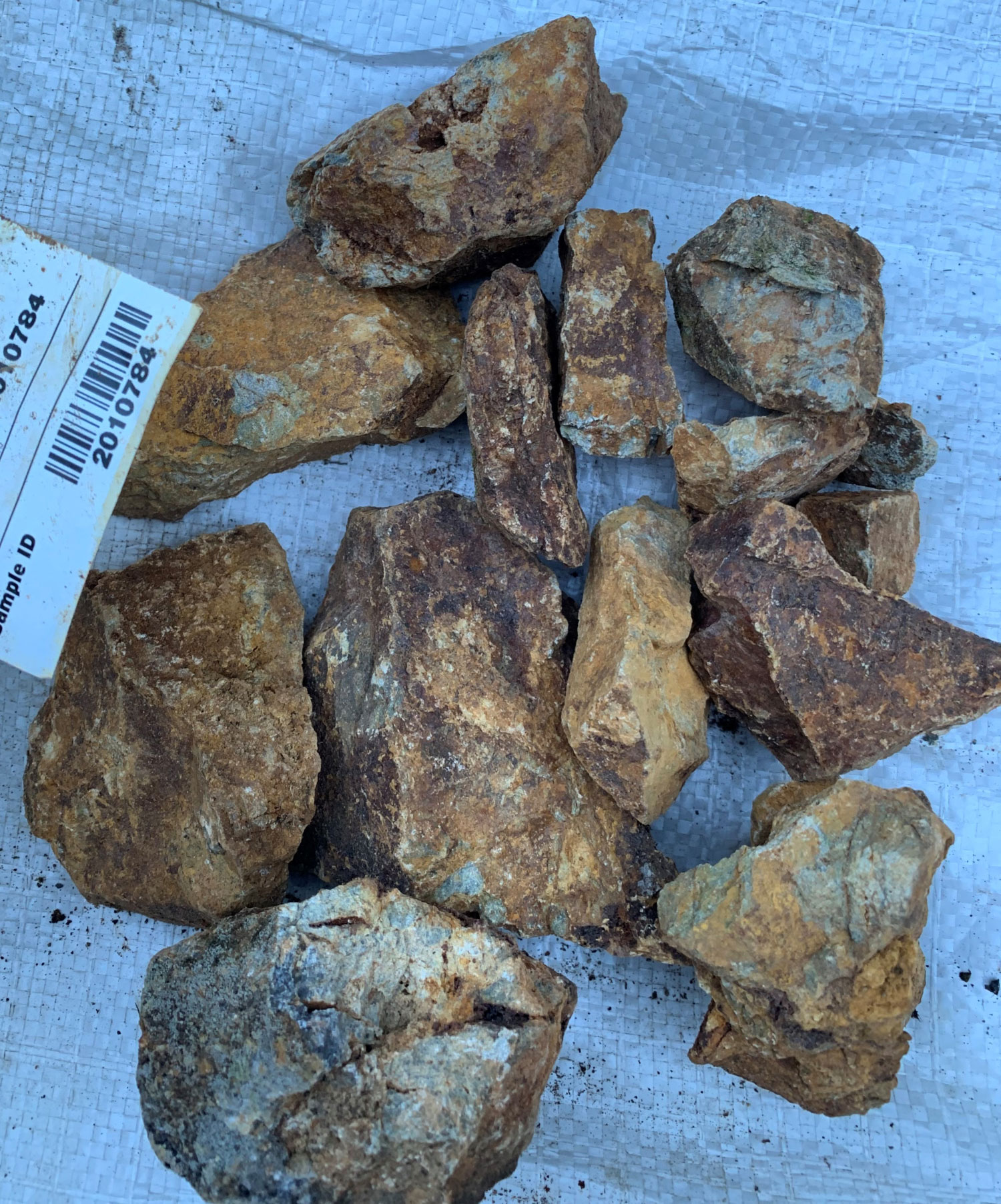
Flan Zone – Historic sampling at the Flan zone returned assays up to 135 g/t Au in boulders. Prospecting in 2023 confirm the presence this mineralization and traced the auriferous boulders back to a bedrock source. Gossanous float material sampled at the Flan zone confirmed high-grade gold mineralization, with assays up to 42.1 g/t Au and 1.93% Cu and outcrop basalt-hosted semi-massive pyrite-chalcopyrite-pyrrhotite returned assays up to 3.1 g/t Au.
Heart Zone – The Heart zone is defined by a 1,150 by 300 m gold-in-soil anomaly with soil values up to 5.44 g/t Au. The main showing consists of a rare outcrop exposure of a brecciated granodiorite dyke emplaced along a fault zone between metasedimentary and basalt rocks. Channel sampling across the dyke returned 0.68 g/t Au over 13.11 meters, including a subinterval of 1.85 g/t Au over 2.92m. Prospecting efforts have sampled the dyke over a 175-meter strike length which remains open.
Watchtower zone – The Watchtower zone is defined by a continuous gold-in-soil anomaly covering a 350 m by 200 m area with maximum Au values of 766 ppb. Prospecting within this zone has returned assay values up to 2.19 g/t Au, 0.54% Cu, and 6.2 g/t Ag from an outcrop with a ‘wormy’ quartz vein stockwork hosted in basalt.
Kokummi Zone – The Kokummi zone is defined by a gold-in‑soil trend over an 850 m strike extent with a 250 m width. Soil samples have returned gold values up to 115 ppb.
Heart Zone

Location / Infrastructure
Castle Rock is located on northern Vancouver Island, British Columbia, approximately 70 km northwest of Campbell River. The property is accessed via a 25 km stretch of a well-maintained Forest Service Roads branching off of Highway 19. The small town of Woss is located 30 km northwest of the property and the deep-water seaport of Port McNeill is located 75 km north. A major transmission line servicing the community of Gold River is located 10 km west of the Castle Rock property.
History
2000 – 2010
The Schoen Creek drainage was first prospected in the early 2000s. Prospector/geologist Mikkel Schau followed up on anomalous Cu-Au regional stream sediment samples, which led to the Flan zone discovery near the confluence of Jackpot and Schoen Creeks. Vuggy quartz veins yielded up to 67.8 g/t Au across a 30 cm wide sulphide vein hosted in a fault zone. Prospecting in the vicinity of the Flan showing continued to return encouraging gold values from large boulders with values up to 135 g/t Au and till samples with values up to 104 g/t Au.
2011 – 2014
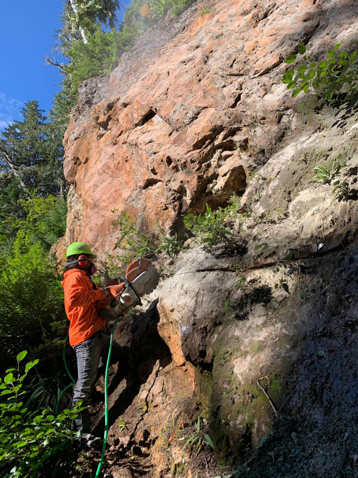
In 2011, Interwest Enterprises (a private oil and gas company) took a 20% interest in the property and funded the first significant exploration program on the property. The program involved property-wide stream sediment sampling and geological mapping which led to several new exploration targets, ultimately leading to the discovery of the Heart and Kokummi zones. In 2013, the Heart showing was sampled with a 30 meter chip sample of gossanous granodiorite breccia returning 2.08 g/t Au. In 2014, new logging roads and clear cuts at the base of the Heart zone provided good access and exposure for geological mapping and sampling.
2014 – 2022
The claim package sat idle with no work filed and expired in early 2022. Trailbreaker acquired the property via staking and purchase of mineral claims. A 3-day first pass-evaluation program was completed at the Heart zone. A total of 32 meters of channel sampling, 9 rock grab samples, and 116 soil samples were acquired. Based on the positive results, a partnership was formed with Cazador Resources, who owned the surrounding claim block. A property wide soil geochemical survey (1005 soil samples) was completed in 2023 and 2024.
Geology and Mineralization
The property is situated in the heavily glaciated Schoen Creek drainage basin that is best described as steep rugged terrain with numerous first growth, high elevation forests remaining intact. Limited bedrock mapping has been completed on the property due to thick forest cover and lack of access. The recent logging activity in the Schoen Lake drainage has exposed many outcrops in the lower valleys, resulting in a significant contrast to previous geological mapping efforts. The new mapping efforts show widespread intrusive activity in an area previously not recognized for the presence of younger intrusive rocks.
The property covers a Middle Triassic unit of black shale and siliceous tuffaceous cherts (Daonella beds) which is overlain by the lower Triassic Karmutsen basalts: a thick pile of pillowed and massive sub-aqueous to sub-aerial lavas. Intrusive rocks include Triassic gabbro sills and later Jurassic plutons that were previously mapped to the northwest and to the southeast. Property-scale mapping shows widespread smaller intrusive dykes and plugs of Jurassic age which are observed throughout the property, including at the Heart zone. A north-trending fault zone cuts through the center of the property, dividing the metasediments and Karmutsen basalts. The felsic dykes and small plutons preferentially tend to intrude along this fault zone.
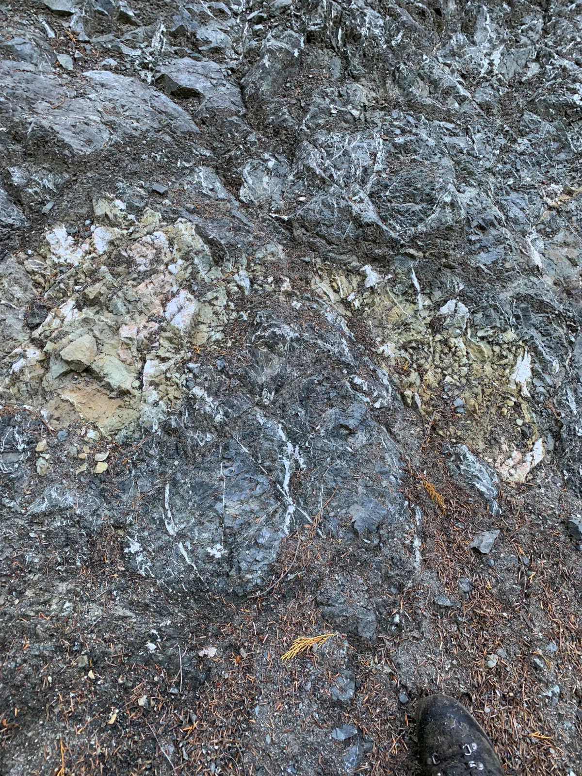
The Heart zone is characterized by a steeply dipping, approximately 15 – 20 meter wide, strongly altered, and brecciated Jurassic age granodiorite dyke that strikes northwest-southeast and intrudes along a regional-scale fault zone. This fault zone separates the Lower to Middle Triassic age sediments from the Upper Triassic Karmutsen basalts. The showing is confined to a cliff exposure in a steeply incised creek drainage, with the reminder of the intrusive unit masked by glacial till and first growth forest. Gold mineralization occurs with disseminated and veined pyrite and sulfosalts, with the dioritic dyke averaging approximately 1 g/t Au. A higher-grade, 3-meter-wide center of the showing averages approximately 2 g/t Au, and displays stronger brecciation and sulfur alteration. High-grade skarn gold mineralization is also observed in massive pyrite lenses hosted in the metasediments surrounding the auriferous dyke with historic grab samples assaying up to 21 g/t Au.
Maps

Photos


Presentation
Address
Trailbreaker Resources Ltd.
650 W Georgia St # 2110
Vancouver, British Columbia
Canada, V6B 4N9