

Introduction
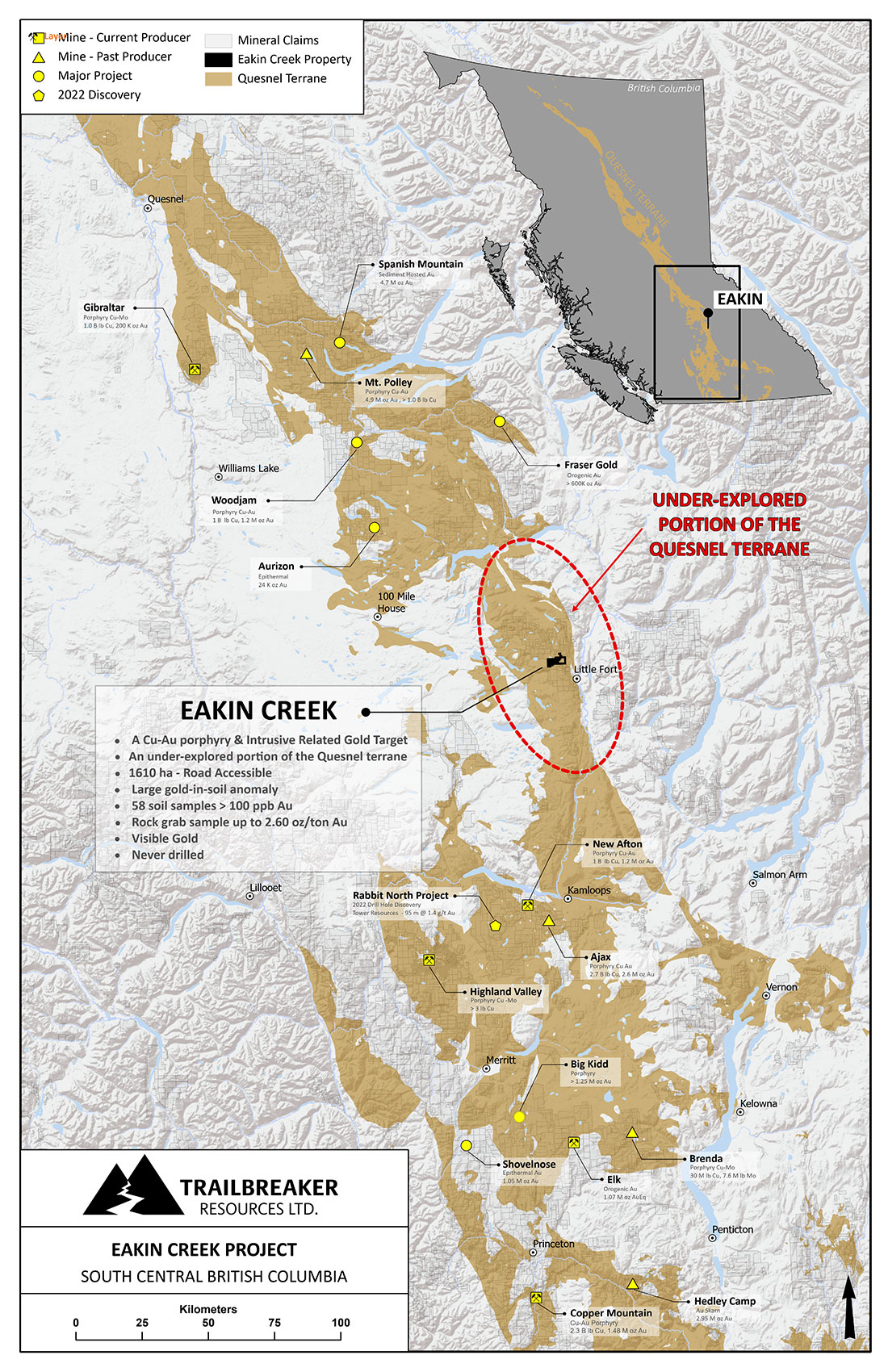
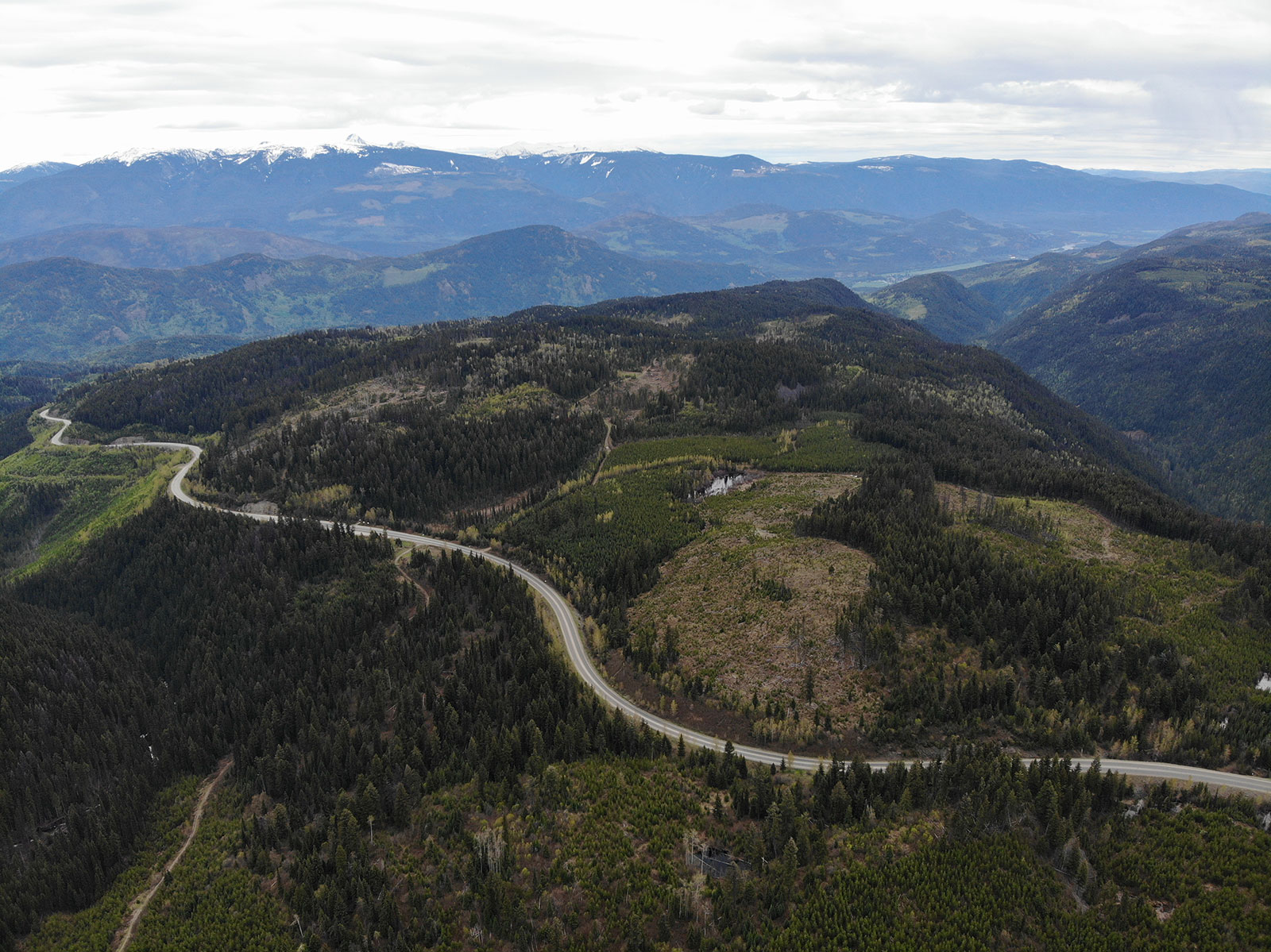
The Eakin Creek property is located 100 kilometres north of Kamloops and can be accessed via Highway 24 and well-maintained forest service roads. The property covers 1610 hectares of prospective ground that drains into placer gold-bearing Eakin Creek. The property lies in an underexplored portion of the Quesnel tectonic terrane which hosts many of BC’s producing copper and gold mines. The claim package is 100%-owned by Trailbreaker Resources with no underlying royalties or payments.
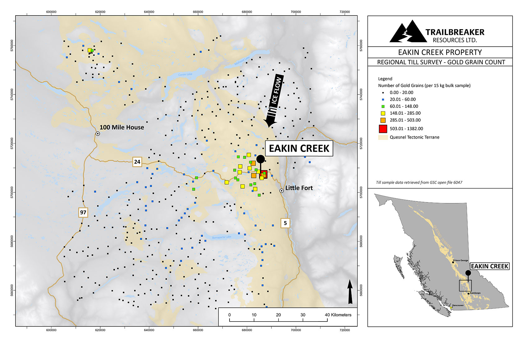
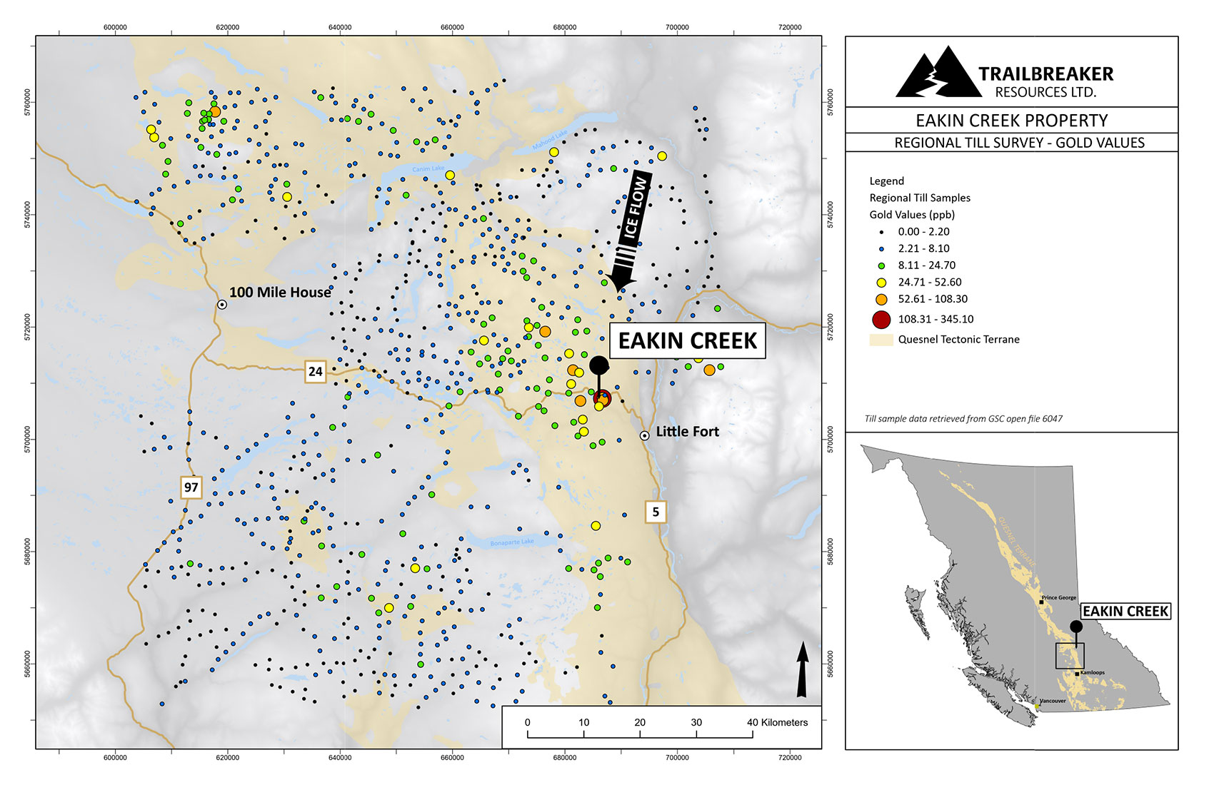
A regional-scale till sampling survey conducted by the Geological Survey of Canada has shown this underexplored portion of the Quesnel terrane has an anomalous Cu-Au-As-Mo geochemical signature that is indicative of copper porphyry environments elsewhere in BC; furthermore, some of BC’s highest gold grain count values are recorded from till sampled on the Eakin Creek property.
Placer gold was first discovered in Eakin Creek in the late 1800s, with small scale mining occurring through to the 1940s. The hard rock source of the placer gold remained a mystery for over 100 years. Gold in bedrock was only first discovered on the property in 1983 during the construction of Highway #24 with subsequent hard rock discoveries continuing through to the early 1990s.
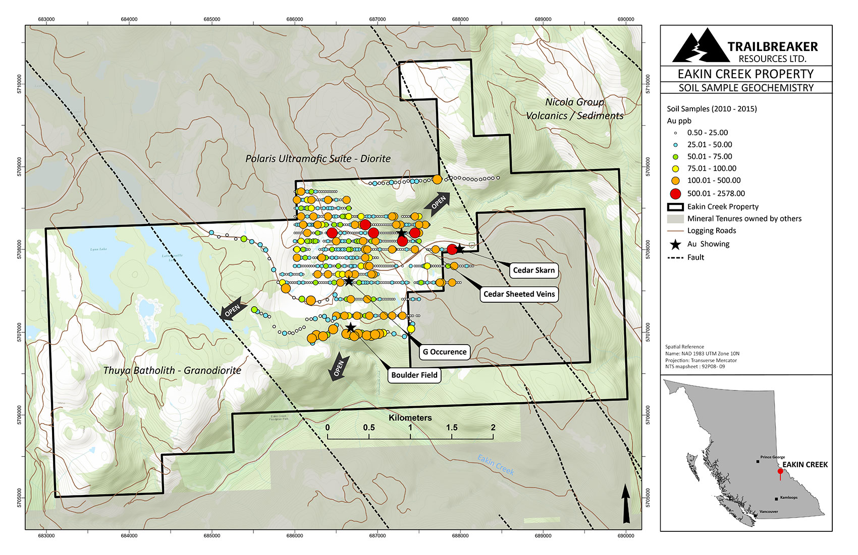
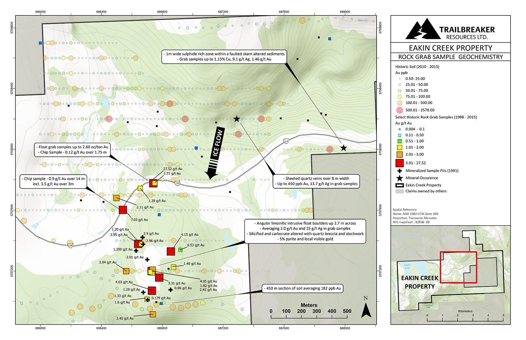
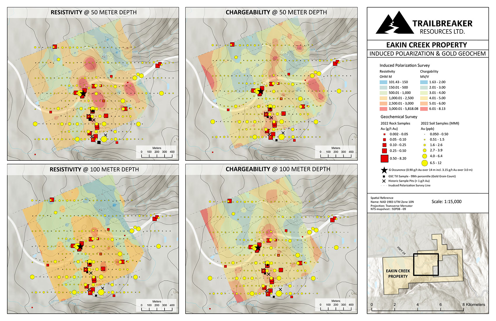
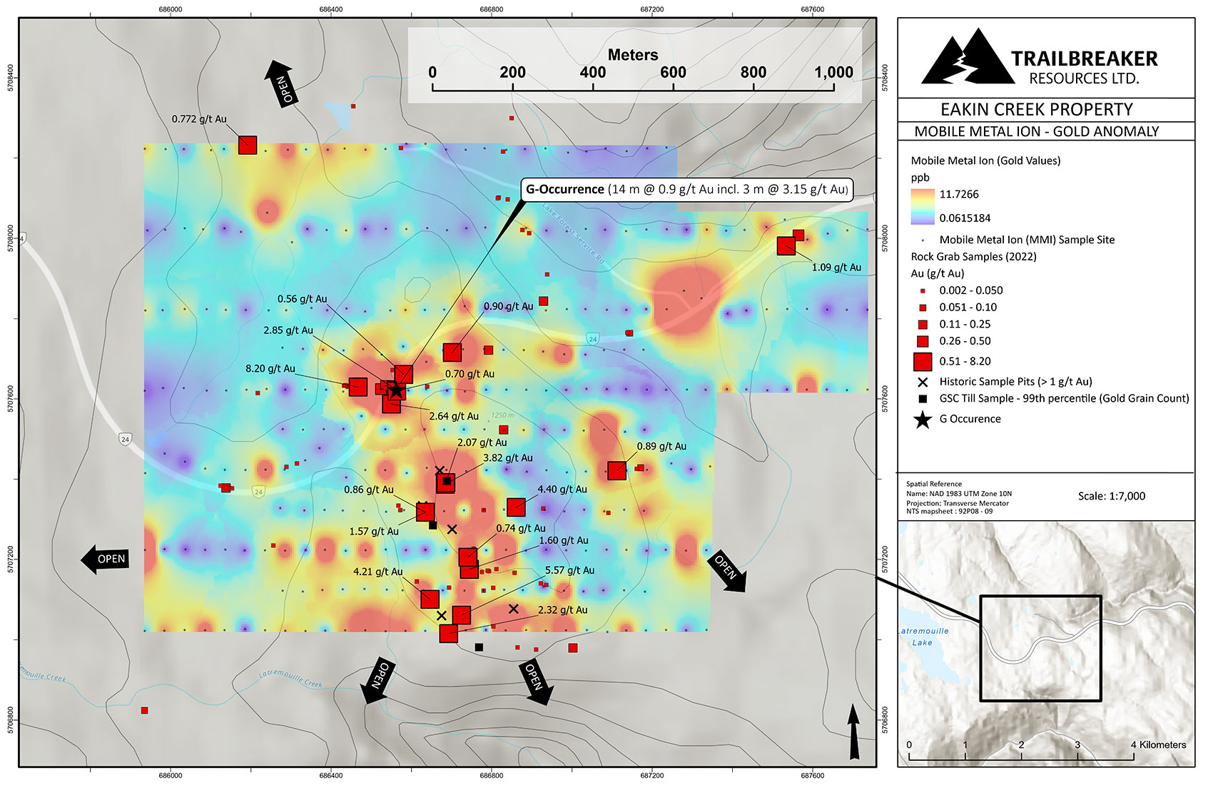
Historic assessment reports show the property hosts a strong, widespread gold-in-soil anomaly with over 58 samples containing greater than 100 ppb Au, with a maximum of 2600 ppb (2.6 g/t) Au. Prospecting and trenching have proved difficult in the area due to widespread glacial till cover, however the limited historic exploration has been successful in determining the sources of the gold-in-soil anomalies. Numerous high-grade float boulders have been sampled from surficial pits, assaying up to 89.13 g/t (2.60 oz/ton) Au and locally containing visible gold. Historic outcrop sampling on Highway #24 returned a 3 m chip sample interval grading 3.15 g/t Au within a 14 m interval containing 0.9 g/t Au (‘G Occurrence’). Gold mineralization on the exposed highway outcropping is associated with fracture-controlled quartz-calcite veins and breccia hosted in an altered Jurassic-age diorite. The property has not been drilled to date nor was any deep geophysical programs completed prior to Trailbreaker’s acquisition.
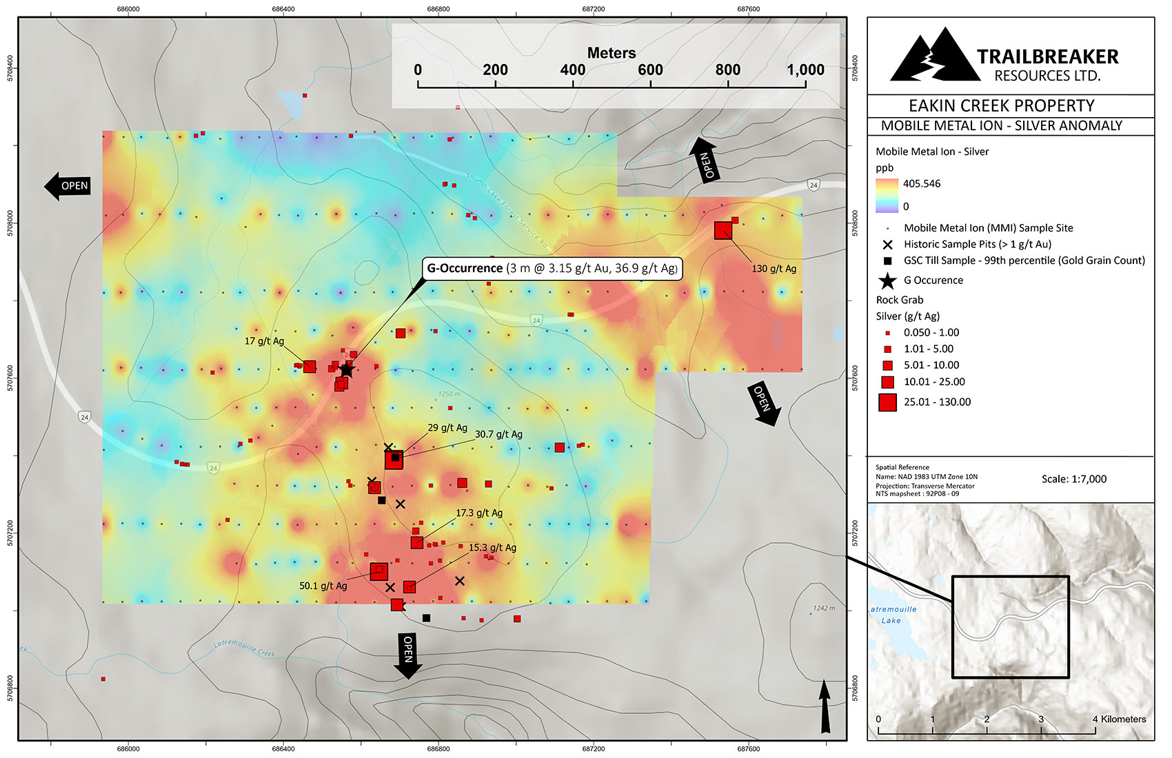
In 2022, Trailbreaker acquired the property and performed a 302-sample MMI (Mobile Metal Ion) soil survey, 10.75 line-kilometer IP survey, and prospecting program. The surveys defined a 1000 x 600 m Au-Ag (Cu-Sb) soil anomaly coincident with a resistivity and chargeability anomaly. Bedrock grab samples from the diorite unit exposed along the highway returned assay values up to 8.2 g/t Au and 130 g/t Ag. A felsic intrusive unit present as float scattered within a 400 x 300 m area yielded values up to 5.6 g/t Au and 30.7 g/t Ag. This boulder field of felsic intrusive rock is located down-ice (direction of documented glacial ice flow) of the highest resistive zone identified in the IP survey. As this felsic lithology would likely be more resistive than the dominant diorite lithology, Trailbreaker geologists have determined the strongly resistive zone to be a likely source of these mineralized boulders.
Trailbreaker’s team believes there is strong potential for a bulk-tonnage intrusive-related gold deposit hidden under the glacial tills. Permitting for an inaugural exploratory drill program is currently pending approval and targets are being planned.
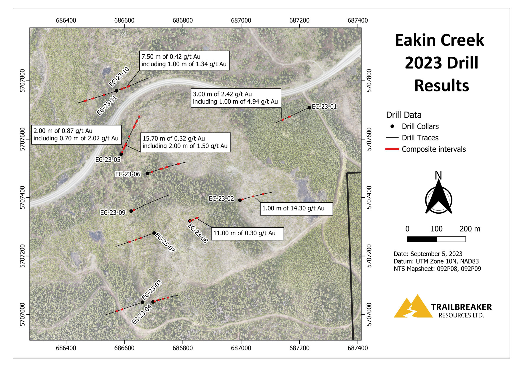
Trailbreaker conducted the first ever drill program at Eakin Creek in the spring of 2023. 2,039 m of diamond drilling was completed across eleven holes, successfully defining a widespread system of gold mineralization. Intervals returning anomalous gold values were encountered in all eleven drillholes, with highlights including: 1.0 m of 14.3 g/t Au from 67.0 m in EC-23-02; 3.0 m of 2.42 g/t Au from 145.0 m, including 1.0 m of 4.94 g/t Au from 147.0 m in EC-23-01; and 15.7 m of 0.32 g/t Au from 38.3 m, including 2.0 m of 1.50 g/t Au from 52.0 m in EC-23-05.
Location / Infrastructure
The Eakin Creek property is located approximately 10 km northwest from the town of Little Fort, 100 kilometres north of Kamloops, British Columbia on Highway 5. The claims can be accessed by a series of maintained logging roads that branch off provincial Highway #24, which cuts through the centre of the claim package. A major railroad and powerline are located just 10 km to the southeast.
History
Late 1800s
- Placer gold was discovered in Eakin Creek near its confluence with the North Thompson River.
1920 – 1940
- Small-scale placer mining recovered 176 ounces of gold from the lower reaches of Eakin Creek between 1921 – 1940. No hard rock source of gold was discovered yet.
1960s – 1970s
- Sporadic exploration for porphyry copper/molybdenum deposits took place in the region during the 1960s and 1970s (Teck, Rio Tino).
1983
- The first gold mineralization was discovered along the newly constructed Highway 24 (Cedar Skarn showing).
1985 – 1987
- Craven Resources conducted mapping, geochemical sampling, and magnetic and VLF-EM surveys on the Cedar Skarn showing.
1988 – 1990
- Additional mineralization (‘G showing’) was discovered a few kilometers west of the Cedar Skarn showing, and also along the Highway 24 road cut.
- Esso Resources Canada optioned the property and conducted a property-wide soil and silt survey around the G and Cedar Skarn showings. This led to the discovery of the Cedar sheeted vein showings within the Nehalliston Creek Canyon as well as numerous gold-in-soil anomalies.
1991
- Huntington Resources Inc extended exploration efforts south of Esso’s work and delineated several more gold-in-soil anomalies. Trenching and sample pits within the gold-in-soil anomalies reveled large angular boulders consisting of a limonitic intrusive that consistently assayed multi-gram gold and silver (boulder field showing).
1992 – 2006
- No significant exploration work was recorded on the property between 1992 – 2006 as gold price was severally deflated.
- In 2000 the BC Geological Survey conducted a regional-scale basal till survey that showed the strongest gold-in-till samples were located on the Eakin Creek property near the G showing. In 2009 the till samples were re-analyzed for gold grain counts which also showed the strongest gold grain counts on the Eakin Creek property.
2007 – 2010
- Bullrock Minerals Inc. completed a large (2 km X 2 km) tight-spaced soil geochemical survey grid that consisted of over 700 samples. The survey was successful in outlining many gold-in-soil anomalies with values up to 2.6 g/t Au. Prospecting around the G and boulder field showings continued to yield auriferous angular felsic intrusive, demonstrating a local source.
2012 – 2014
- White Oryx Minerals completed some small soil grids, extending Bullrock Minerals’ earlier grids as well as additional prospecting.
2015 – 2021
- The property claims expired and became fragmented with various owners involved and no significant exploration occurring. In 2015, Cathro Resources Corp. completed reconnaissance soil geochemical lines along the logging roads south of the G and boulder field showings, for a total of 96 samples. This survey further extended know gold-in-soil anomalies to the south with a 450 m section of soil samples averaging 182 ppb Au (50 m sample spacing).
2022
- Trailbreaker Resources staked new ground and consolidated existing mineral tenures to form the Eakin Creek property.
- Trailbreaker conducted a 302-sample MMI soil survey, 10.75 line-kilometer IP survey, and prospecting program.
2023
- Trailbreaker conducted an inaugural 2,039 m drill program in eleven drillholes
- Drilling intersected highlights including:
-
- EC-23-02: 1.0 m of 14.3 g/t Au from 67.0 m
- EC-23-01: 3.0 m of 2.42 g/t Au from 145.0 m, including 1.0 m of 4.94 g/t Au from 147.0 m
- EC-23-05: 15.7 m of 0.32 g/t Au from 38.3 m, including 2.0 m of 1.50 g/t Au from 52.0 m
Geology and Mineralization
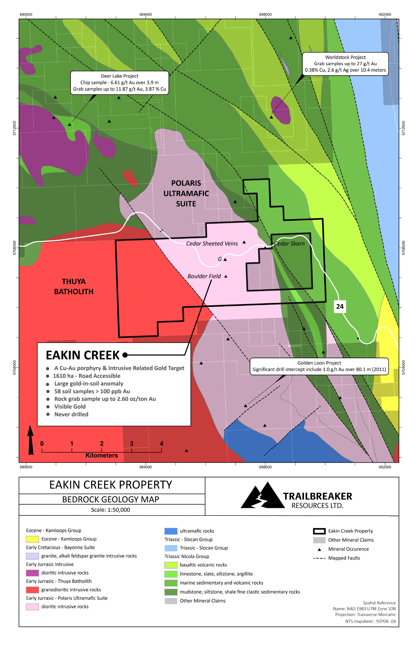
The Eakin Creek property is situated in the southern part of the Quesnel terrane within the Intermontane belt. This part of the Quesnel terrane is structurally complex and made up of highly variable and faulted Mesozoic age volcanic and sedimentary assemblages, and intruded by Triassic – Jurassic age intrusives. Many of British Columbia’s historical and current porphyry producers, as well as several other gold deposits occur within this tectonic belt.
On the property, the early Jurassic age Thuya Batholith granites and the north-trending Polaris Ultramafic Suite diorite cut the sedimentary and volcanic rocks of the Triassic Nicola Group. Early mapping on the property suggests northwest-trending faults are associated with the intrusive contacts.
Beyond, Eakin Creek, the nearest significant gold mineralization is located 5 km to the south on the Golden Loon project. The Golden Loon showings were discovered in the 1980s with the first drilling in early 1990s. Gold mineralization consists of visible gold and is associated with quartz and disseminated sulphides found within shallowly plunging, structurally-controlled and silicified zones cutting quartz monzonite. Significant drill holes intervals include 1.0 g/t Au over 80.1 meters and 2.46 g/t Au over 10.43 meters.
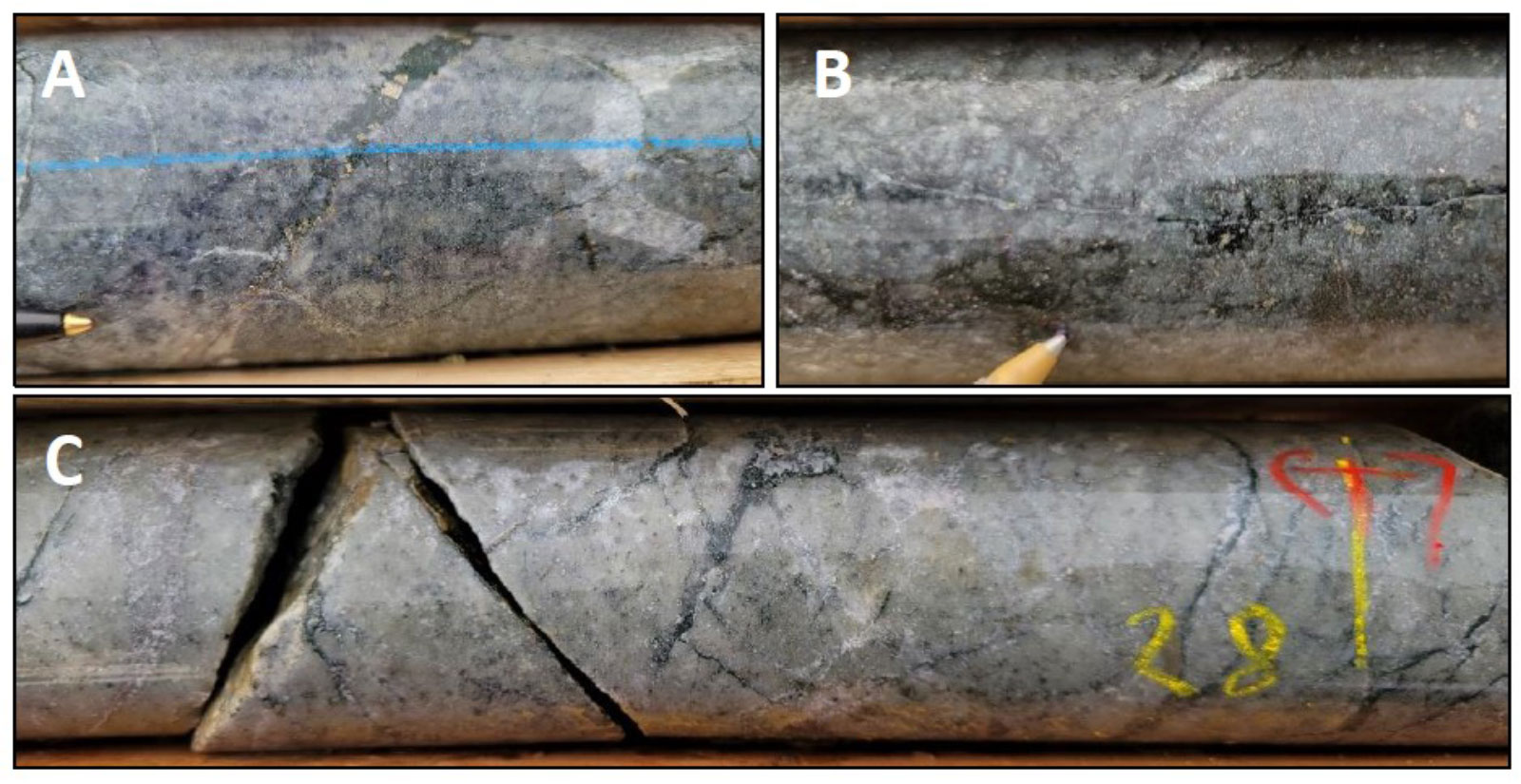
Gold mineralization in drill core is associated with zones of silicified intermediate intrusive rocks hosting disseminated pyrite and quartz-carbonate-chlorite veins containing pyrite ± magnetite. Gold mineralization is strongly correlated with silver (Ag) and tellurium (Te). This style of mineralization is similar to that observed within “float” material at surface. It is therefore interpreted that drilling has encountered the bedrock source of the surface geochemical anomaly.
Gold mineralization was also found to be structurally associated, particularly with faulting. Zones of faulting, brittle deformation, and brecciation were found to be spatially associated with increased gold grades.
Maps
-

- Location Map
-
- Geology Map
-
- Soil Geochemistry
-
- Rock Geochemistry
-
- Regional Till Survey – Gold Grain Count
-
- EC regional till survey gold icpms
-
- Ground Magnetic & IP survey

-
- IP Gold Geochemistry
-
- MMI gold in soil anomaly
-
- MMI silver in soil anomaly
-
- Eakin Creek Drill Results
Photos
-
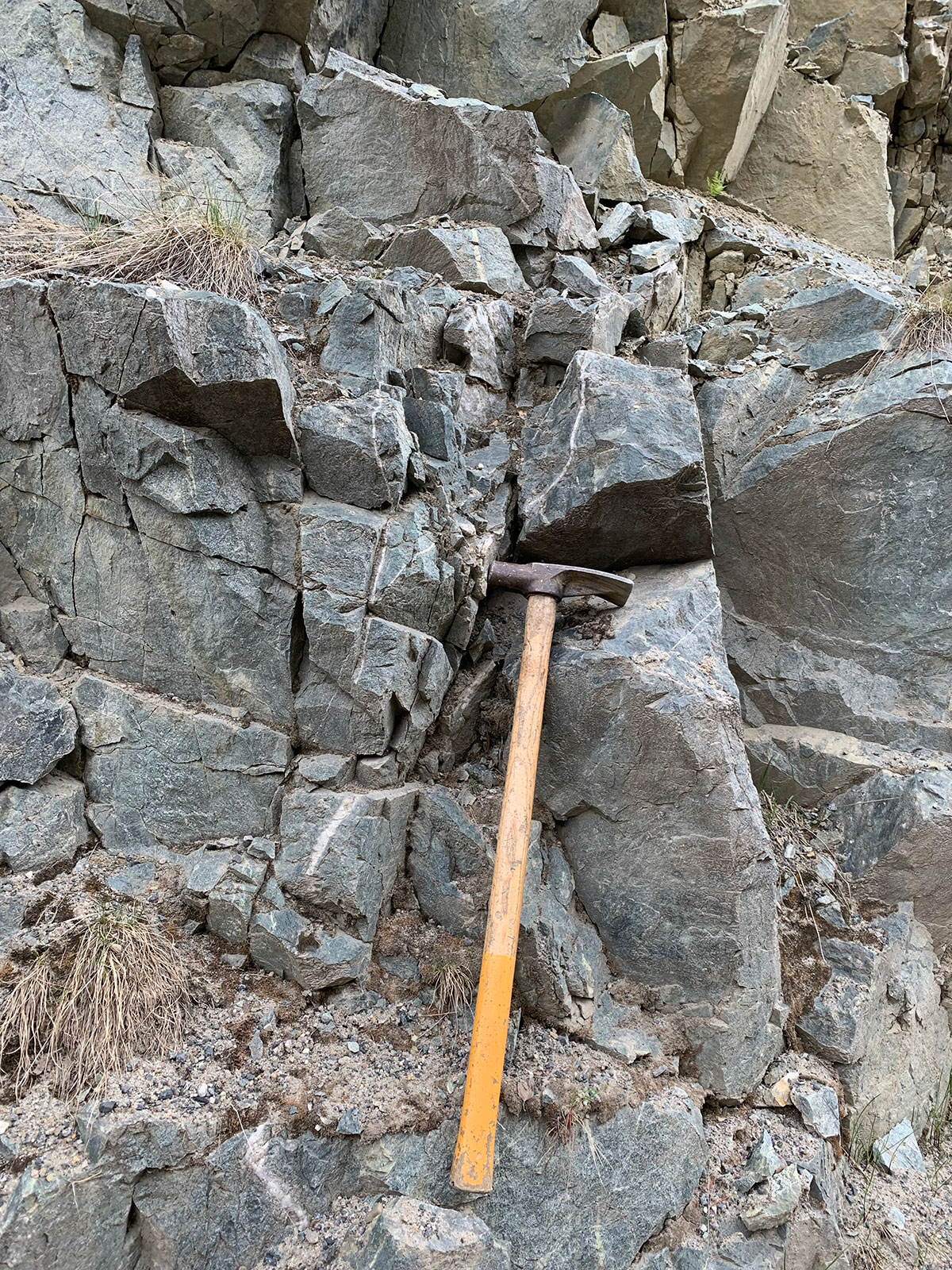
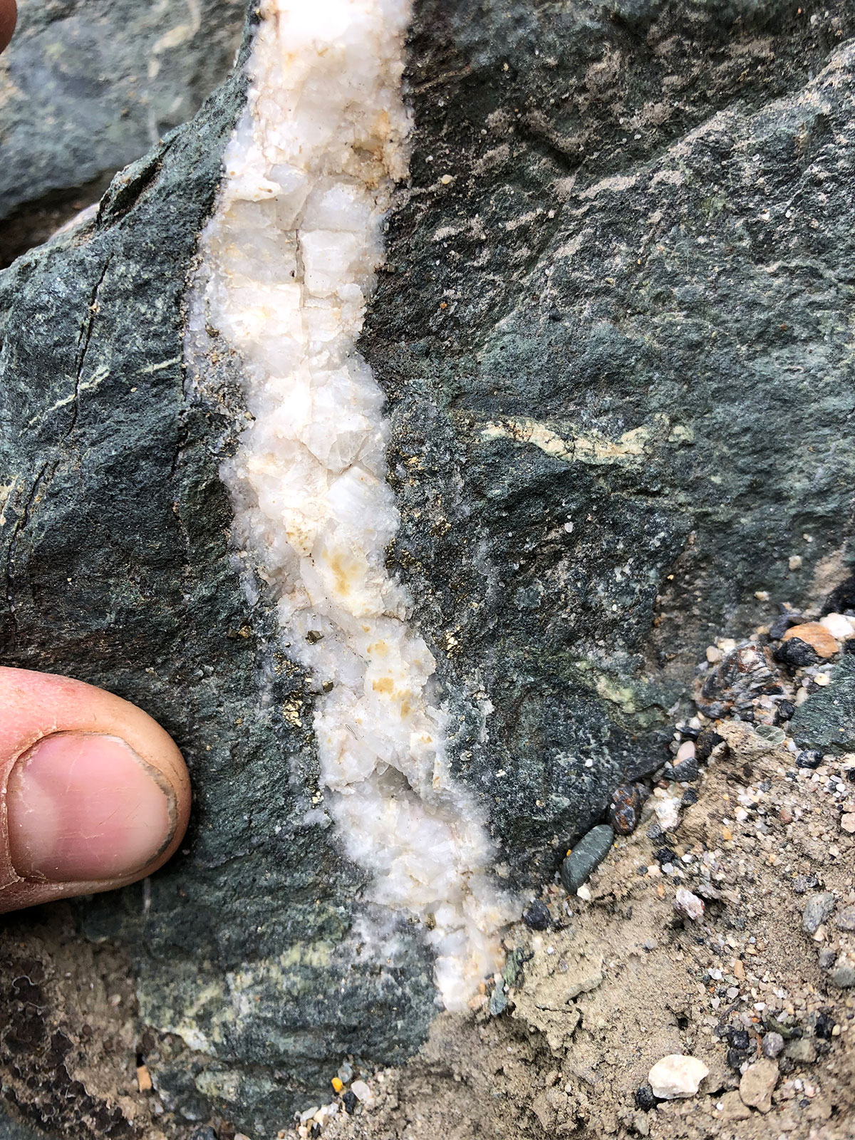
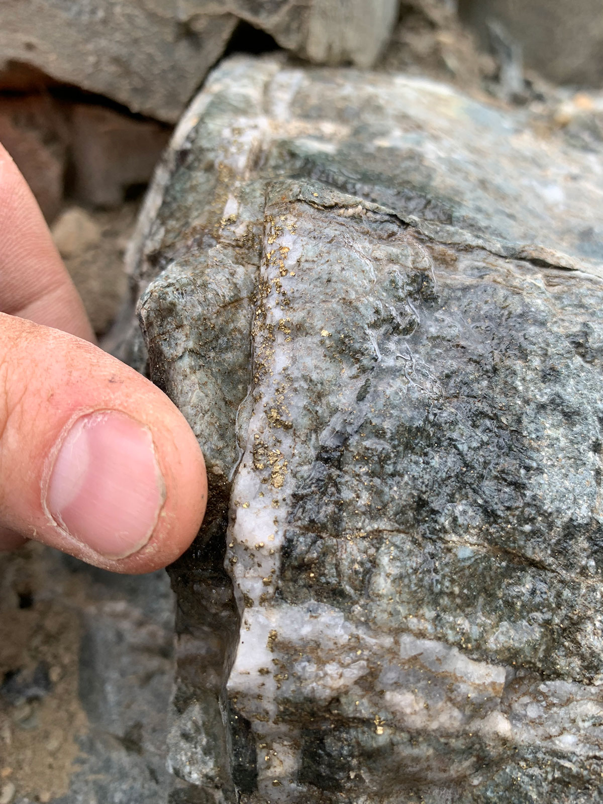
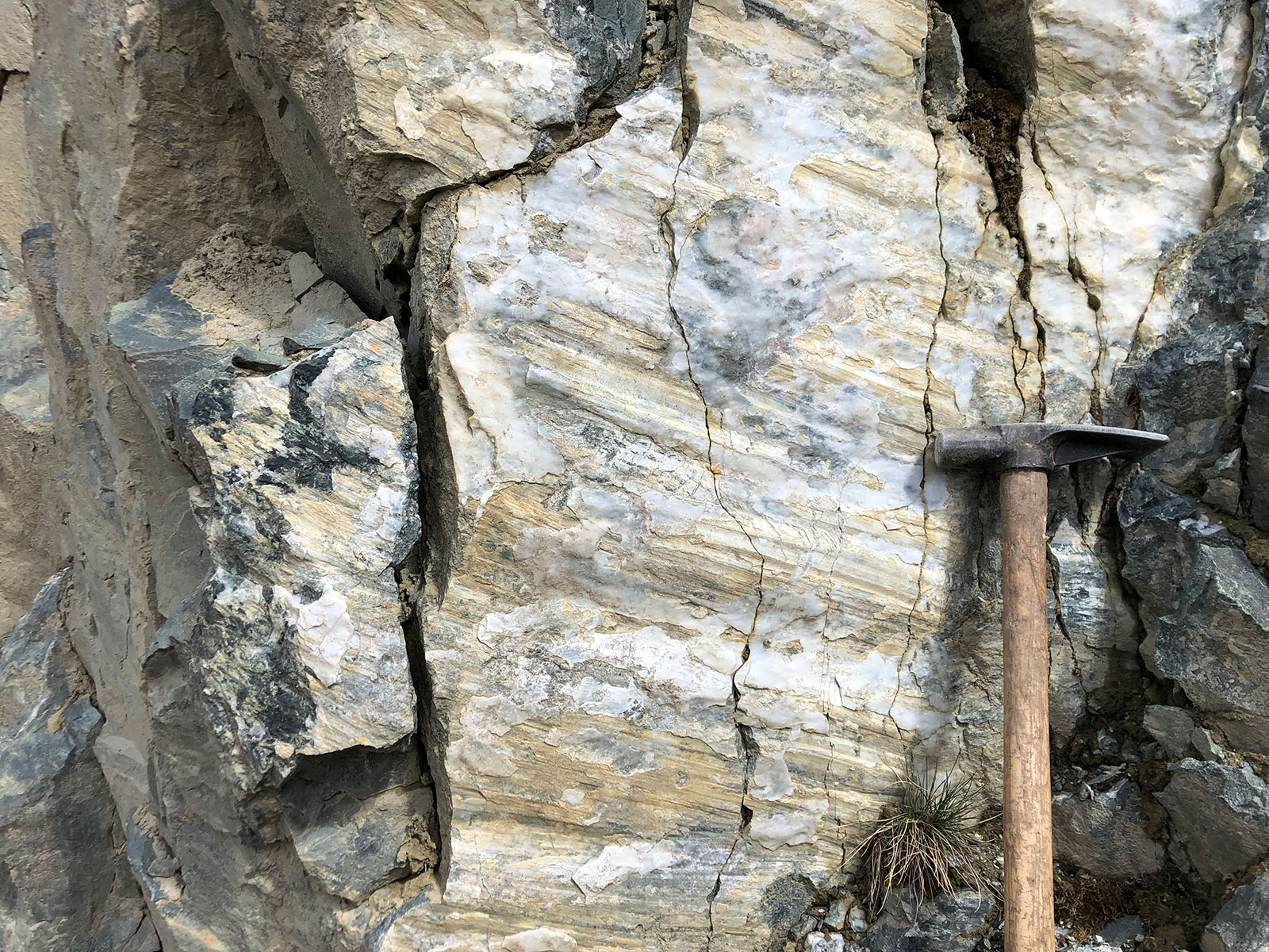
- Pyritic quartz-carb vein cutting diorite at the G-occurrence
-
- Outcrop, quartz-carb veining – 2.8 gpt Au & 9.7 gpt Ag
-
- Outcrop quartz breccia-vein – 8.2 gpt Au & 17.0 gpt Ag

-
- Mineralized quartz-carb vein hosted in diorite
-
- Mineralized quartz-carb stockwork
-
- Mineralized felsic intrusive – 5.6 gpt Au & 15.3 gpt Ag
-
- Mineralized felsic intrusive – 3.8 gpt Au & 29.0 gpt Ag
-
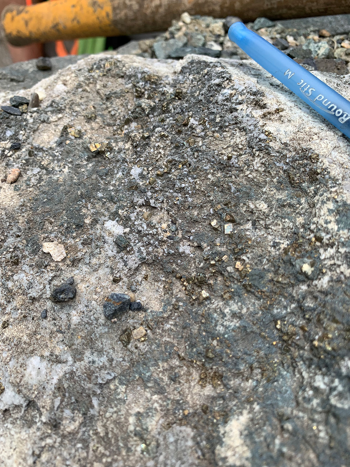
- Large cubic pyrite

-
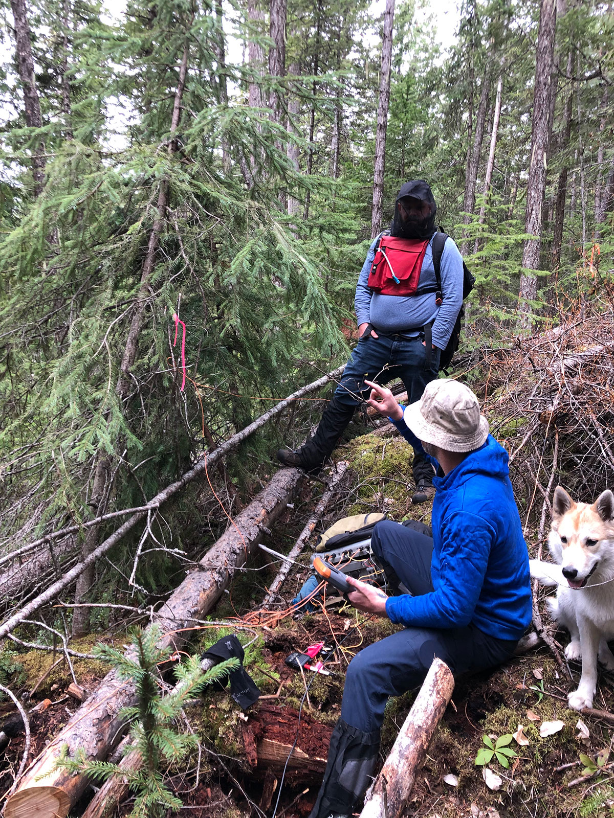
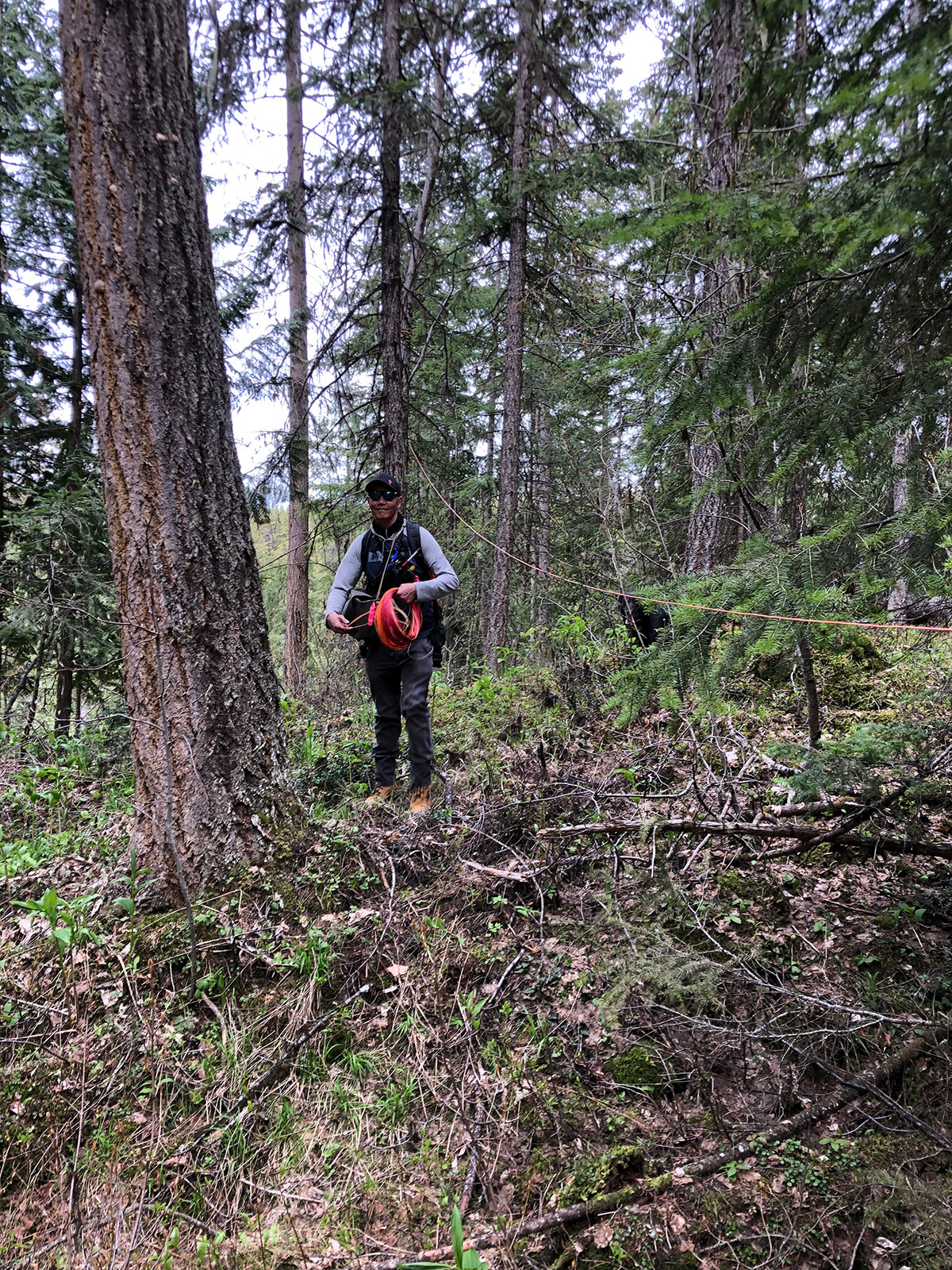
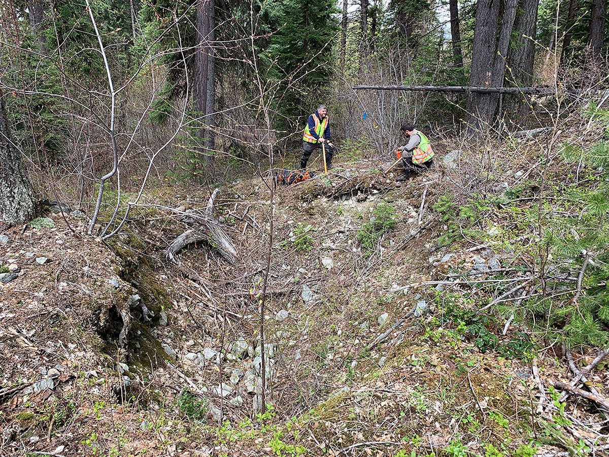
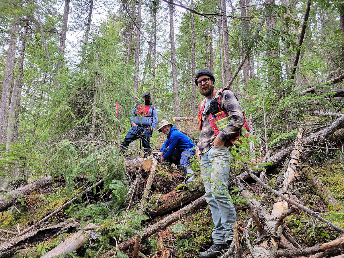
- IP survey crew taking measurements
-
- IP survey crew lay electrical current wires
-
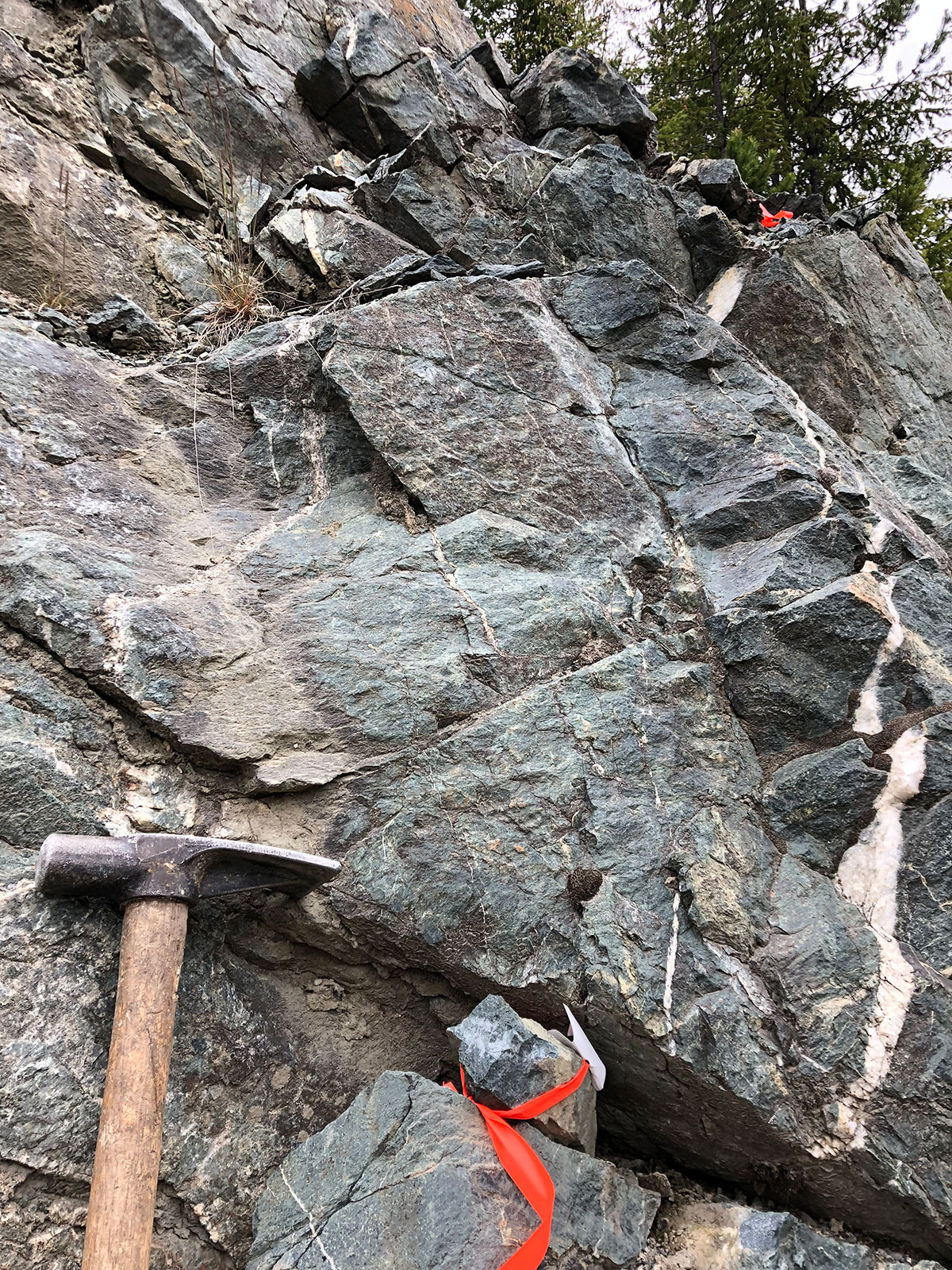
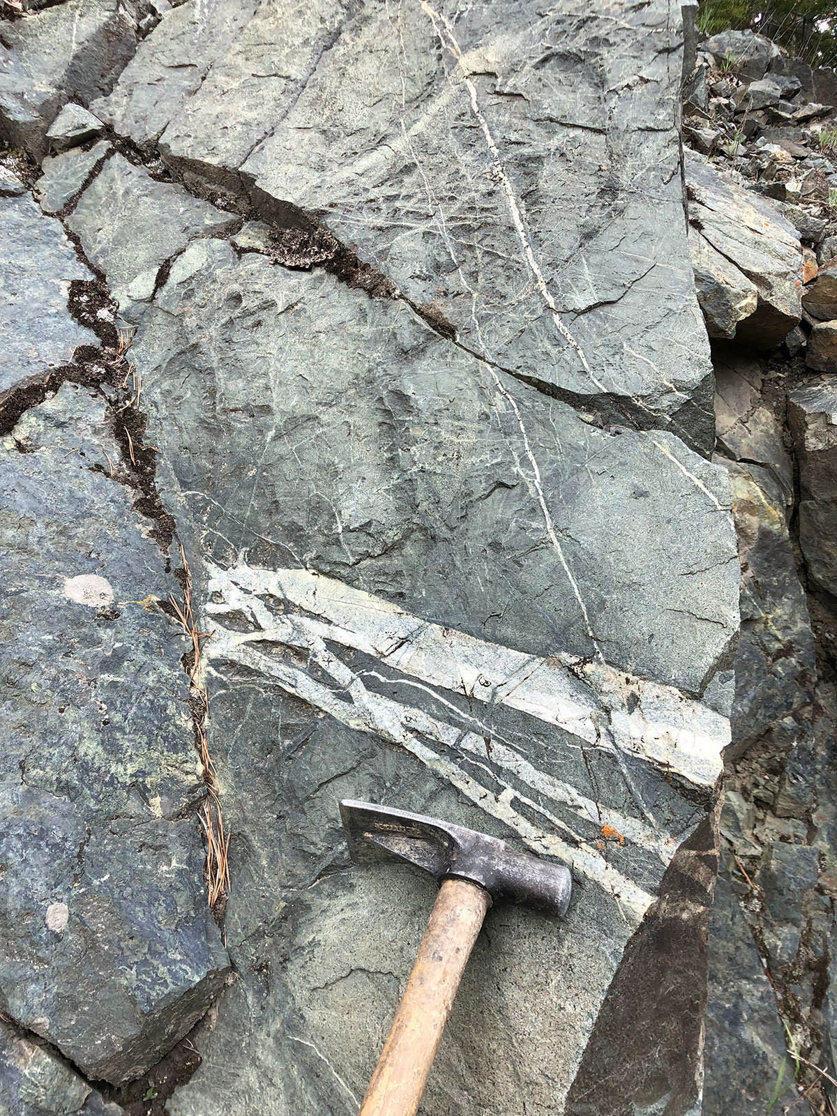
- Intense quartz-carb stockwork in diorite
-
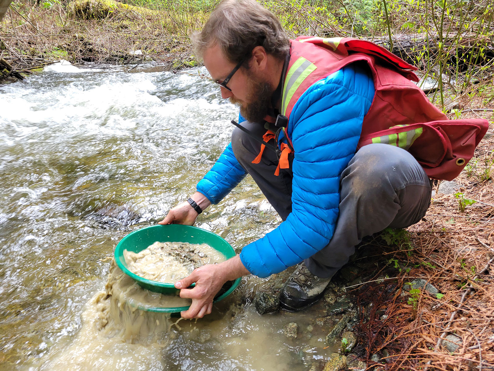
- Heavy mineral sampling

-
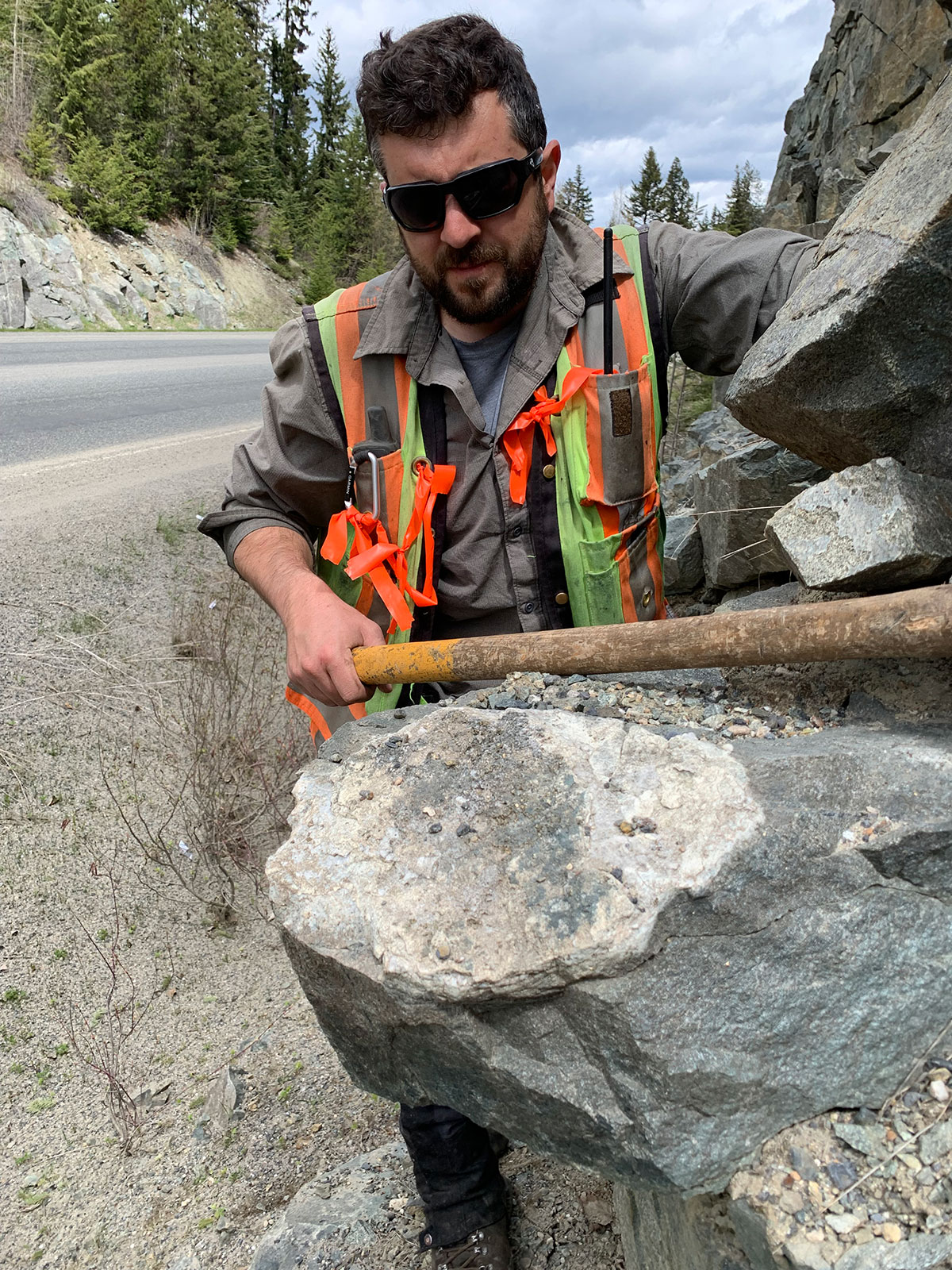
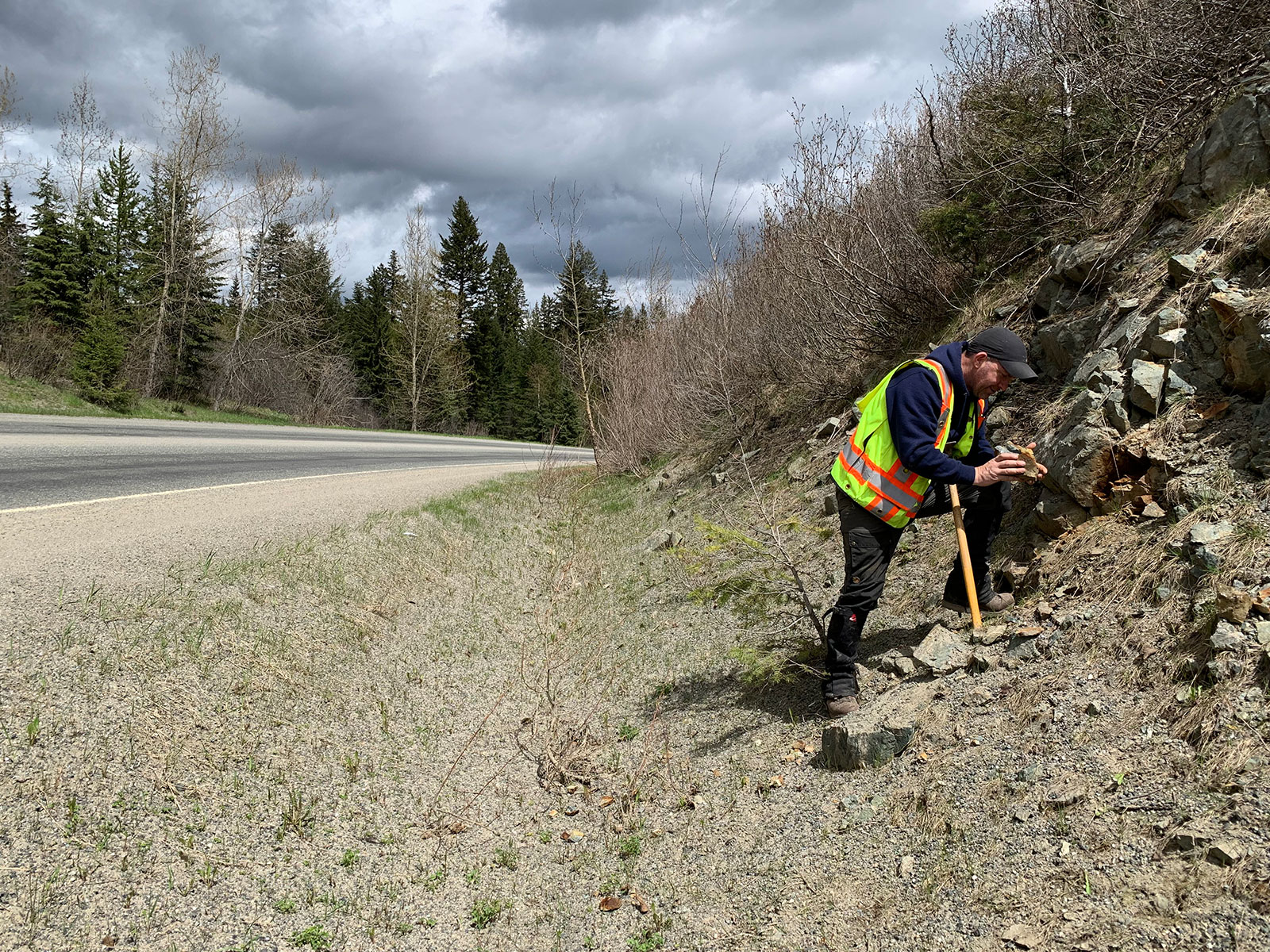
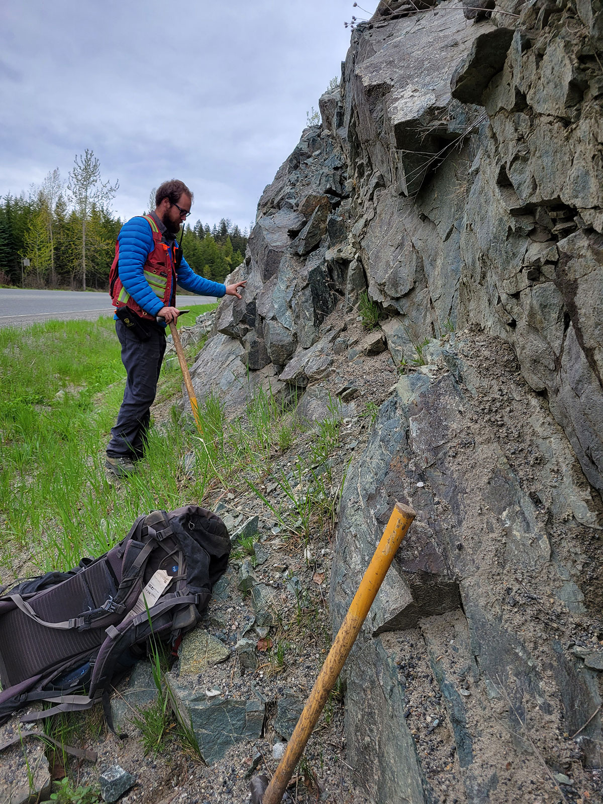
- Geologist sampling roadside outcrop
-
- Geologist samples outcrop beside highway
-
- Disseminated pyrite @ the G-Occurrence
-
- Diorite outcrop beside highway 24 – 2.8 gpt Au & 9.7 gpt Ag
-
- cubic pyrite in quartz-carb veins (G-Occurrence)
-
- Crew selecting the correct sample interval for the mobile metal ion (MMI) soil survey
-
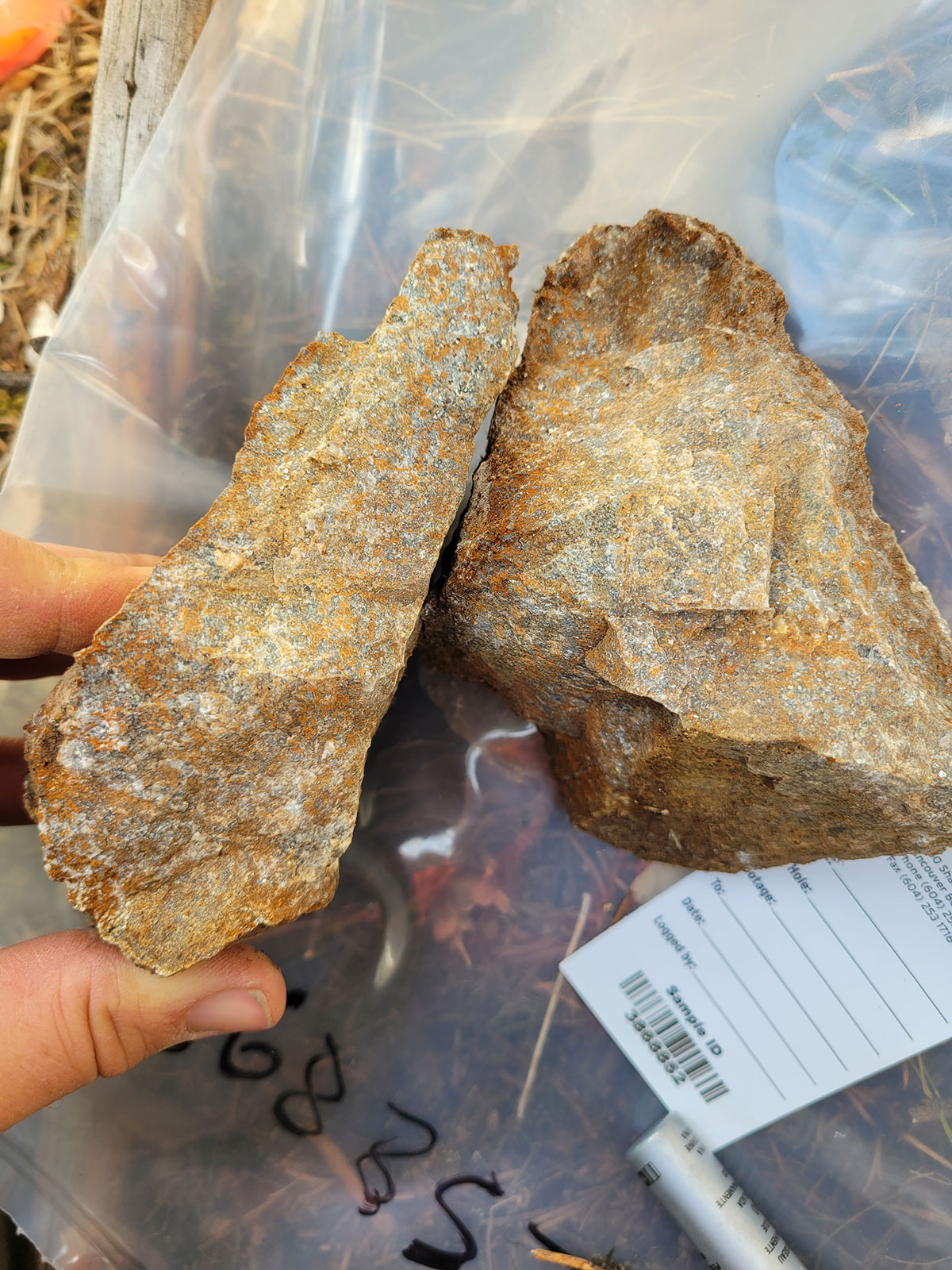
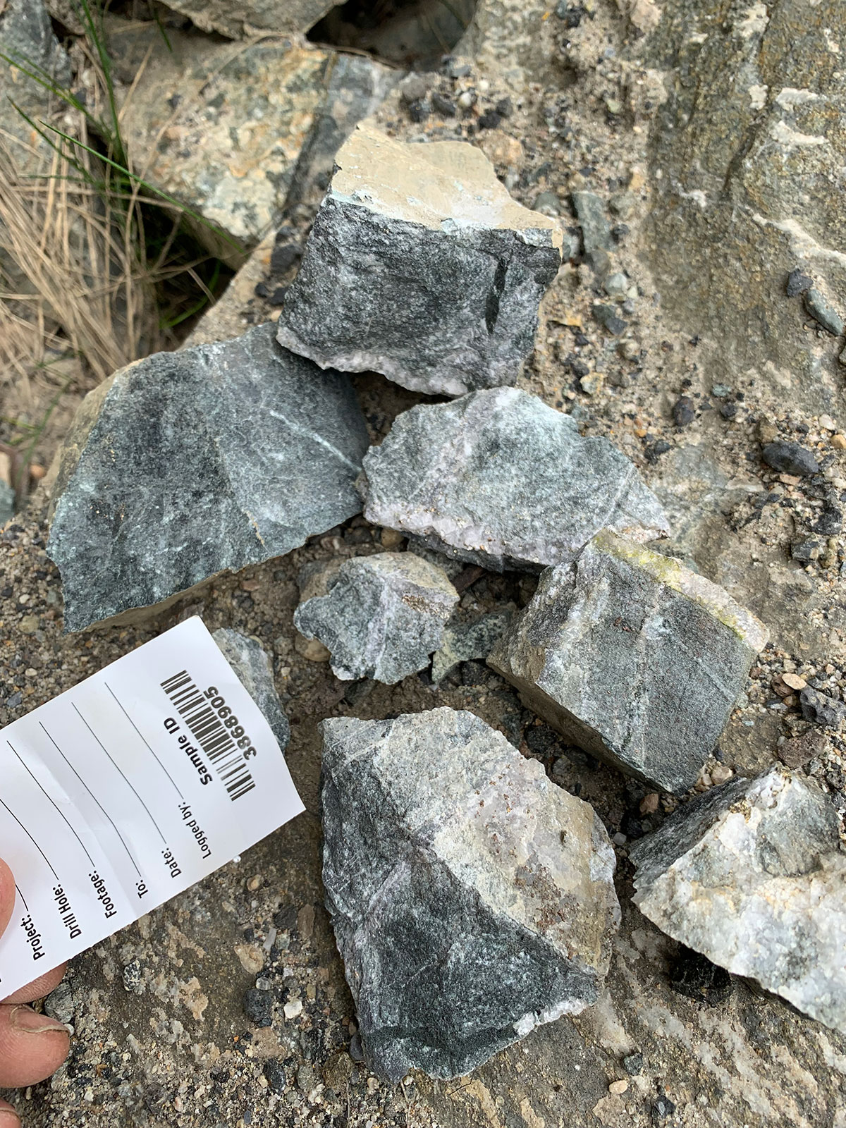
- Auriferous felsic intrusive float boulders
-
- Highway 24 cutting the main zone at the property
-
- Crew taking a mobile metal ion (MMI) soil sample

-
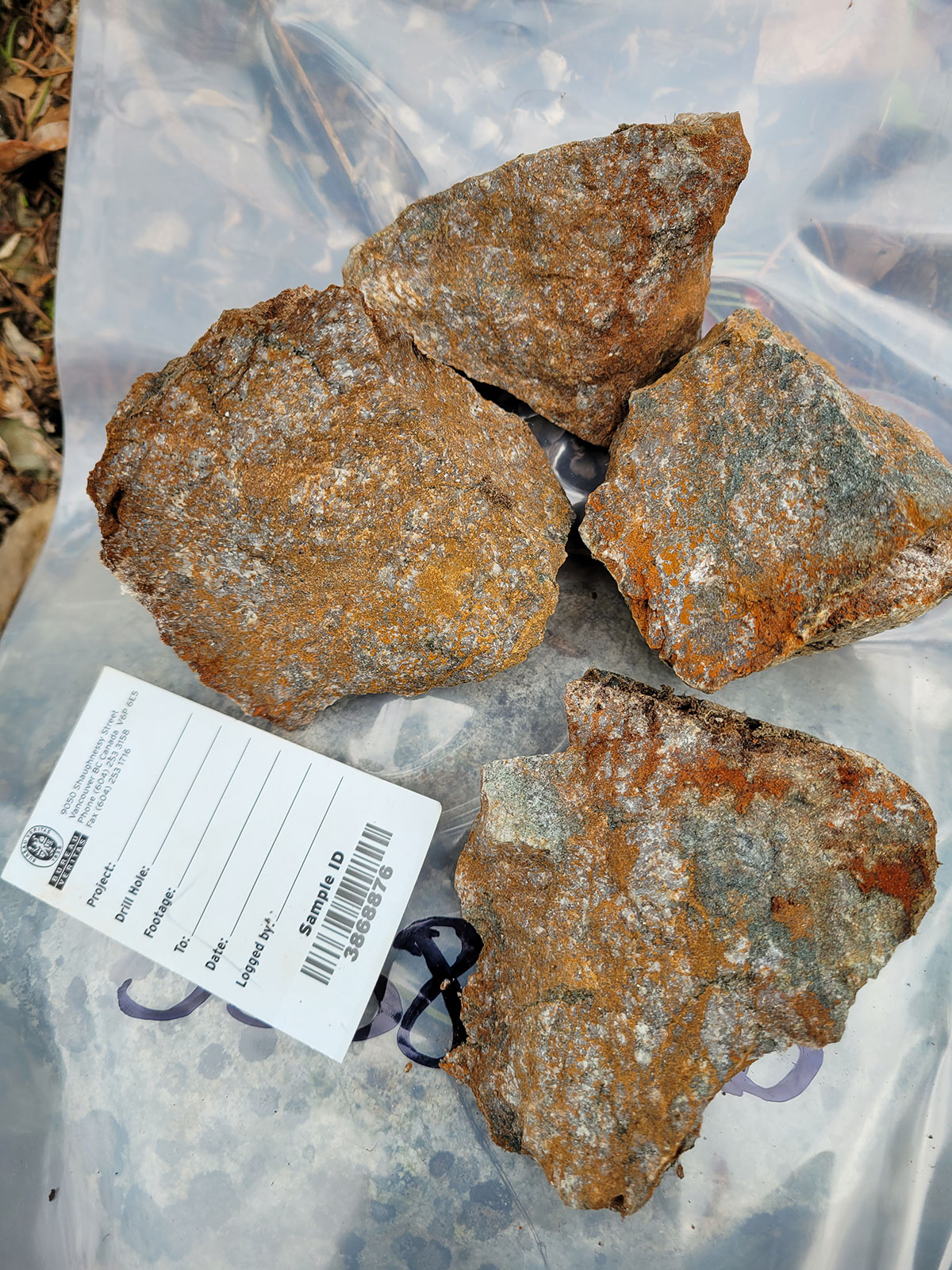
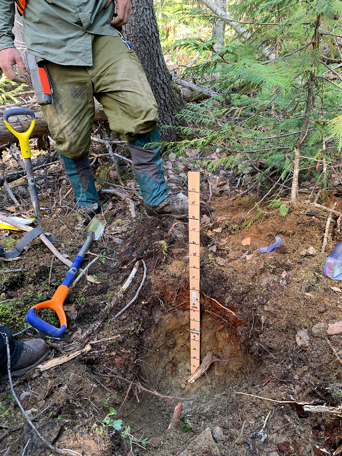
- Investigating historic sample pits from 1991 (bedrock was not encountered)
-
- G-Occurrence (14 meter @ 0.9 gpt Au incl. 3.0 meter @ 3.15 gt Au & 36.9 gpt Ag)

-
- Looking south-east – highway 24 cutting the Eakin Creek property
-
- IP survey crew
-
- Faulted quartz-carb vein surface exposed along the highway cut
-
- panning the glacial till for placer gold

-
- Finding placer gold on Eakin Creek
-
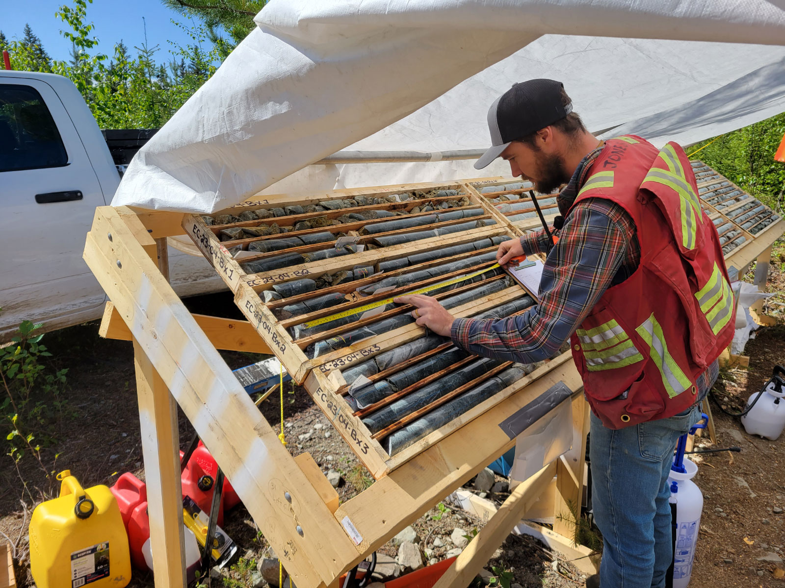
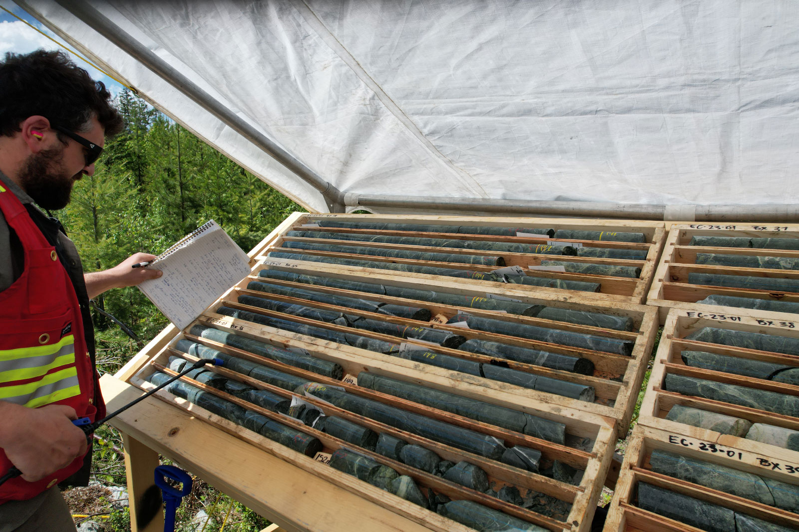
- Core teching
-
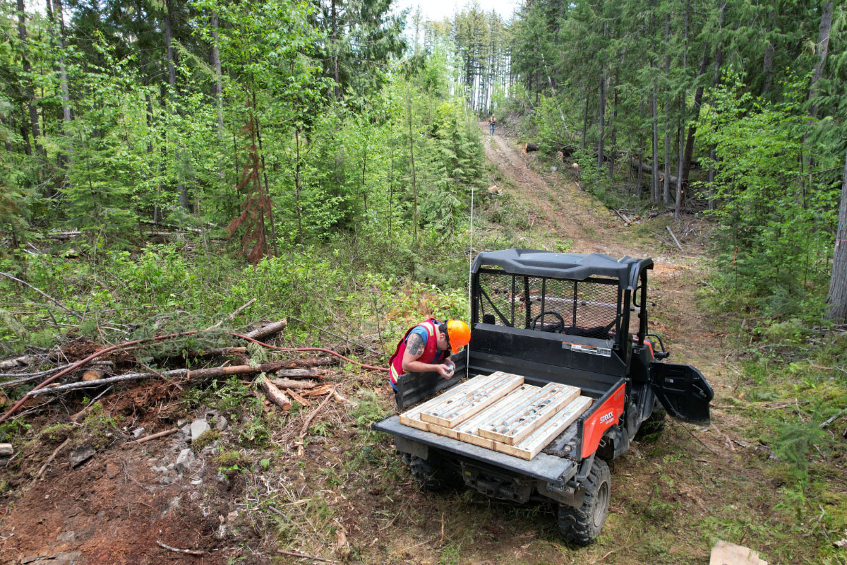
- Core transport
-
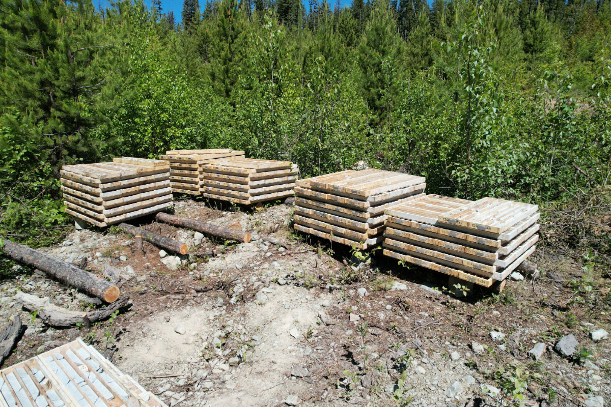
- Cross piled core
-
- Core Transport
-
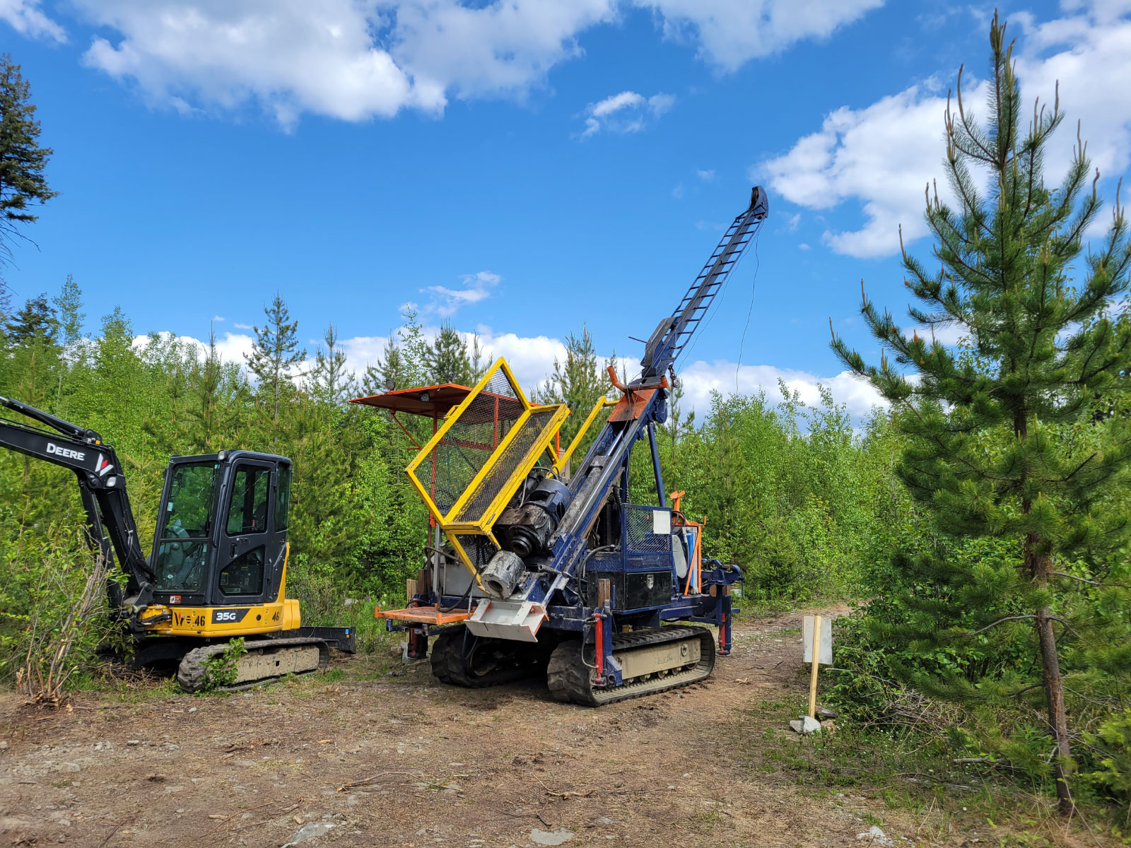
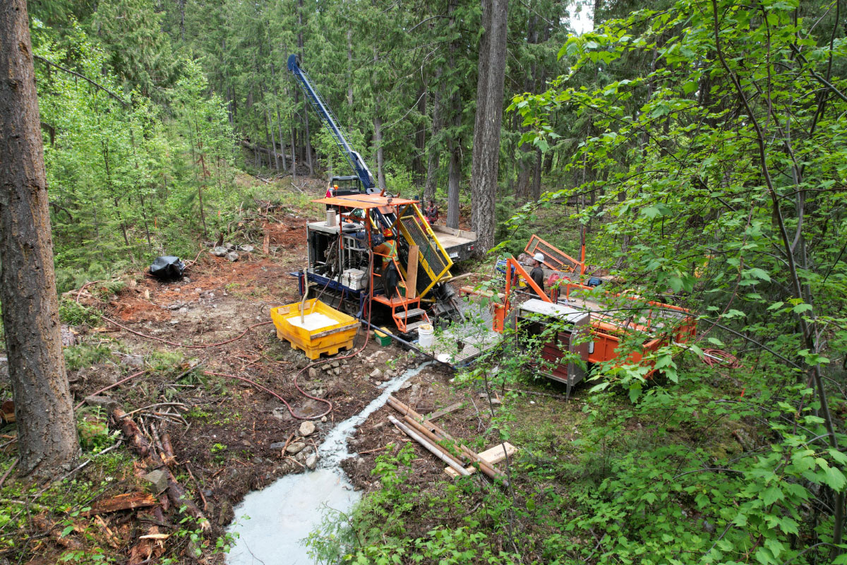
- Drilling EC-23-03

-
- Drill move
-
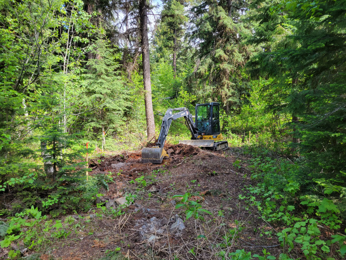
- Drill pad building
-
- Drill pad building
-
- holes1-5 900meters

-
- holes1-5 900meters
-
- Mineralized, silicified intermediate intrusive rocks with disseminated pyrite and quartz carbonate chlorite pyrite veinlets
-
- Spraying core still

Videos
Presentation
Address
Trailbreaker Resources Ltd.
650 W Georgia St # 2110
Vancouver, British Columbia
Canada, V6B 4N9