

Introduction
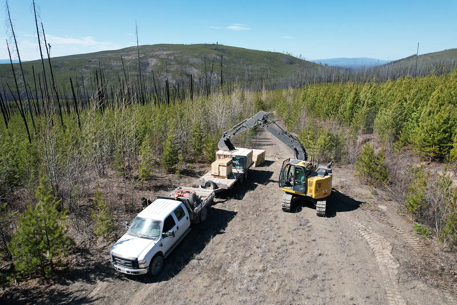
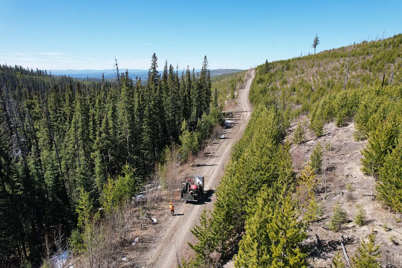
The 9,453 hectare Liberty property is an early-stage copper-molybdenum (Cu-Mo) porphyry target located in the Cariboo Mining district, approximately 60 km northwest of Quesnel, BC. The property is road accessible by an extensive network of well-maintained Forest Service Roads.
The Liberty property is located within the Cache Creek terrane, which hosts multiple Cu-Mo porphyry deposits, such as Taseko’s Gibraltar Mine, which is the second largest open-pit copper mine in Canada. The Gibraltar Mine, located 110 km southeast of Liberty, contains 6.4 billion pounds of copper from past production and current reserves. The current reserve has an average copper grade of 0.24% and a cut-off grade of 0.15% Cu.
Location Map
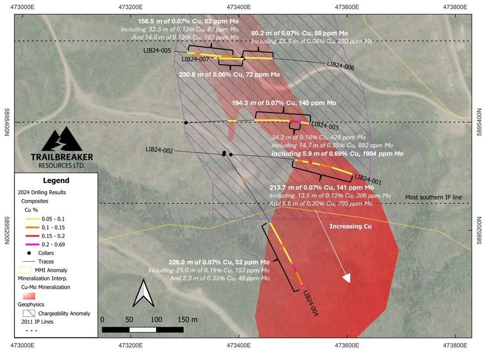
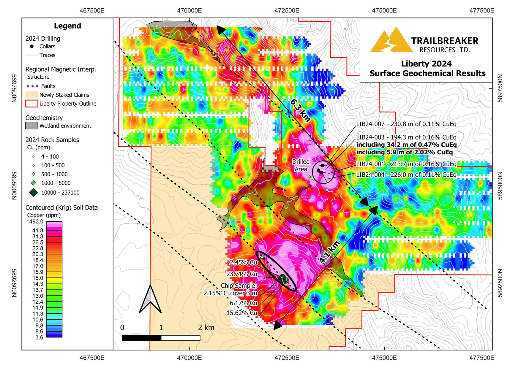
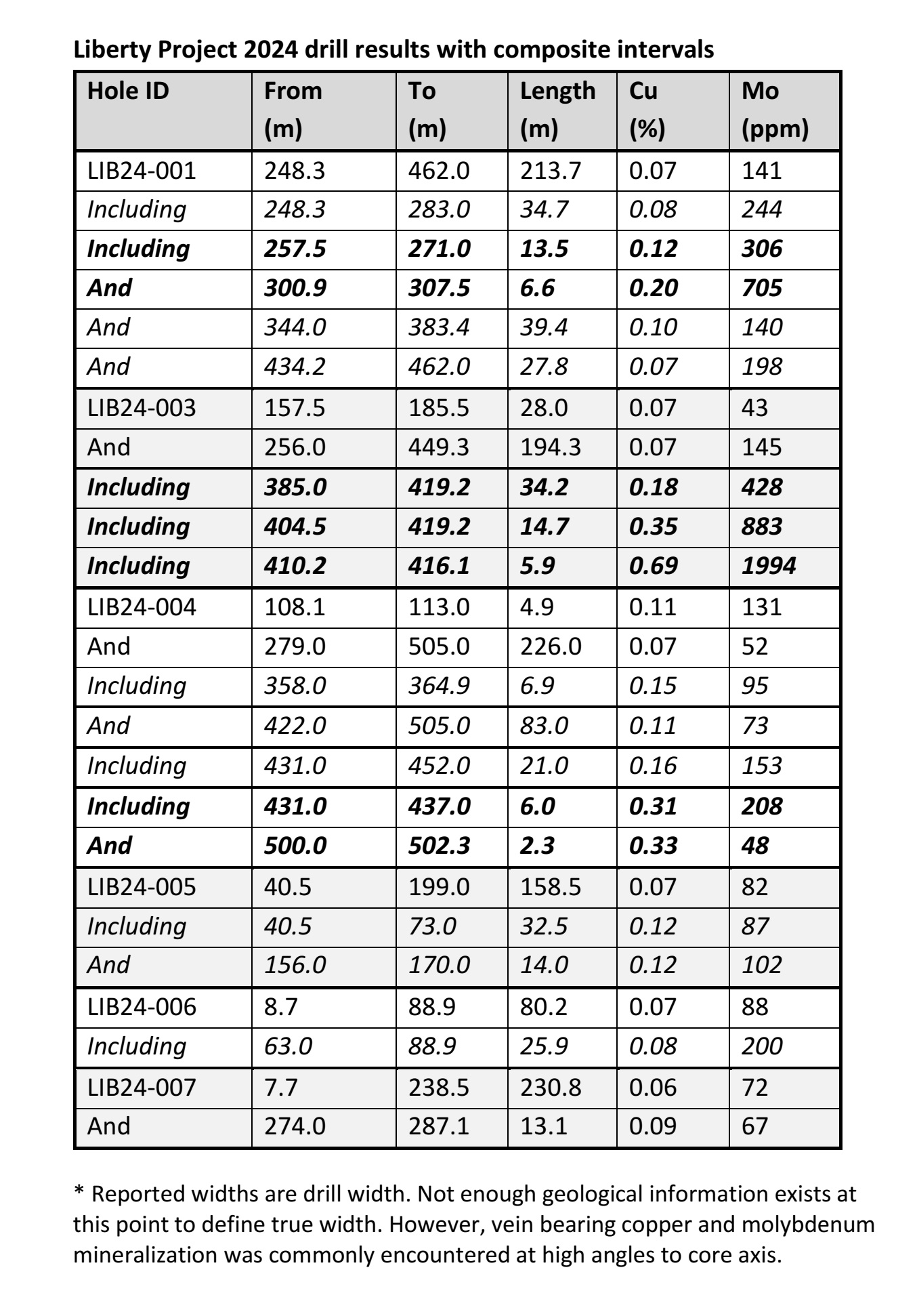
Trailbreaker’s 2024 drill program at Liberty encountered widespread Cu-Mo porphyry-style mineralization at the northeastern margin of a large Cu-in-soil geochemical anomaly, with numerous ~200m+ intervals of low-grade Cu-Mo mineralization (e.g. 213.7 m of 0.07% Cu, 141 ppm Mo in LIB24-001) punctuated by higher-grade mineralization (e.g. 34.2 m of 0.18% Cu, 428 ppm Mo, including 5.9 m of 0.69% Cu, 1,994 ppm Mo in LIB24-003). Mineralization is coincident with an Induced Polarization (IP) chargeability feature and is hosted in porphyritic granodiorite.
2024 Drill Results
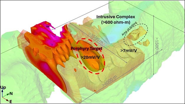
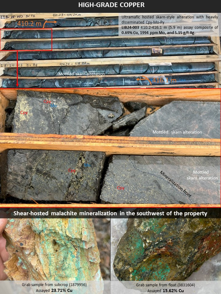
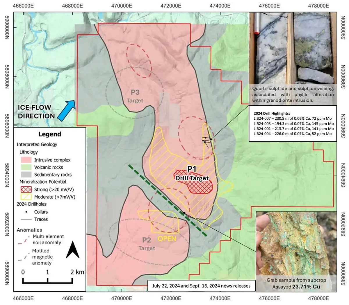
Post 2024 drilling, a large property-scale geochemical and geophysical program has delineated multiple porphyry targets on the property and has shown the 2024 drill campaign was completed at the margin of a much larger and stronger chargeability anomaly. The core of this strong (>20 mV/V) chargeability anomaly measures 1,600 m by 800 m, extending >700 m in depth, and is believed to represent increased sulphide content associated with a porphyry core. Furthermore, this chargeability anomaly is up-ice from the strongest Cu-Mo soil anomaly on the property. Prospecting within the southwestern portion of the property-scale geochemical anomaly has defined an area of high-grade copper mineralization, with grab samples assaying up to 23.71% Cu.

Geology & Geophysical Targets
ZTEM/IP Interpretation and Proposed Drill Target
Location / Infrastructure
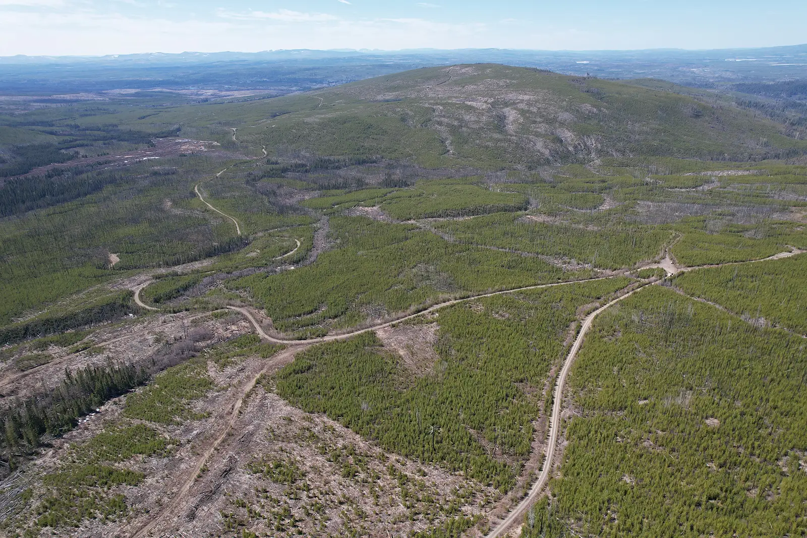
The Liberty property is located in central British Columbia, approximately 60 km northwest of Quesnel, BC. A series of Forestry Service Roads transect the property. The property is located in the Fraser Plateau, consisting of gently rolling hills, with elevations ranging from 850 m to 1300 m above sea level. Climate in the area is typical of central BC, where summers are warm and dry and winters are cold with little snow. This combination of infrastructure and climate allows for year-round access to the property.
History
1960s
The first documented exploration on the property occurred from 1967 to 1971. Rio Tinto staked the claims due to anomalous Cu in stream sediment samples. They conducted work consisting of soil sampling, IP, trenching, and diamond drilling exploring for porphyry and shear-hosted Cu. The work culminated in a ~1,000 m diamond drilling program in 1969, which mostly focused on the shear-hosted Cu mineralization in the southwest of the property. However, a few holes also targeted the more northern porphyry target. The northern-most drillhole (DDH-A8) returned 123.1 m of 0.11% Cu and 0.024% Mo from the top of bedrock (29 m) to the end of hole. Drilling to the south of this hole intersected granodiorite with abundant pyrite, which is interpreted to be part of the outer phyllic zone.
1997-2013
The project remained dormant until 1997, when William Poole staked the area. Between 1997 and 2003 prospecting found wollastonite skarn, polymetallic vein, vein-hosted gold, and talc-magnesite showings.
In 2011 and 2012, IP and MMI soil surveys were conducted over the porphyry target, defining a coincident Cu-Mo±Au±Ag soil and IP chargeability anomaly atop a Mesozoic aged pluton.
Trenching in 2013 was designed to test the surface exposure, however deep overburden prevented many trenches from reaching bedrock. The few trenches that did reach bedrock encountered chlorite-altered diorite with disseminated chalcopyrite, assaying up to 0.39% Cu and a continuous chip sample assaying 0.11% Cu over 10 m.
2015-2018
The property changed ownership a few times since 2013, with minimal work being completed. Work during this time included a single IP line and biogeochemical sampling atop the porphyry target.
2024
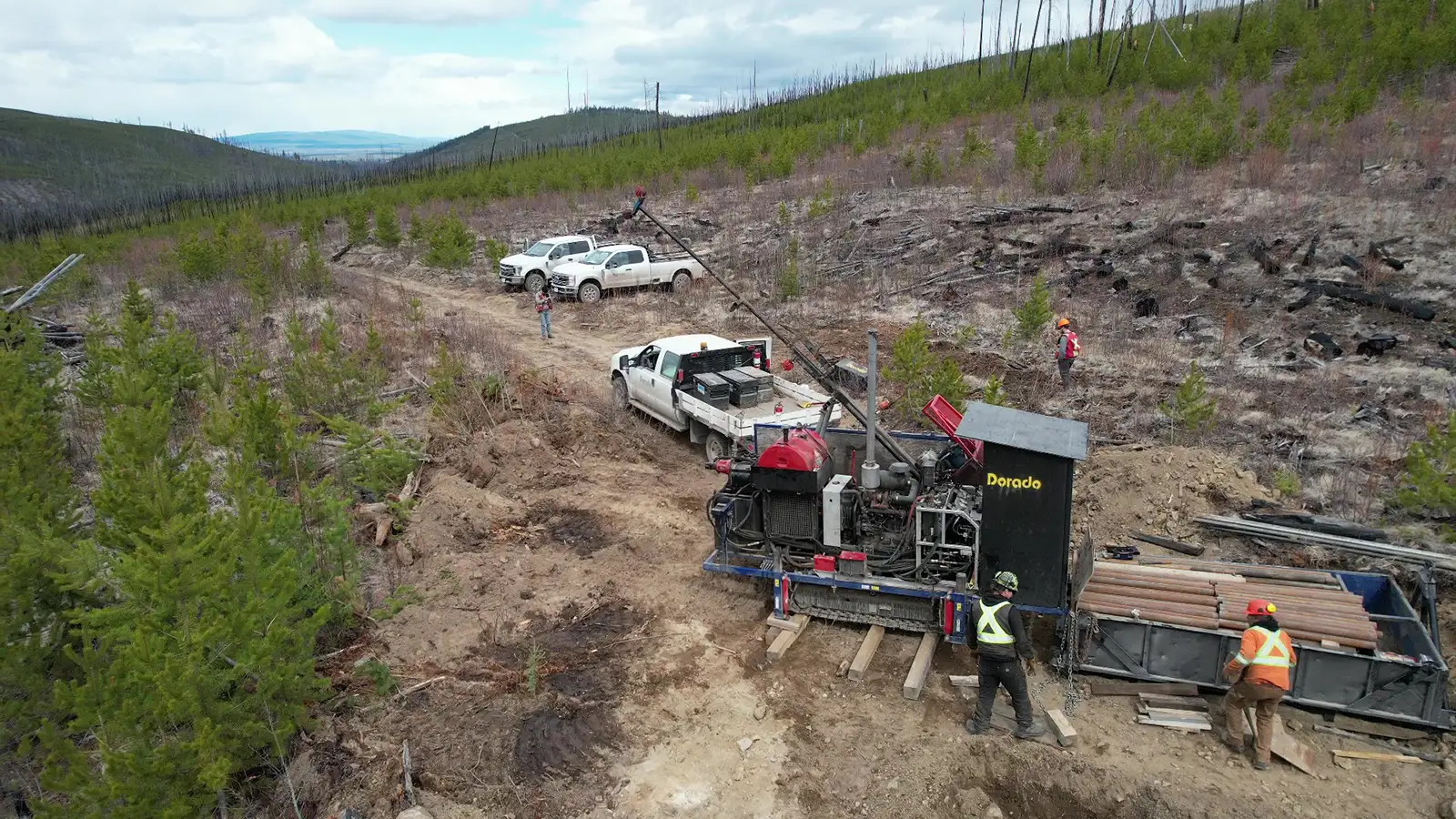
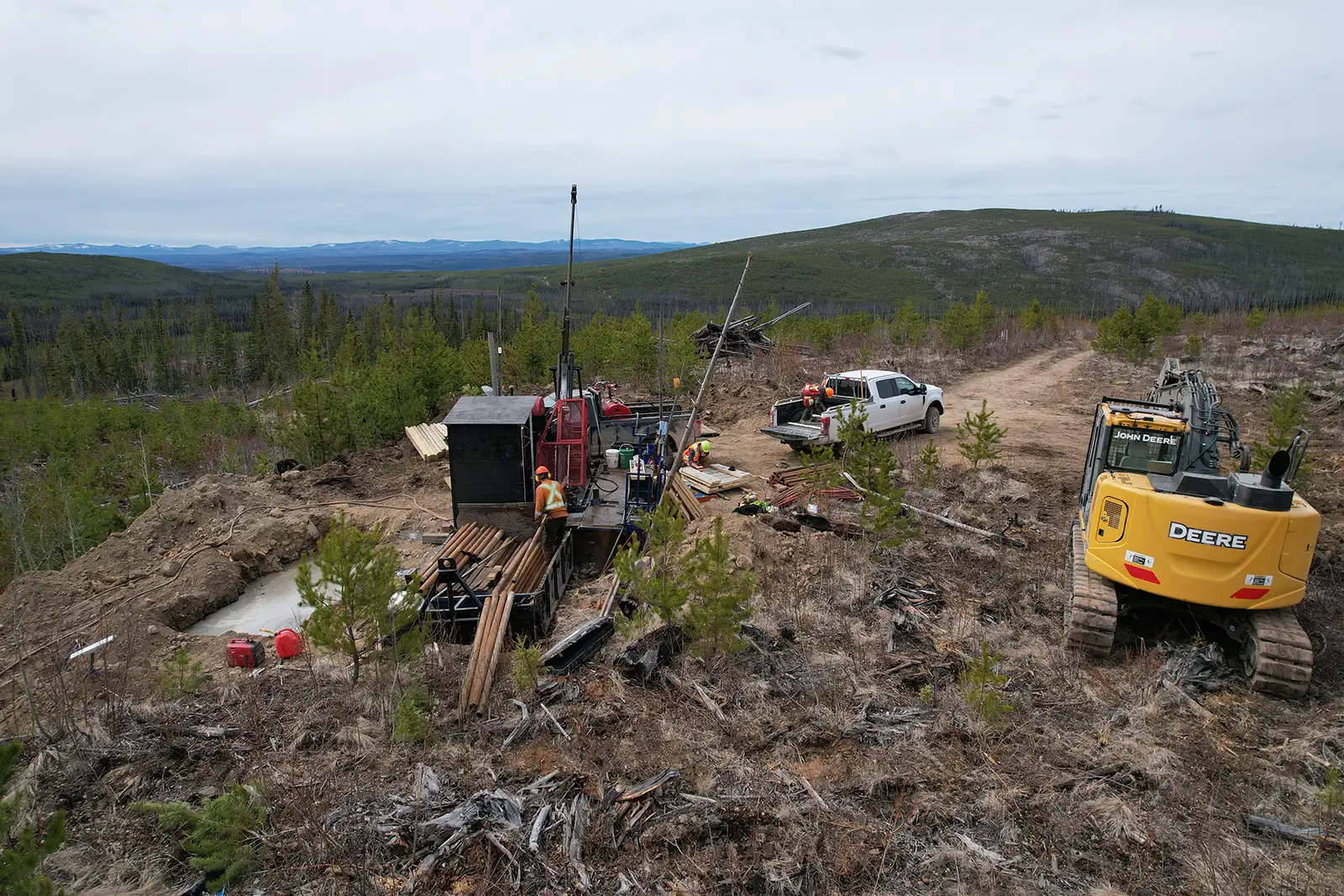
Trailbreaker optioned the claims in February of 2024. Historic data was compiled, and the historic IP was re-modelled to generate drill targets within the coincident MMI soil anomaly. A seven-hole diamond drilling program (2,442 m) was completed at the porphyry target in the spring (April). Drill results confirmed and further expanded on Rio Tinto’s work from the 1960s with all drill holes encountering Cu and Mo mineralization. Highlights include 194.3 m of 0.07% Cu, 193 ppm Mo including 34.2 m of 0.18% Cu, 428 ppm Mo and 14.7 m of 0.35% Cu, 883 ppm Mo.
A property-scale soil survey (1,601 soil samples) and prospecting (47 rock grab samples) were conducted in the summer, shortly after the drill campaign. This led to the discovery of a 10 km by 1.8 km Cu-in-soil anomaly with grab samples within the anomaly assaying up to 23.71% Cu. Based on these encouraging results, in fall of 2024, the property was expanded with additional staking and a property-wide airborne ZTEM (electromagnetic) survey and a 33 line-km IP survey was completed.
The combined interpretation of the IP and ZTEM data has defined 4.0 km x 3.5 km area of moderate (>7 mV/V) chargeability anomaly that is coincident with an intrusive complex transecting the property from north to south. The 2024 drilling on the margin of this anomaly returned long, continuous intervals of Cu-Mo mineralization in drill core. Within this large area, there is a central 1,600 m x 800 m area, extending >700 m in depth, of strong (>20 mV/V) chargeability, which is interpreted to be caused by increased sulphide content, potentially associated with a porphyry core. This remains the focus of a planned phase 2 drill program.
Geology and Mineralization
The Liberty property covers a moderate-sized polyphase granodiorite to diorite pluton (~8 km long and 2-4 km wide) Jurassic to Cretaceous (?) in age. The pluton has intruded into the volcanic and sedimentary rocks of the Mississippian to Triassic aged Cache Creek Group. To the east of the property, Eocene-aged Endako Group volcanic rocks unconformably overly the Cache Creek Group and granodiorite pluton. Chilcotin Group basalts are present along the western margin of the claims. Approximately 90% of the property is covered by unconsolidated glacial tills from Pliestocene glaciation.
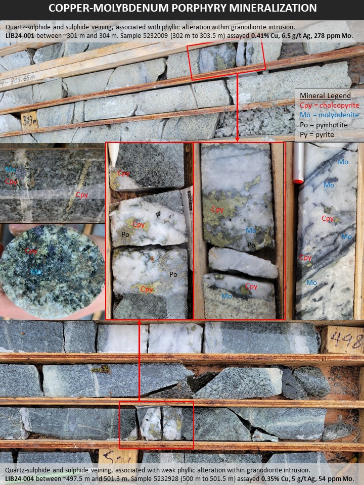
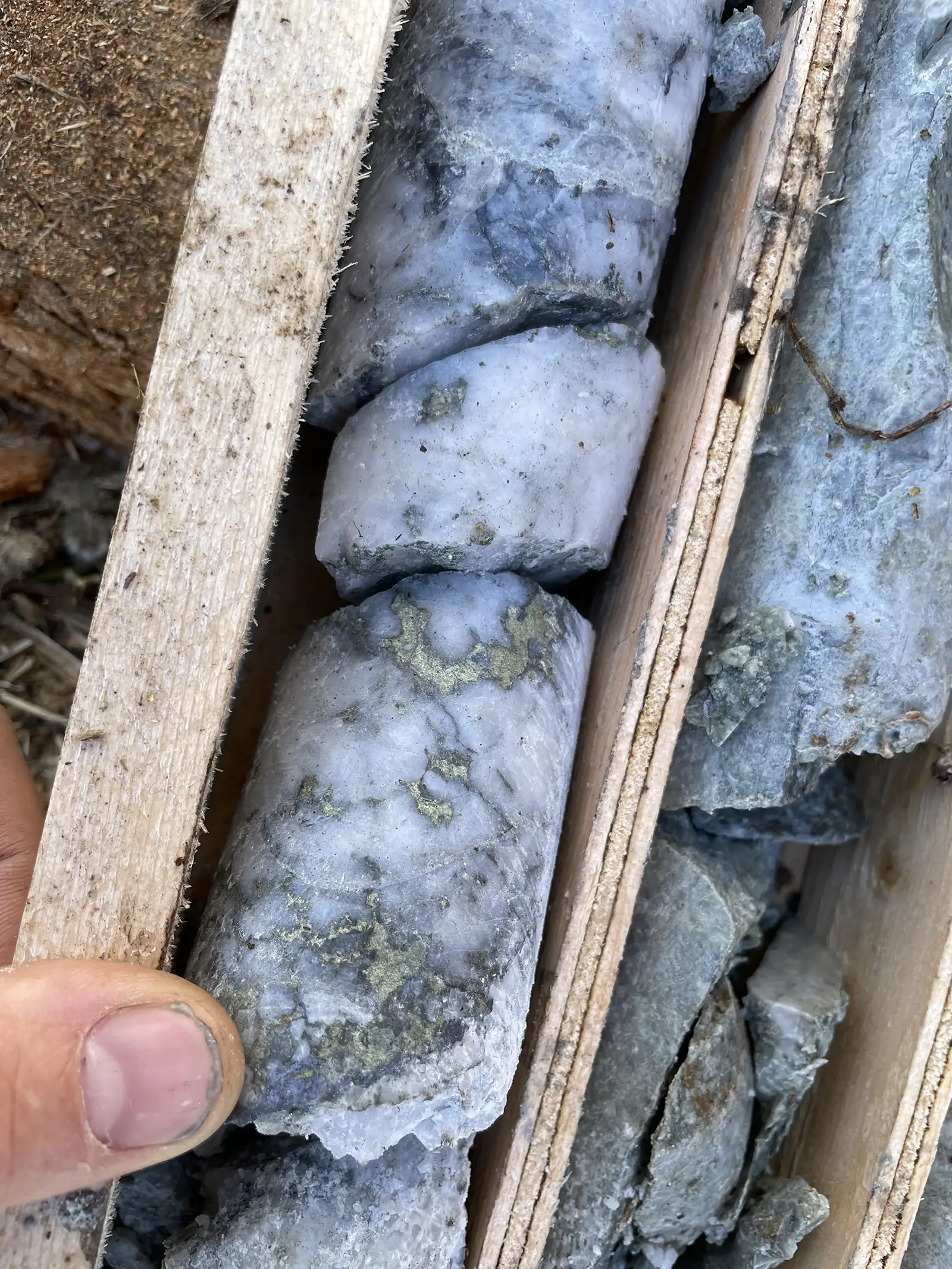
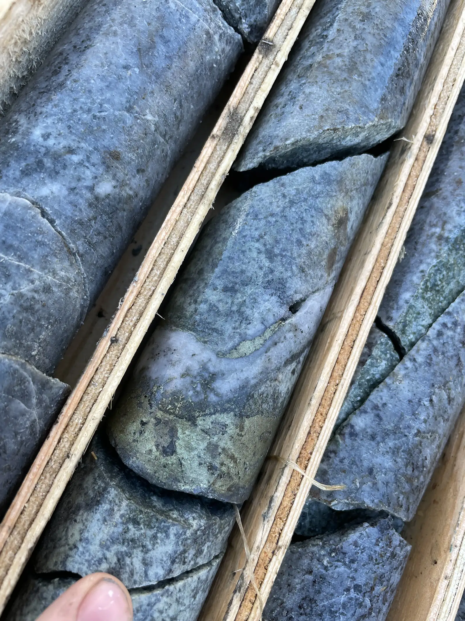
Drilling toward the east, through the chargeability high, encountered moderate to strong chlorite-altered (propylitic) granodiorite with porphyry-style chalcopyrite ± molybdenite-pyrite-pyrrhotite stringers and quartz veins containing chalcopyrite ± molybdenite-pyrite-pyrrhotite. Intermittent quartz-sericite ± clay (phyllic) alteration overprints the propylitic alteration zones. The phyllic alteration is associated with increased quartz-vein content, with individual veins reaching up to 0.75 m in core width and associated with fault zones. Late-stage molybdenite-bearing veinlets with sericitic selvages overprint other alteration and veining.
Fine grained ultramafic rocks of the Cache Creek Complex are encountered at the bottom of LIB24-001 and LIB24-003. In LIB24-003, the contact of the ultramafic rocks and the granodiorite intrusion displays localized skarn-style alteration and mineralization, with fine grained light green and pink mottled alteration and heavily disseminated to semi-massive chalcopyrite-molybdenite-pyrite mineralization. This alteration assemblage transitions into talc and asbestos alteration distal from the contact, and contains molybdenite ± chalcopyrite mineralization.
Cu and Mo mineralization in drill core is associated with elevated gold, silver, and rhenium (Re). Higher grades of these metals, potentially in economic quantities, may occur in various parts of the overall mineralized system. The presence of these elements is in line with the gold and silver (Ag) anomalies in the MMI surveying.
Alteration and veining notably decrease in LIB24-002, although are still present. LIB24‑002 was drilled toward the west, targeting the margin of the chargeability anomaly, where it is coincident with high resistivity and strong multi-element soil anomalies. This drilling shows that the decreasing chargeability coincides with decreasing chalcopyrite and molybdenite mineralization as well as decreasing pyrite content.
Prospecting in the southwestern portion of the property returned numerous rock samples with >1% Cu, including 23.71% Cu from a malachite vein striking 140° – 320°. This area displays iron-carbonate, talc, and actinolite alteration along the contact between ultramafic rocks to the northeast and an argillite unit to the southwest. This contact was also identified in outcrop 900 m to the northwest, with similar iron-carbonate alteration and elevated Cu values (up to 0.23% Cu in float around the contact). The Cu-in-soil anomaly is particularly strong along this contact and extends to the northeast, with an average width of 1.8 km.
The malachite mineralization in the southwest Liberty property area shares similarities with the highest-grade mineralization encountered from the Spring, 2024 drilling which returned 34.2 m of 0.18% Cu, 428 ppm Mo including 5.9 m of 0.69% Cu, 1,994 ppm Mo in hole LIB24-003. The high-grade mineralization in LIB24-003 is located along the contact of a granodiorite intrusion with ultramafic rocks. This high-grade interval is part of a wider interval of mineralized granodiorite (194.3 m of 0.07% Cu, 145 ppm Mo). In the southwestern area, where the high-grade malachite was sampled, mineralization also occurs along the contact of ultramafic rocks with the argillite unit, which display similar iron-carbonate, talc and actinolite alteration. This near-surface high-grade mineralization may be associated with a mineralized intrusion, similar to that encountered in drilling.

Drill Results

Mineralization 1
Mineralization 2
Soil sampling and prospecting were designed to cover prospective geological and regional structural settings across the entire property. A total of 1,601 soil samples and 47 rock samples were collected. Cu-in-soil values are anomalous through an arcuate zone that transects the center of the property. This zone extends northeast for 4.1 km (~1.8 km width) from the southwestern limit of sampling to the centre of the property. From there, it extends northwest for an additional 6.3 km (~1.0 km width) to the northern property boundary.
This extensive Cu-in-soil is locally coincident with anomalous gold (Au), silver (Ag), molybdenum (Mo), and arsenic (As) values, defining more constrained multi-element soil anomalies. The most significant of these occur in the southwestern area, the area of Spring, 2024 drilling, and the northern area. The multi-element anomalies align well with the highest Cu-in-soil anomalies.
Two areas within the soil survey are marked by wetland conditions, with deeper organic horizons and shallow groundwater levels with water-saturated soil. These areas may cause a subdued geochemical response in soil, as the soil development has occurred in a different environment than elsewhere on the property. They occur in the central and northern boundary areas of the property.
Maps
-

- Location Map
-
- Cu-in-soil-Geochemical-Anomaly
-
- 2024 Drill Results
-
- Drill Results
-
- Mineralization 1
-
- Mineralization 2

-
- Geology & Geophysical Targets
Photos
Presentation
Address
Trailbreaker Resources Ltd.
650 W Georgia St # 2110
Vancouver, British Columbia
Canada, V6B 4N9